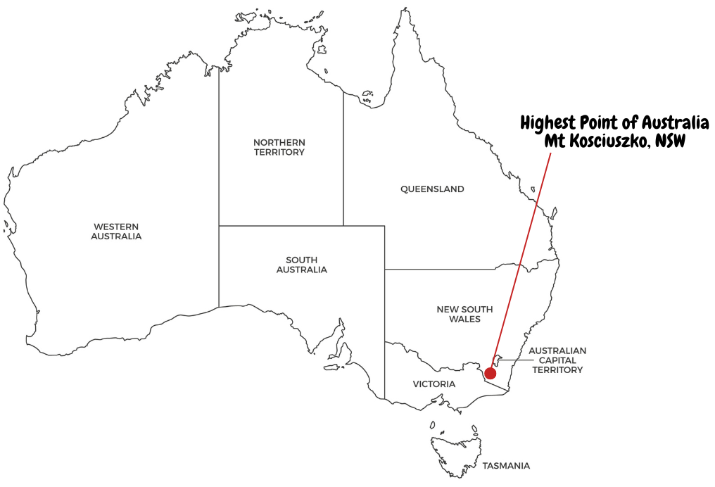
Prepare to be whisked away on an exhilarating adventure as we delve into the epic journey of conquering Mt. Kosciuszko, the towering pinnacle that proudly stands at 2228 meters, making it the highest point in Australia. This isn't just any ordinary hike—it's a thrilling odyssey through the rugged beauty of the Snowy Mountains, promising jaw-dropping vistas, moments of pure awe, and a sense of triumph that only comes from scaling new heights.
For those eager to explore more, check out our overview itinerary post covering all the extreme points of Australia — a comprehensive journey through the far-reaching corners of this vast and captivating land.
Important Notes for Your Mt. Kosciuszko Summit Hike:
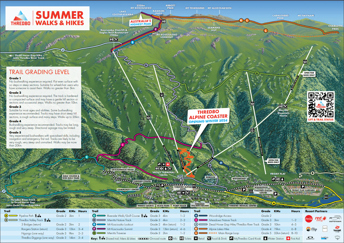
Before we embark on this thrilling journey, it's crucial to note a few key details. Firstly, this itinerary specifically covers the hike to Mt. Kosciuszko Summit starting from Eagles Nest Restaurant near the Kosciuszko Chairlift Top Station, marked as F (purple line) in the map below. If you're considering the longer trek from Charlotte Pass, marked as K/L (orange line) in the map below, be prepared for a more demanding adventure.
While it might be possible to access the summit during winter, this itinerary highly recommends tackling the hike during the summer months. The warmer weather not only makes for a more comfortable trek but also ensures safer conditions along the trail.
One essential aspect to keep in mind is the windy nature of the trail, starting right from Eagles Nest Restaurant and persisting all the way to the summit. Even during the summer season (as experienced during our Australia Day holiday hike), lightweight wind jackets and scarfs are highly recommended to shield against the brisk mountain breezes.
Hydration is key to a successful hike, so remember to carry plenty of water with you. Staying hydrated not only enhances your performance but also helps you fully enjoy the awe-inspiring landscapes and breathtaking views that await at the summit.
Explore our itineraries hassle-free with these recommended services!
Car Rental
Getting there
The hike to Mt. Kosciuszko Summit begins in Thredbo, nestled within the Snowy Mountains. To ensure a hassle-free experience, we recommend parking your vehicle at either Friday Flats Carpark or the public carpark near Thredbo Leisure Centre as shown in the maps below and walk to Kosciuszko Chairlift Base Station. Both options provide free parking for the entire day, allowing you to immerse yourself in the hike without time constraints. It's worth noting that Thredbo enforces a 2-hour parking limit (2P) in most areas, making the designated free parking areas even more convenient.
As Thredbo is situated within the Kosciuszko National Park, all vehicles must purchase a valid vehicle pass to enter the park. Day passes and multiday park entry permits can be conveniently purchased online or at the NPWS vehicle entry stations and the Thredbo Visitor Centre.
Provided below is an AllTrails map for the walk along with some key facts.
| Mount Kosciuszko Summit walk – Key Facts | |
|---|---|
| Trailhead | Eagles Nest Restaurant near the Kosciuszko Chairlift Top Station |
| Trail Type | Out & Back |
| Distance | 13km |
| Duration | 4 - 6 hours |
| Accumulated Elevation Gain | 365m |
| Difficulty | Grade 3 |
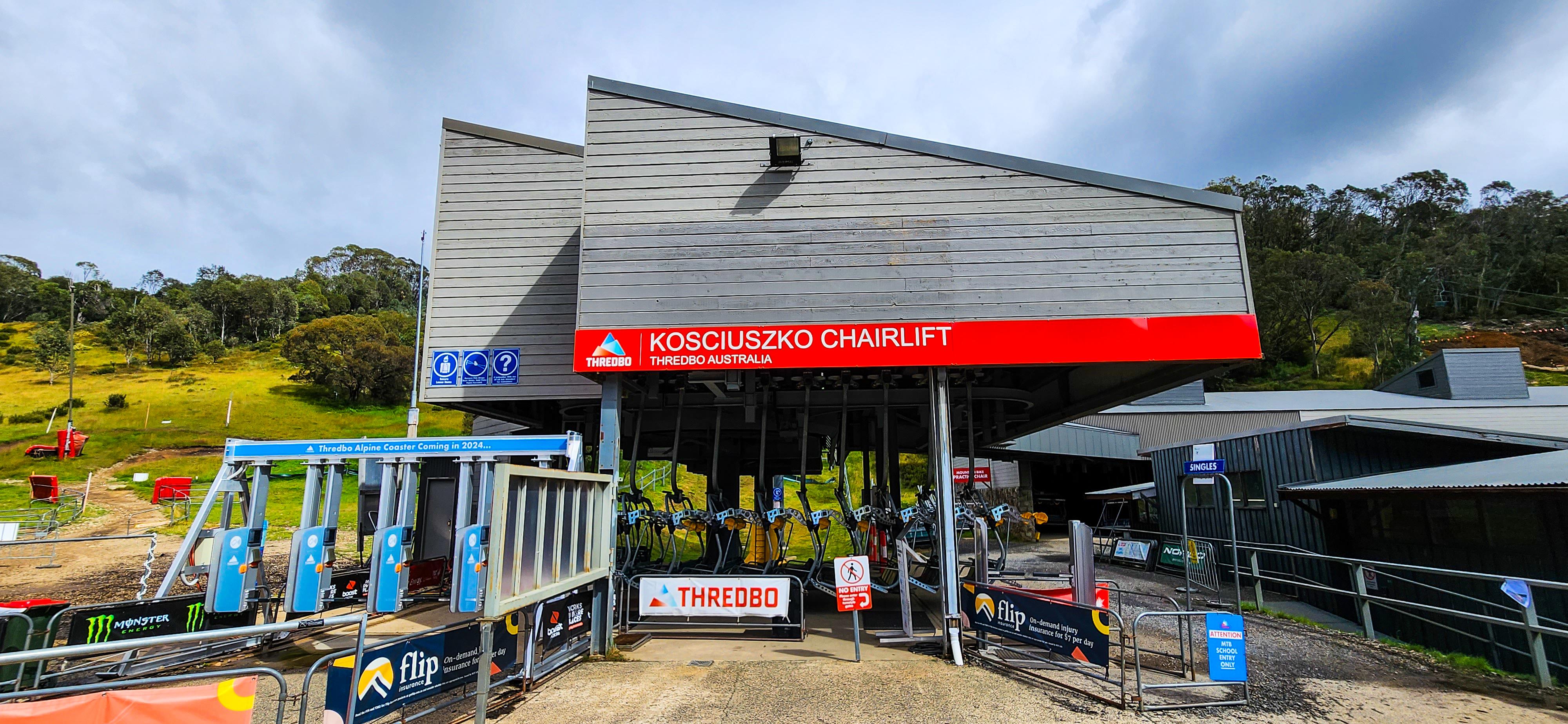
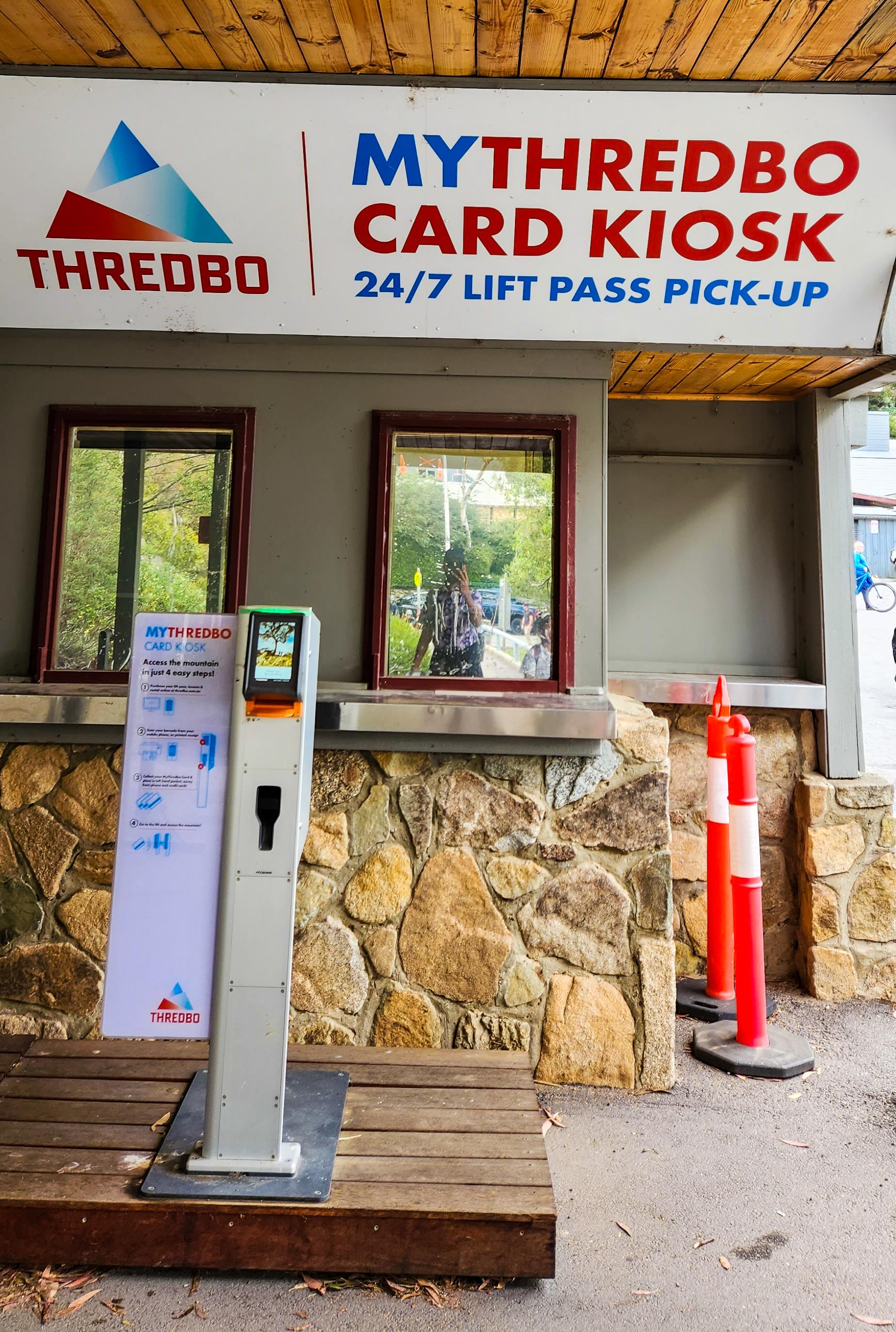
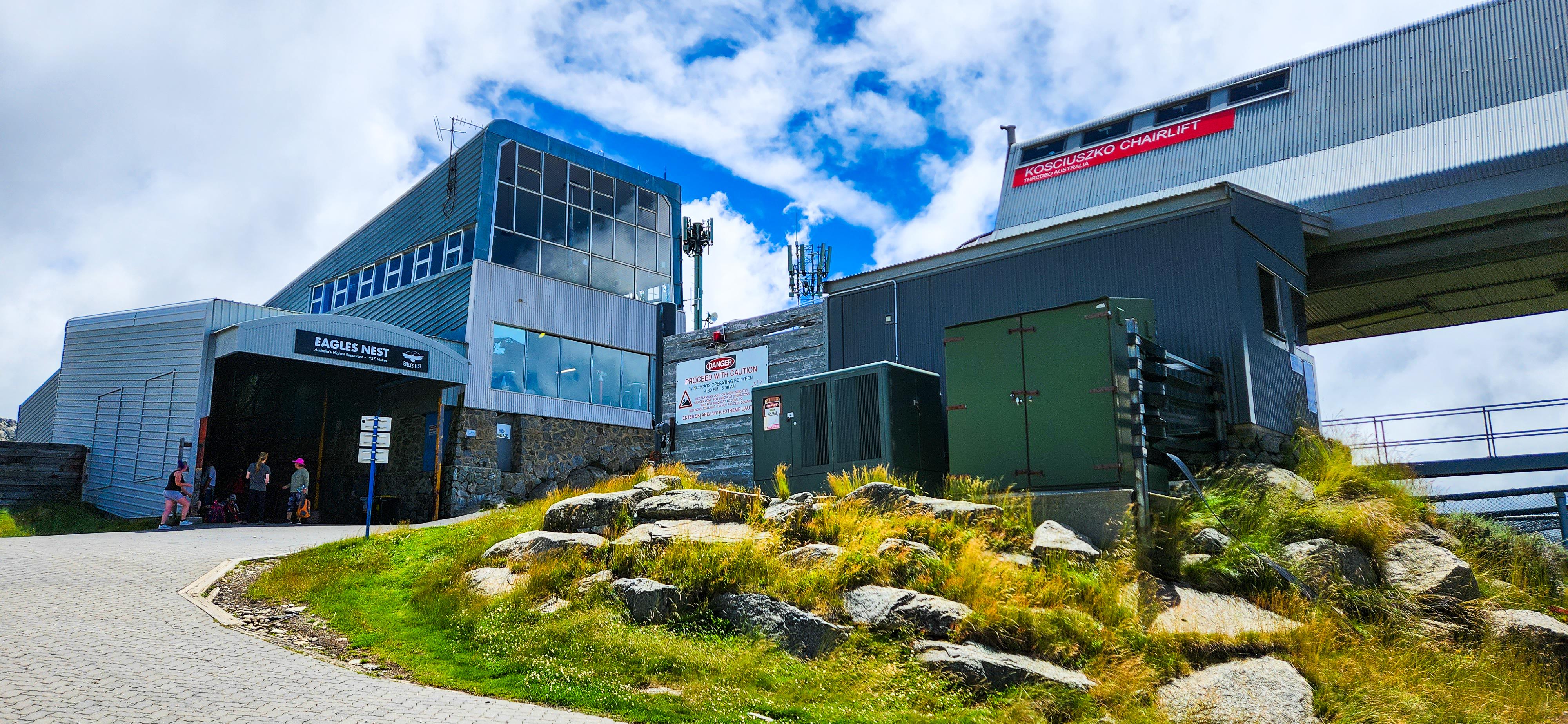
The adventure begins at the Kosciuszko Chairlift Base Station, located within the Thredbo Retail & Rental Valley Terminal, except when the chairlift is closed due to windhold (more on this at the bottom of this post!) . You will need to take the 15-min Kosciuszko Chairlift from the Base Station to the Top Station to commence your walk to the Summit. To access the chairlift, you'll need a MyThredbo Card, which can be obtained by purchasing a lift pass online. After purchasing your pass, simply collect your MyThredbo card from the 24/7 MyThredbo Card Kiosks located outside the Valley Terminal, using the barcode sent to your email. For more detailed information about lift passes, visit MyThredbo's website. Once aboard the chairlift, sit back, relax, and enjoy the scenic ride up to the Top Station.
Upon disembarking from the chairlift at the Top Station, make sure to visit Eagles Nest Restaurant, which proudly stands as Australia's Highest Restaurant at 1937 meters. Before commencing your hike to Mt. Kosciuszko Summit, take some time to soak in the panoramic views and perhaps indulge in a delicious meal or refreshments at Eagles Nest Restaurant. For information on their opening hours and menu offerings, visit their website. However, please note that the restaurant may not be open on days when the chairlift is closed due to windhold. While Eagles Nest Restaurant is a fantastic option, we always recommend that you pack your takeaway food from Thredbo to ensure you have sustenance for your hike; The Bakery in the Village Square is a great choice! If the restaurant is open, it's a great opportunity to fuel up and enjoy the high-altitude dining experience!
Make sure to utilize the restroom facilities at Eagles Nest Restaurant before starting your hike, if necessary. The next available facilities can be found at Rawson Pass, approximately 5 kilometers from the restaurant.
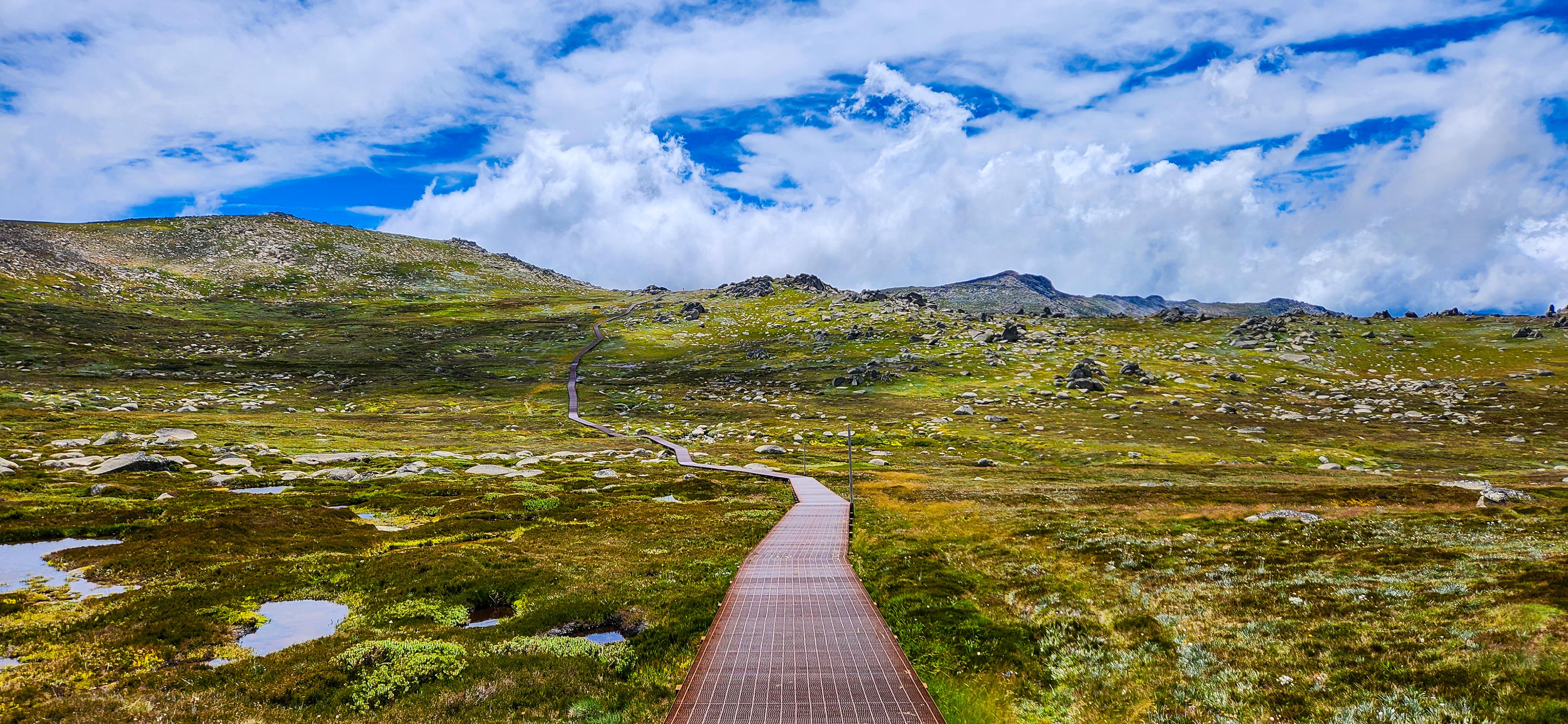
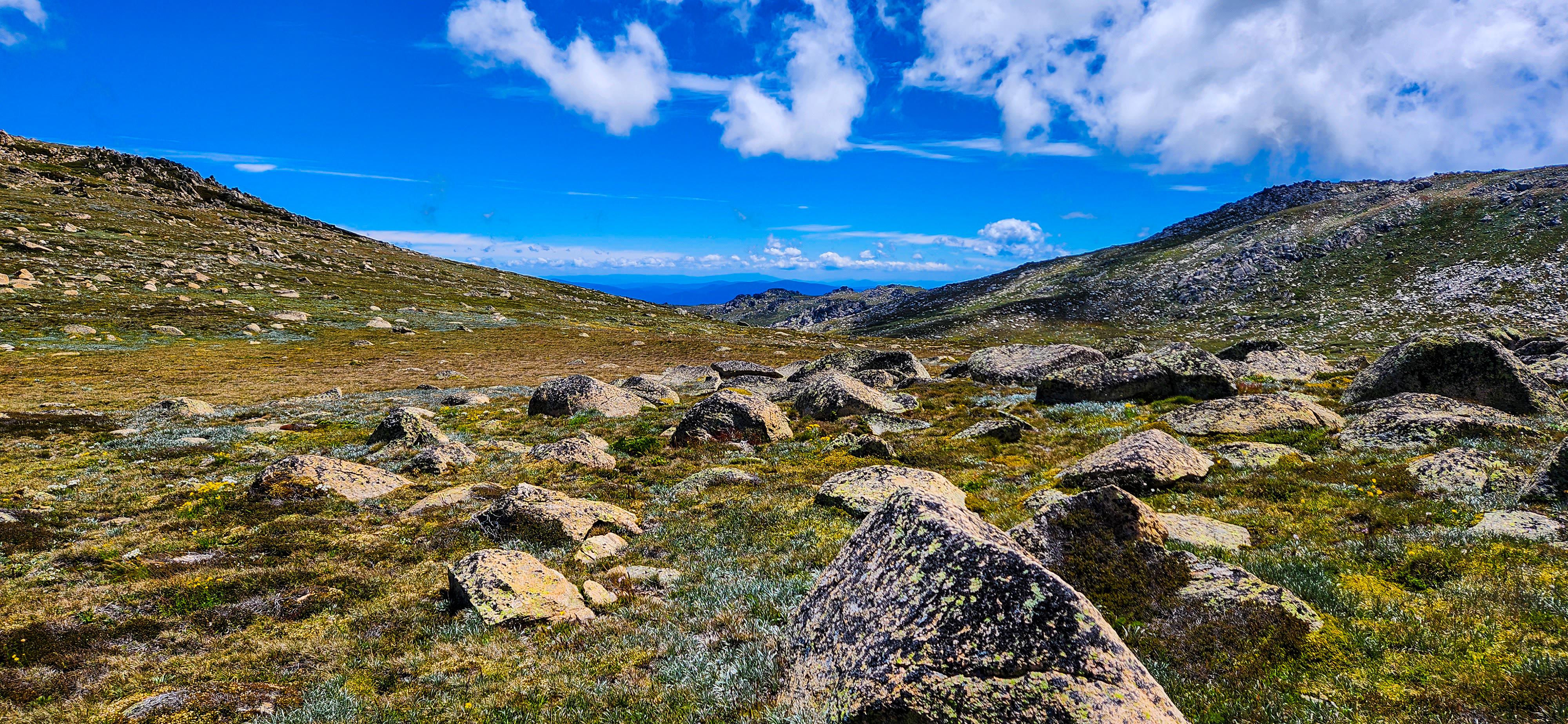
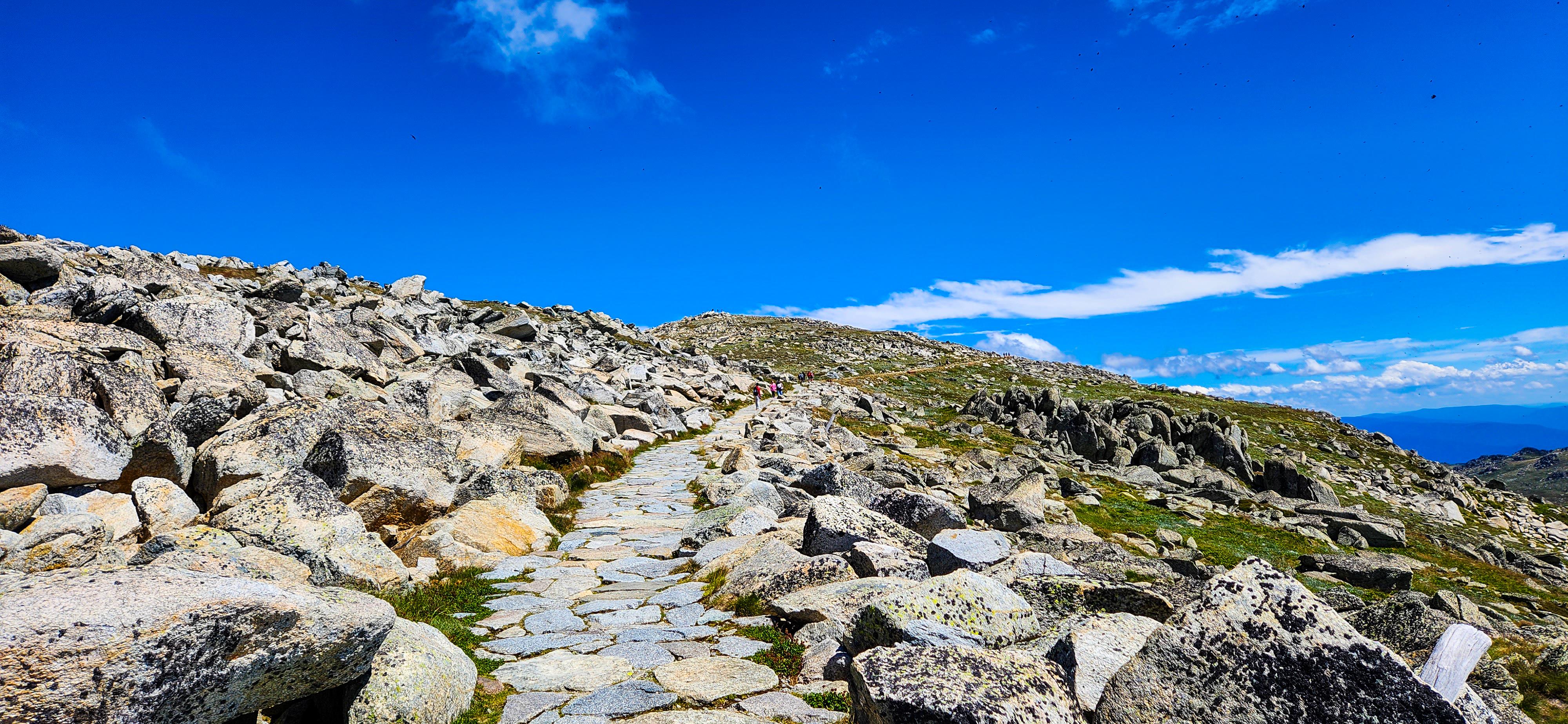
After visiting Eagles Nest Restaurant, embark on a scenic stroll towards the summit of Mt. Kosciuszko. The walk from Eagles Nest Restaurant to Rawson Pass follows an elevated walking track designed to preserve the natural alpine flora while offering an easy route suitable for all ages and abilities. As you traverse this picturesque trail, take moments to absorb the vastness of the landscape, marvel at the rugged beauty of the Snowy Mountains, and capture some memorable photographs along the way.
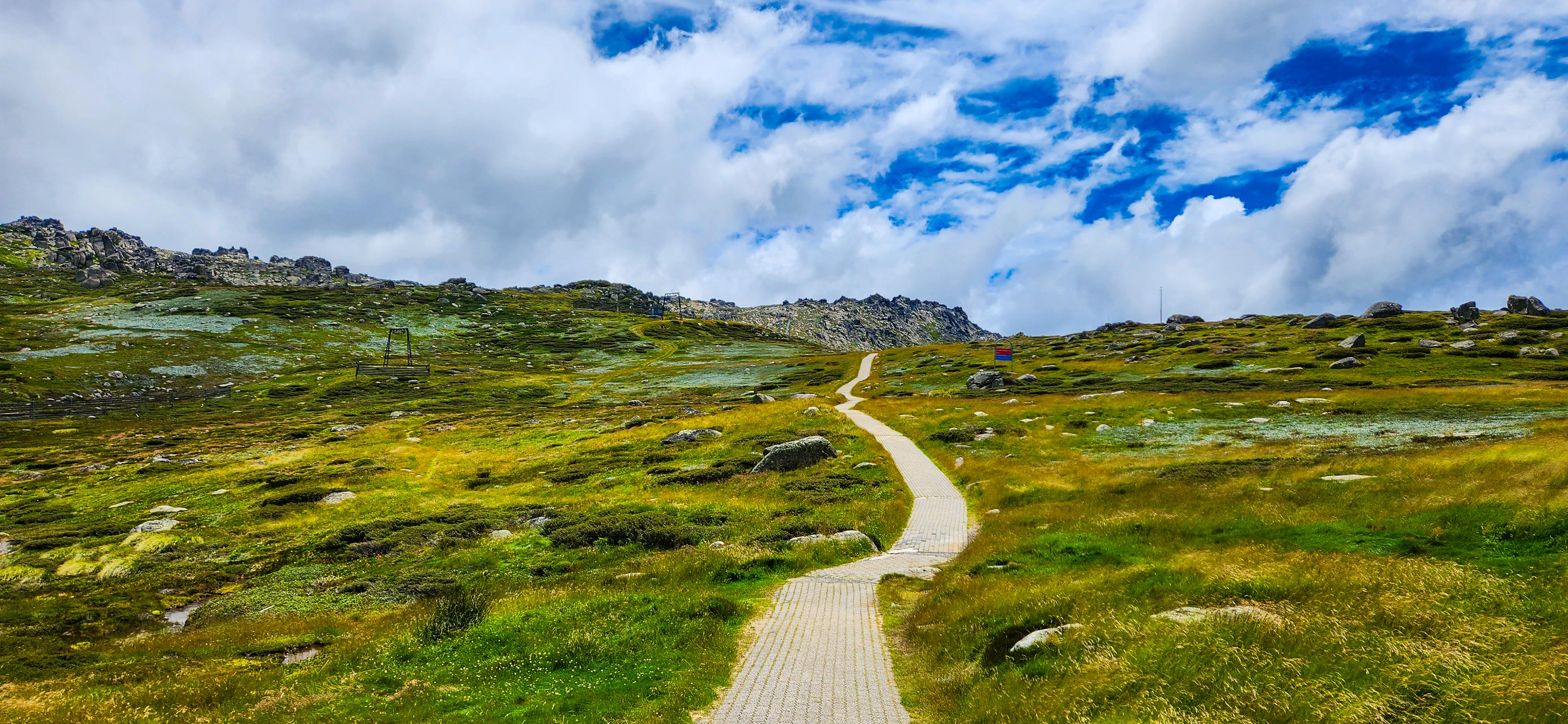
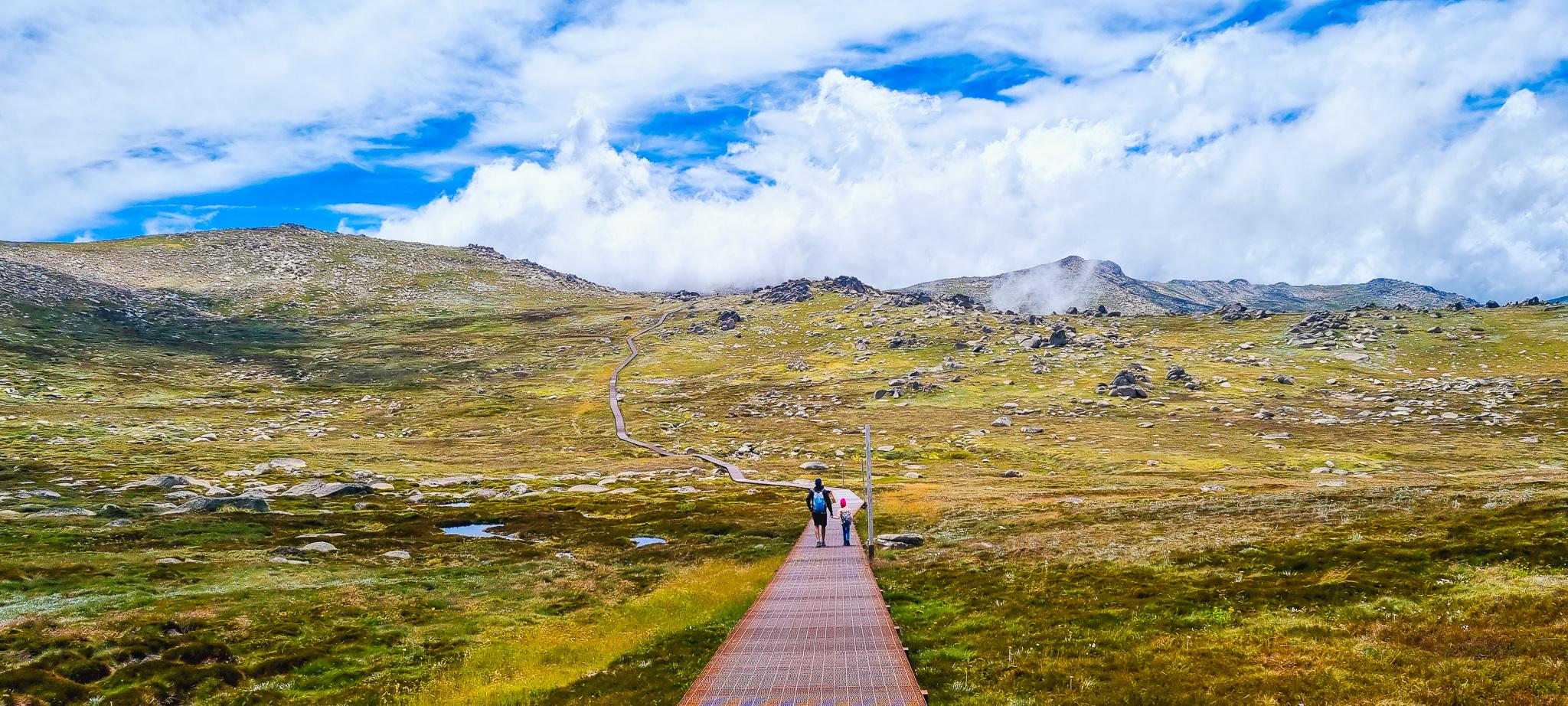
Your first notable stop along this journey is Kosciuszko Lookout, situated approximately 2 kilometers from Eagles Nest Restaurant. This lookout presents breathtaking panoramic views of the surrounding Snowy Mountains, providing a tantalizing preview of the majestic terrain that lies ahead on your ascent to the summit. Take time to pause at Kosciuszko Lookout, soak in the sheer beauty of the surrounding peaks, and appreciate the natural splendor that surrounds you before continuing your upward climb.
Many hikers choose to conclude their walk at the Kosciuszko Lookout after admiring the beauty of Mt Kosciuszko from a distance. If you find yourself in this group, simply retrace your steps back along the same scenic track towards Eagles Nest Restaurant. Upon reaching Eagles Nest Restaurant, take the chairlift back to Thredbo, completing your journey with a relaxing and scenic descent.
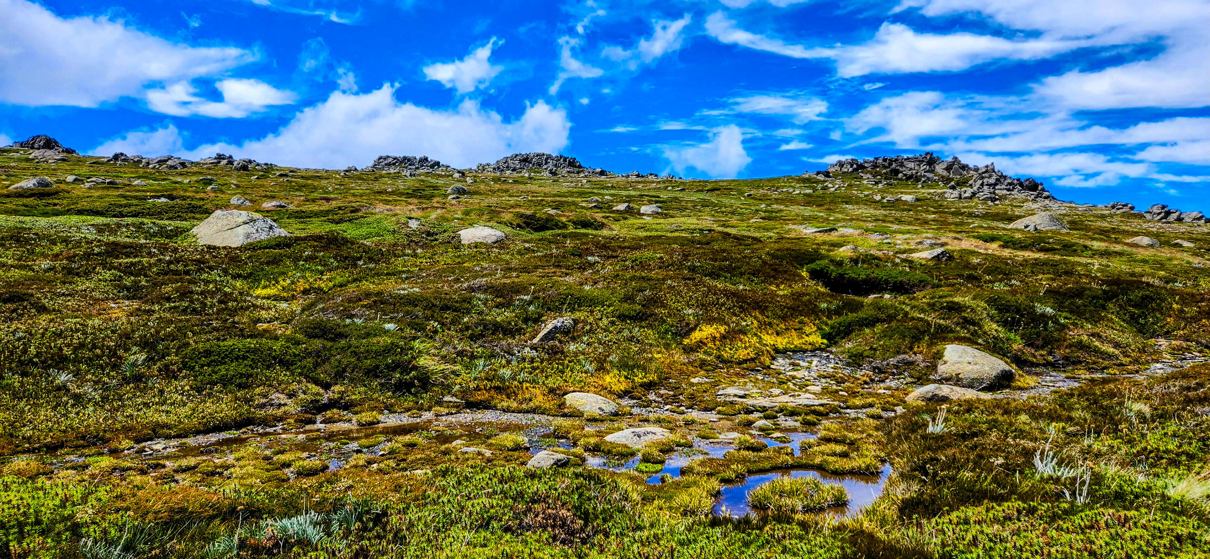
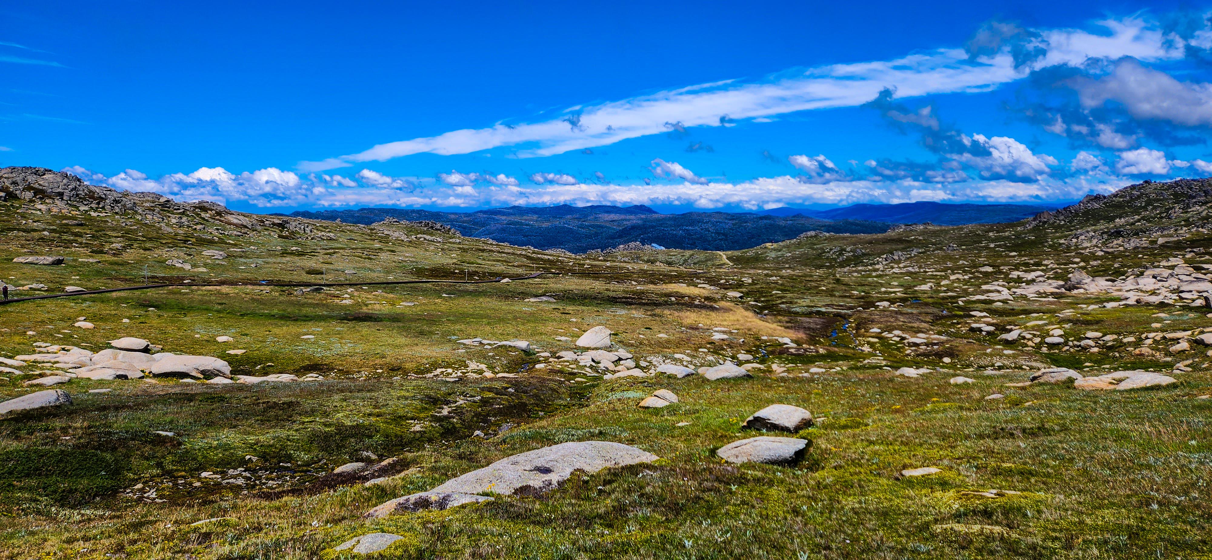
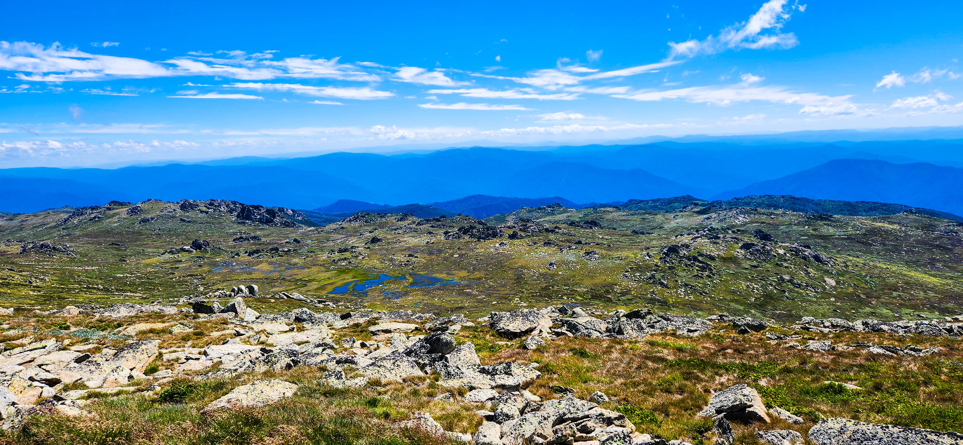
After taking in the breathtaking views at Kosciuszko Lookout, continue your ascent towards Cootapatamba Lookout. This part of the trail offers mesmerizing vistas of the alpine landscape, with rugged peaks and glacial valleys stretching as far as the eye can see. The tranquility of the surroundings and the crisp mountain air create a serene atmosphere, perfect for reflection and appreciation of the natural wonders around you.
As you approach Cootapatamba Lookout, situated approximately 4 kilometers from Eagles Nest Restaurant, the scenery becomes even more awe-inspiring. From the lookout, take in views of Lake Cootapatamba, Australia’s highest lake and also one of only 5 lakes formed by glacial activity on the Australian mainland. The lookout provides a panoramic perspective of the Snowy Mountains, showcasing the vastness and grandeur of this alpine region. Pause at Cootapatamba Lookout to soak in the majestic views, capturing the essence of this pristine wilderness through your lens or simply in your memory.
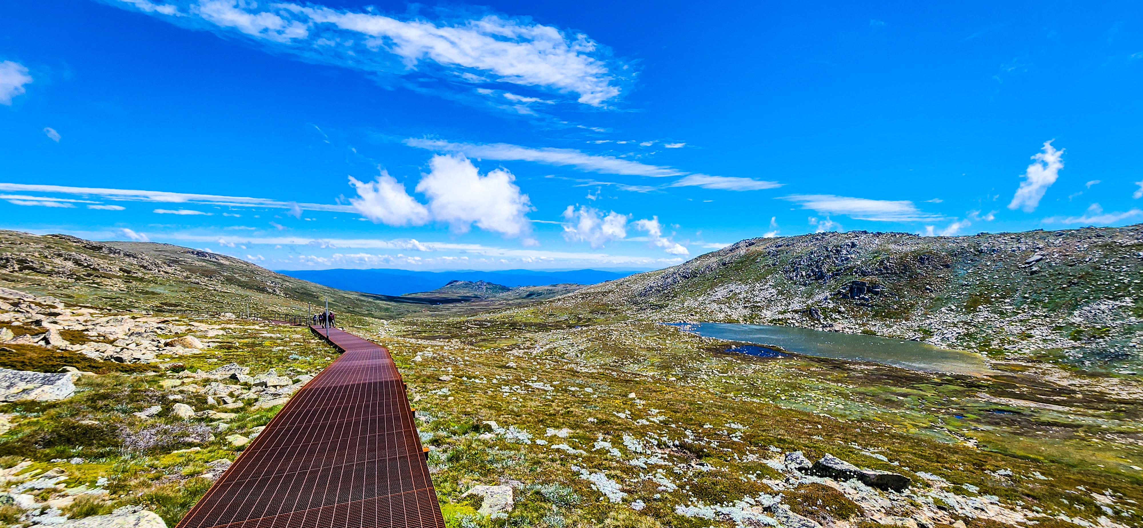
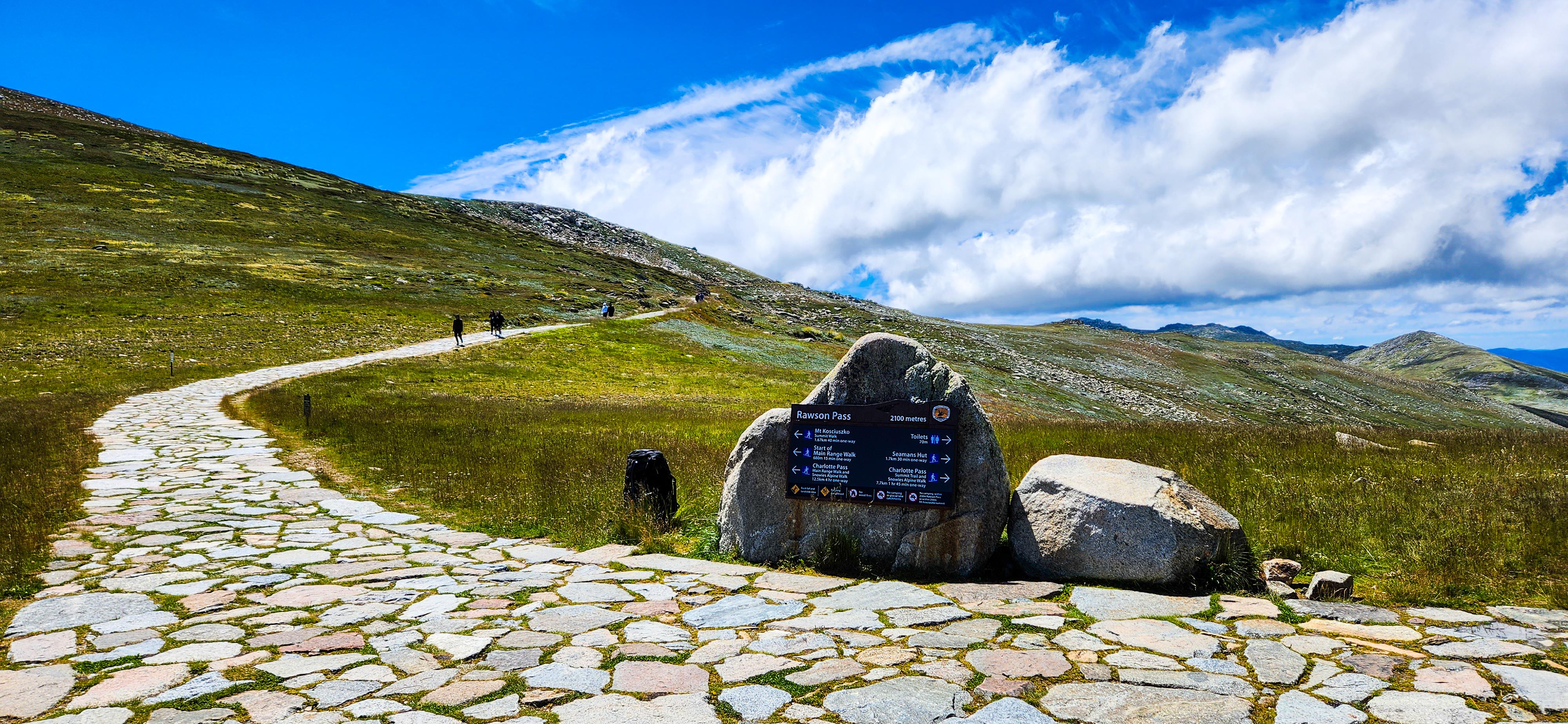
Continuing along the well-marked track, you'll reach Rawson Pass, a pivotal point in your hike. Here, you'll find a junction of trails, restroom facilities, and informational displays about the flora, fauna, and history of Kosciuszko National Park. Rawson Pass serves as a resting spot and a place to gather your energy before the final stretch to the summit.
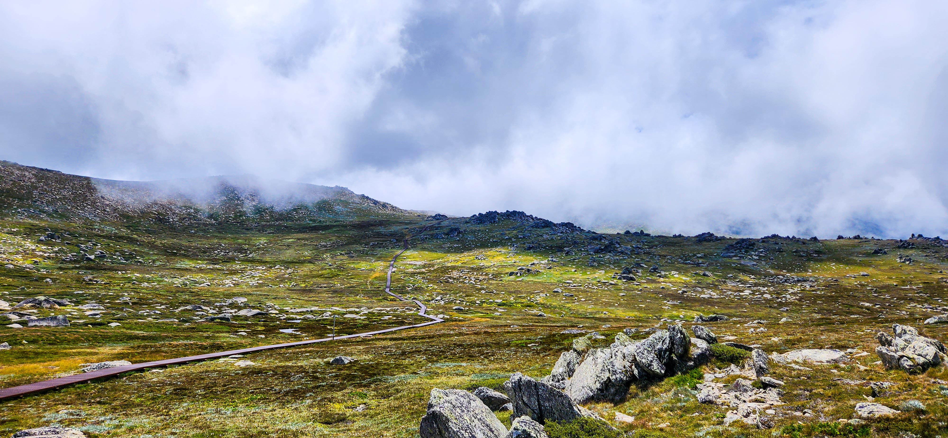
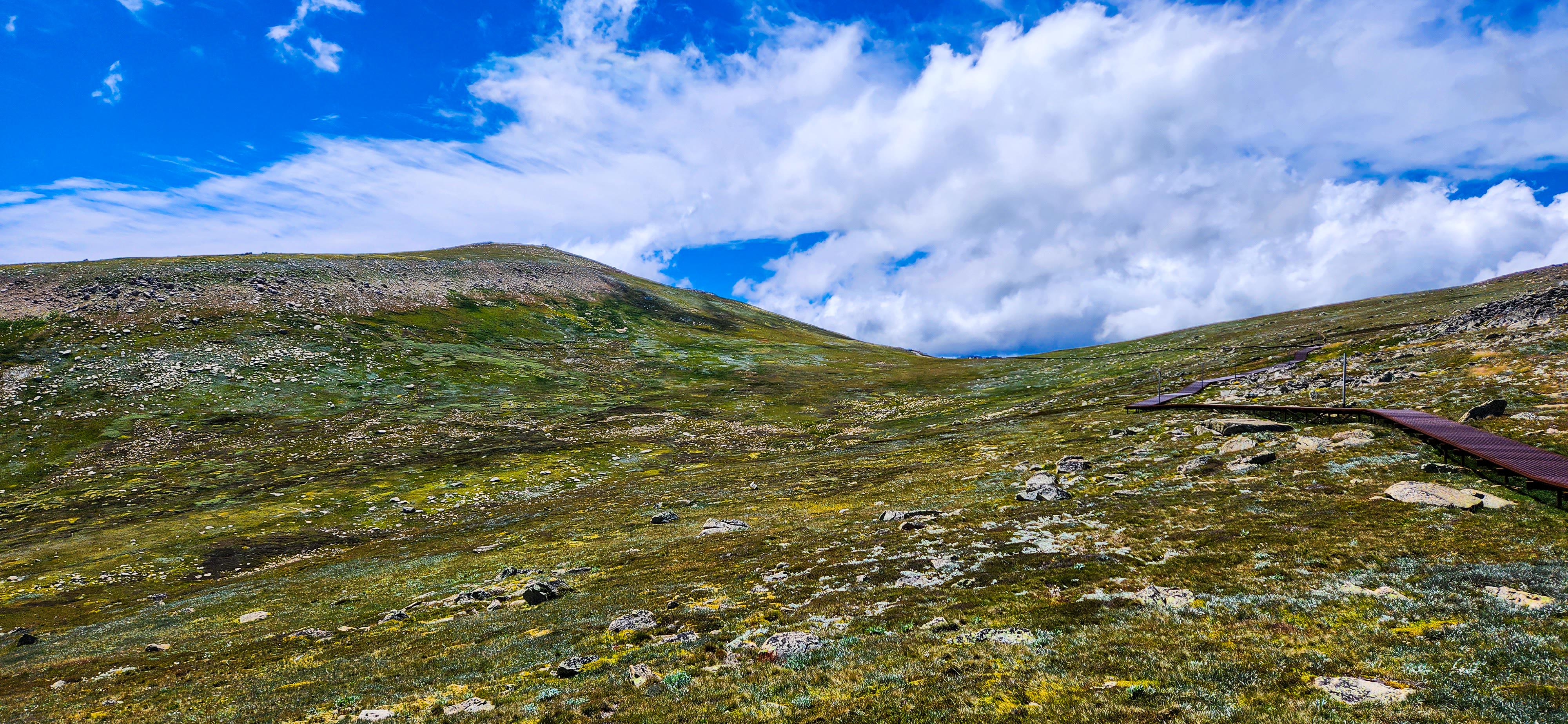
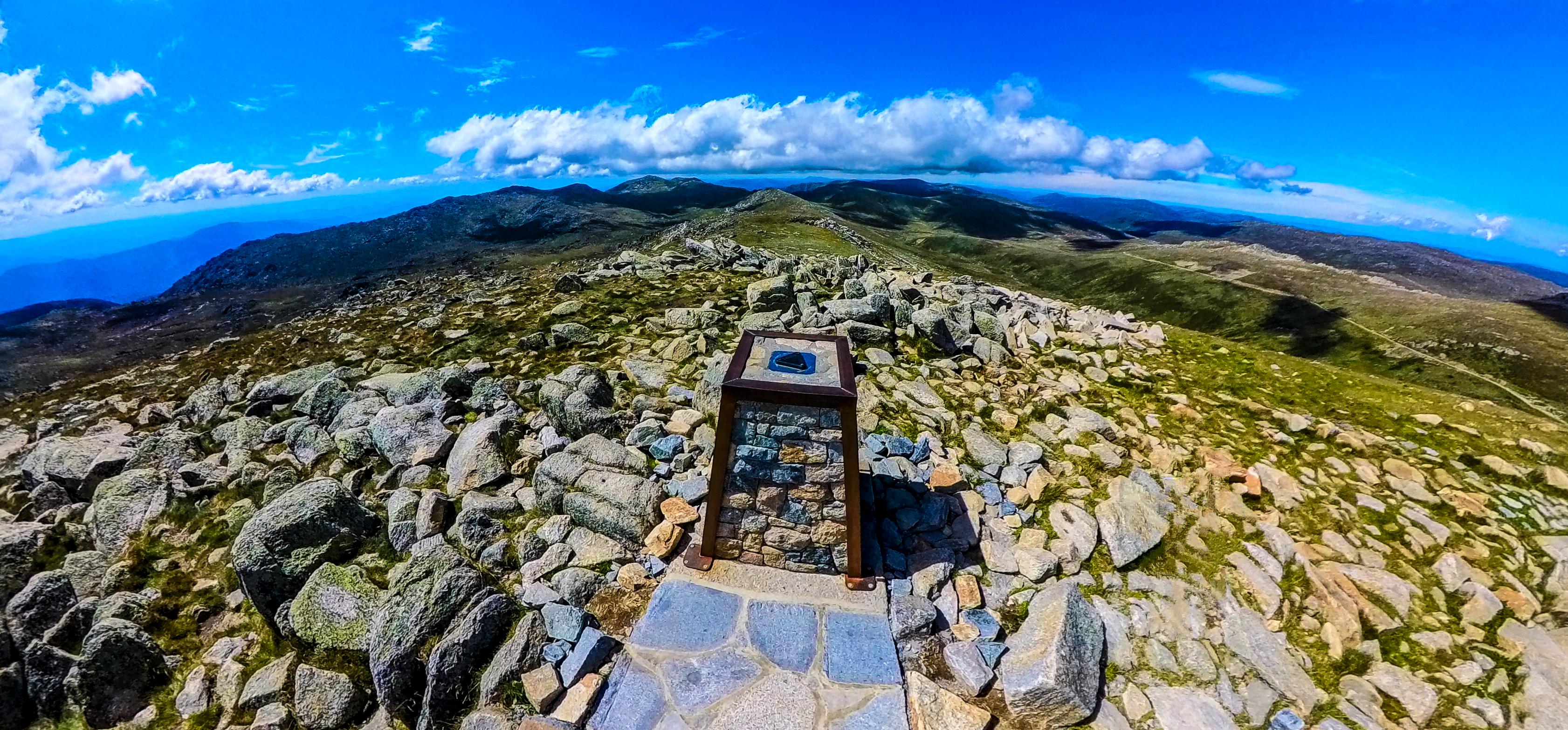
The final leg of your journey to Mt. Kosciuszko Summit unfolds as you leave Rawson Pass behind and follow the marked path towards the highest point in Australia. The trail gradually ascends, offering panoramic views of the surrounding mountains and valleys.
As you approach the summit, a sense of anticipation and accomplishment fills the air. The vastness of the Snowy Mountains unfolds before you, showcasing nature's grandeur in all its glory. Follow the trail, take in the beauty of your surroundings, and embrace the exhilaration of reaching new heights as you stand atop Mt. Kosciuszko Summit, a testament to your determination and the awe-inspiring beauty of the Australian alpine landscape.
After savoring the breathtaking views and sense of achievement at Mt. Kosciuszko Summit, retrace your steps back to Eagles Nest Restaurant. The return journey along the familiar track offers a chance to reflect on the memorable experience and soak in the natural beauty of the Snowy Mountains once more. Upon reaching Eagles Nest Restaurant, take the chairlift back to Thredbo, adding a scenic and relaxing conclusion to your adventure!
**Key Information!!**
On the day of our visit, the Kosciuszko Chairlift was not operational due to windhold. If you encounter a similar situation during your visit, fear not; you have two alternative options to reach the summit, each offering its own unique experience. Regardless of which option you choose, exercise caution as these walking trails intersect with mountain bike trails; stay alert and be mindful of fast-moving mountain bikers to ensure a safe and enjoyable hike. Also, please take caution when walking downhill as both of these trails are quite steep and can be slippery at times. Consider using walking poles to minimize strain on your muscles and joints, ensuring a safer and more enjoyable hike without the risk of injuries.
Option#1 - Merritts Nature Track: This challenging 4-kilometer track begins from Thredbo Village and ascends steeply to the top of the Kosciuszko chairlift. It typically takes 2-3 hours to complete, offering a rigorous uphill hike amidst the stunning alpine scenery. Once at the top of the chairlift, follow the itinerary outlined above to continue your hike to the summit.
Option#2 - Merritts Gondola: Alternatively, you can opt for the Merritts Gondola, which operates from the Valley Terminal next to the Kosciuszko Chairlift Base Station. You can use the MyThredbo card to access both the Kosciuszko Chairlift and Merritts Gondola at no additional cost. The gondola ride to the Merritts Gondola Top Station takes approximately 6 minutes and is unaffected by high winds, making it a reliable option even when the chairlift is not operational. From the Top Station, hike to the top of the Kosciuszko chairlift via the Gunbarrel Chairlift Top Station. This 3-kilometer track, while still steep, offers a slightly lower elevation gain compared to the Merritts Nature Track. Follow the itinerary outlined above to proceed from the Kosciuszko chairlift towards the summit.
Keep in mind the operating times of the Kosciuszko chairlift (9AM to 4PM) and Merritts Gondola (9:30AM to 4PM) when planning your hike; up-to-date information can be found here. If you anticipate not being able to reach either of these by closing time, be prepared for a strenuous walk back to Thredbo village from Eagles Nest Restaurant. We decided to use the Merritts Gondola for our onward journey, and for our return trip, we opted to walk down the Merritts Nature Track due to it being past the closing time. Carry sufficient food, water, and battery packs for your mobile devices in case of emergencies. Safety is paramount, so plan accordingly and enjoy your hike to Mt. Kosciuszko Summit! Nevertheless, the views during this additional walk are worth the extra effort!!
Love our itinerary? Excited to visit Mt. Kosciuszko Summit? Book your accommodation via Booking.com below at cheaper prices!
This post may contain affiliate links. This means that, at no additional cost to you, we may earn a small commission if you make a purchase through the links provided. These commissions help support our website and allow us to continue sharing our travel experiences. Thank you for your support.
This itinerary is based on our personal experiences and recommendations. All information is provided for general guidance only and may change due to circumstances beyond our control. Travellers are encouraged to independently verify details and make choices according to their own preferences and safety considerations. We do not accept responsibility for any loss, injury, or inconvenience sustained by anyone using our itineraries.