Imagine stepping into a world shaped by fire and ice, where ancient volcanic peaks loom over vivid emerald lakes and steam rises from the earth beneath your feet. Widely regarded as New Zealand’s finest one-day walk and one of the best in the world, the Tongariro Alpine Crossing is not just a hike; it's an odyssey through one of the country's most awe-inspiring landscapes. This 20.2-kilometre trek challenges and rewards adventurers with surreal vistas and the thrill of walking in the shadow of active volcanoes. Prepare to be captivated by nature's raw power on this unforgettable journey through Tongariro National Park.
Explore our itineraries hassle-free with these recommended services!
Car Rental
Getting there
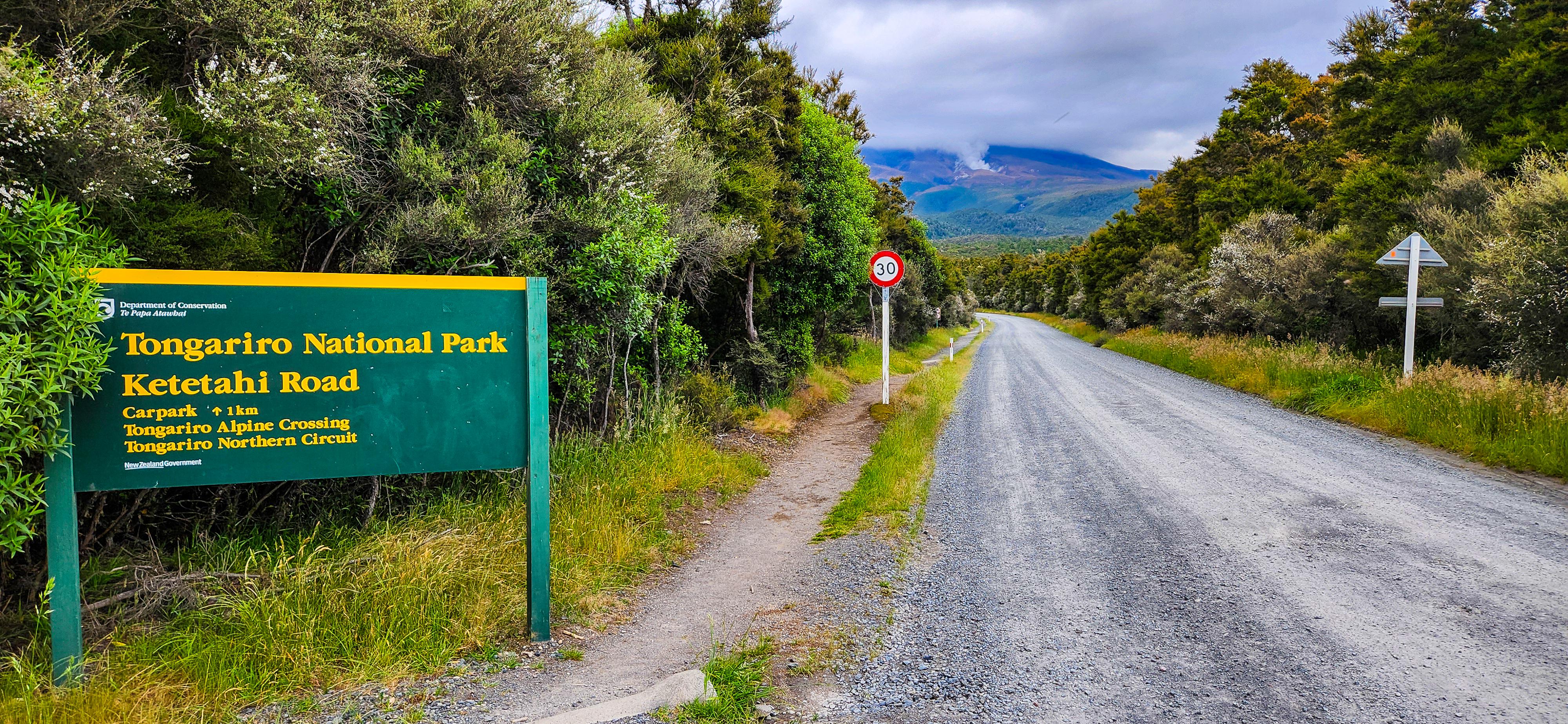
The Tongariro Alpine Crossing is a point-to-point hike, starting at the Mangatepopo car park and ending at the Ketetahi car park. Parking at Mangatepopo Car Park for the Tongariro Alpine Crossing is not feasible due to a strict 4-hour time limit. This restriction makes it impossible to park, hike the full crossing, and return within the allotted time. This car park is only suitable for those planning a brief section of the hike before turning back. No private parking options are available at this end of the trail either. For our journey, we opted to park at the Tongariro Crossing Car Park, conveniently located 900 metres from Ketetahi Car Park, the hike's endpoint. From there, we utilised Tongariro Crossing Car Park's shuttle service to the Mangatepopo Car Park, to begin our trek. This arrangement allowed us to complete the hike and return directly to our vehicle, making for a seamless end to our adventure. Given the point-to-point nature of the trail and parking restrictions, this is a practical solution for most hikers. The Tongariro Crossing Car Park closes at 7 PM, so it’s important to start your hike early to ensure you have enough time to complete the walk and return before the gate is closed. If you anticipate being late, it's recommended to notify the car park, and they will keep the gate open for you. This gives you peace of mind, ensuring you won't miss out on retrieving your vehicle after the hike.
For those preferring not to leave their car parked all day or travelling without a car, several shuttle services from nearby towns like Taupō and Turangi offer convenient drop-off and pick-up options from your accommodation. These services take the hassle out of driving and ensure a stress-free end to your hike with a shuttle waiting at the conclusion.
Booking Your Tongariro Adventure with DOC
In addition to making your Tongariro Crossing Carpark booking, securing a booking with DOC is essential and must be done through the New Zealand Department of Conservation (DOC) website. It costs nothing to book the Tongariro Crossing! The booking is crucial for DOC in managing visitor numbers and preserving the natural environment. You’ll need to select a specific day for your hike and keep the booking confirmation email handy. This confirmation is necessary when accessing parking and shuttle services. Ensuring your spot in advance helps manage the high demand and guarantees a smooth start to your adventure. For more details, visit Tongariro Crossing Booking.
Tongariro Weather: What to Expect
The weather in Tongariro National Park is notoriously unpredictable, with conditions that can change rapidly. It's essential to check the forecast before your hike. The New Zealand Department of Conservation (DOC) provides up-to-date weather information and alerts. Even in summer, be prepared for sudden temperature drops, strong winds, and rain. In winter (June to October), the trail can be covered in snow and ice, making the hike more challenging and potentially hazardous. During these months, it's advisable to undertake the crossing with a guided tour equipped for winter conditions.
The New Zealand Department of Conservation (DOC) closely monitors weather conditions and may close the Tongariro Crossing if it becomes unsafe, notifying shuttle operators and car park providers. These closures can happen even in summer due to the area's unpredictable weather. It's advisable to include additional days in your itinerary as a backup in case of closure. Although we experienced a clear day during our hike, by the evening, the crossing became increasingly cloudy, and it was subsequently closed for the next two days due to adverse conditions. This highlights the importance of flexibility in your plans. Always check the weather forecasts and be ready for possible delays to ensure a safe and enjoyable experience.
Packing List and Preparedness
When preparing for the Tongariro Alpine Crossing, it's crucial to pack appropriately for the alpine conditions. To ensure a safe and comfortable experience, consider packing the following essentials:
- Clothing: Layered clothing is essential, including a thermal base layer, an insulating mid-layer, and a waterproof outer layer.
- Footwear: Opt for sturdy waterproof hiking shoes with good ankle support and weatherproof socks. Cotton socks don't help!
- Accessories: Bring a warm hat, a beanie, gloves, and sunglasses to protect against the sun and wind. Don't forget sun protection, toilet paper and hand sanitiser.
- Equipment: Walking poles, a headlamp, map, compass or GPS device are useful for navigation.
- Food and Water: Carry high-energy food & snacks and at least 2 litres of water, as there are no water sources along the track.
- Safety Gear: Include a first aid kit, emergency blanket, and a mobile phone with a spare battery or power bank.
Proper preparation is crucial, as the alpine environment can be unforgiving. Ensure you're in good physical condition and inform someone about your hiking plans before setting out.
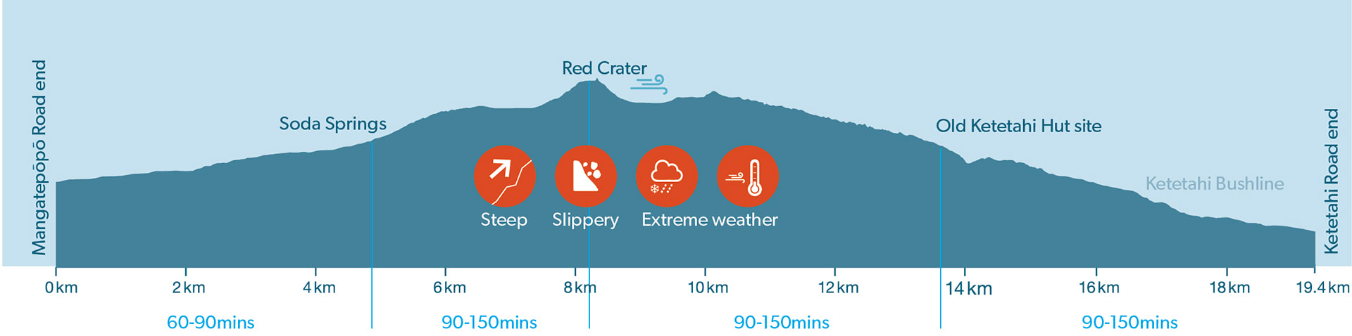
Key Facts About the Hike
- Distance: 20.2 kilometres (12.6 miles)
- Duration: Approximately 7 to 8 hours
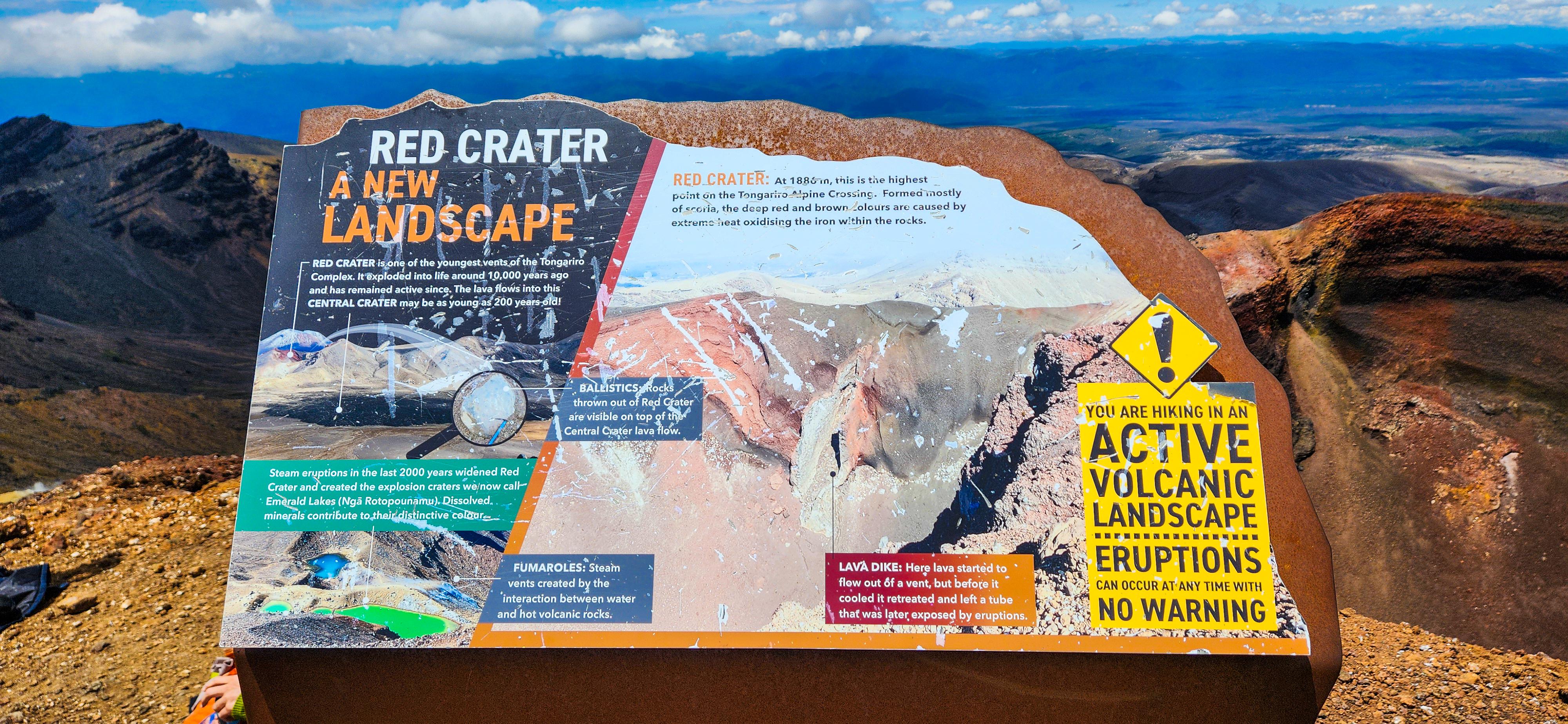
- Elevation Gain: 847 metres (2,779 feet)
- Highest Point: Red Crater at 1,886 metres (6,188 feet)
- Difficulty: Strenuous; suitable for hikers with good fitness levels
- Track condition: Steep and undulating - Track surface is generally well formed, some sections are steep, rough and/or muddy
- Best Time to Hike: November to May for milder weather; guided hikes recommended during winter months due to snow and ice.
Provided below is the AllTrails map for the walk.
Sections of the Walk: What to Expect
The Tongariro Alpine Crossing offers a diverse range of landscapes, each with its own challenges and rewards. From volcanic terrain to alpine meadows, the walk is split into several sections, each providing unique experiences. As you progress, you'll encounter different views, varying levels of difficulty, and key landmarks that make this one of New Zealand's most iconic hikes. Understanding what to expect in each section helps you prepare mentally and physically for the adventure ahead.
Mangatepopo Car Park to Soda Springs
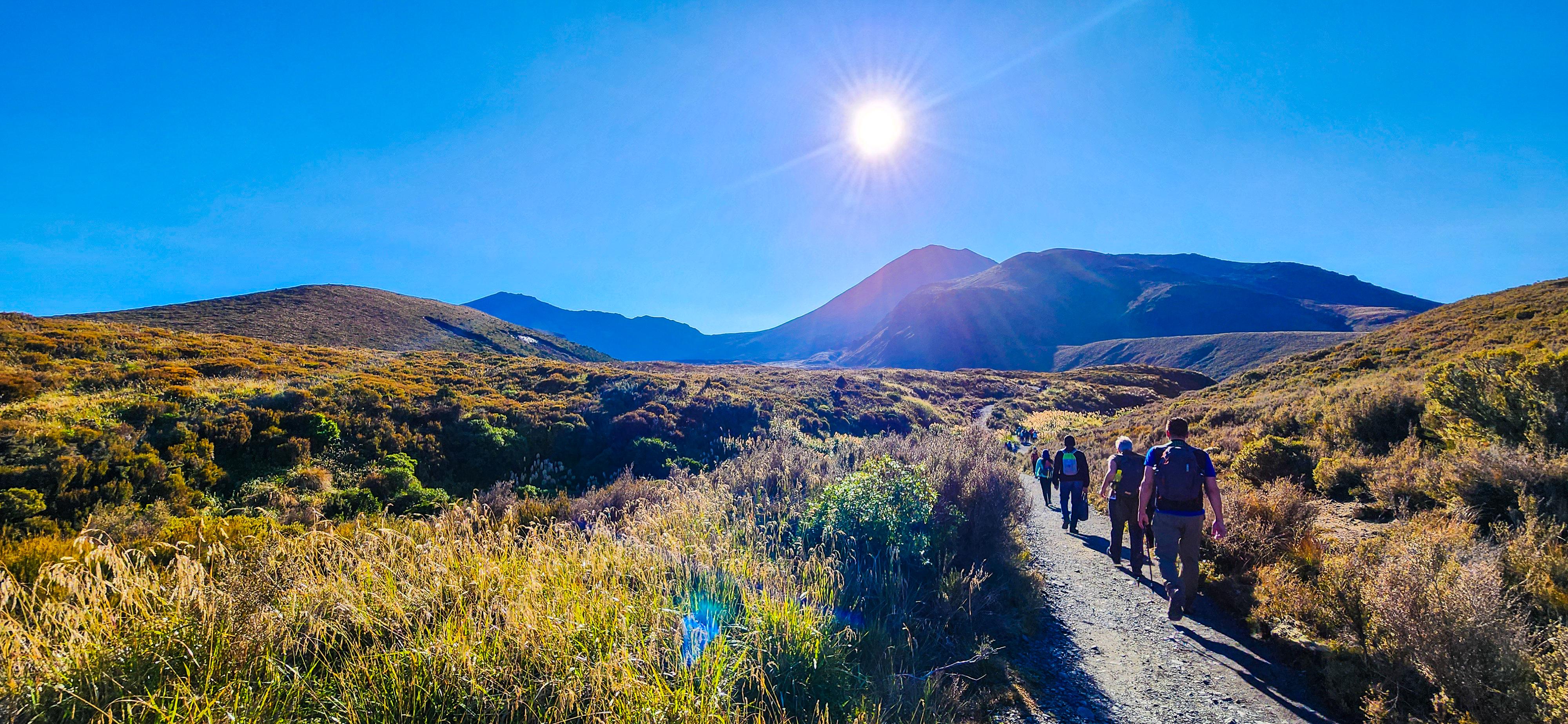
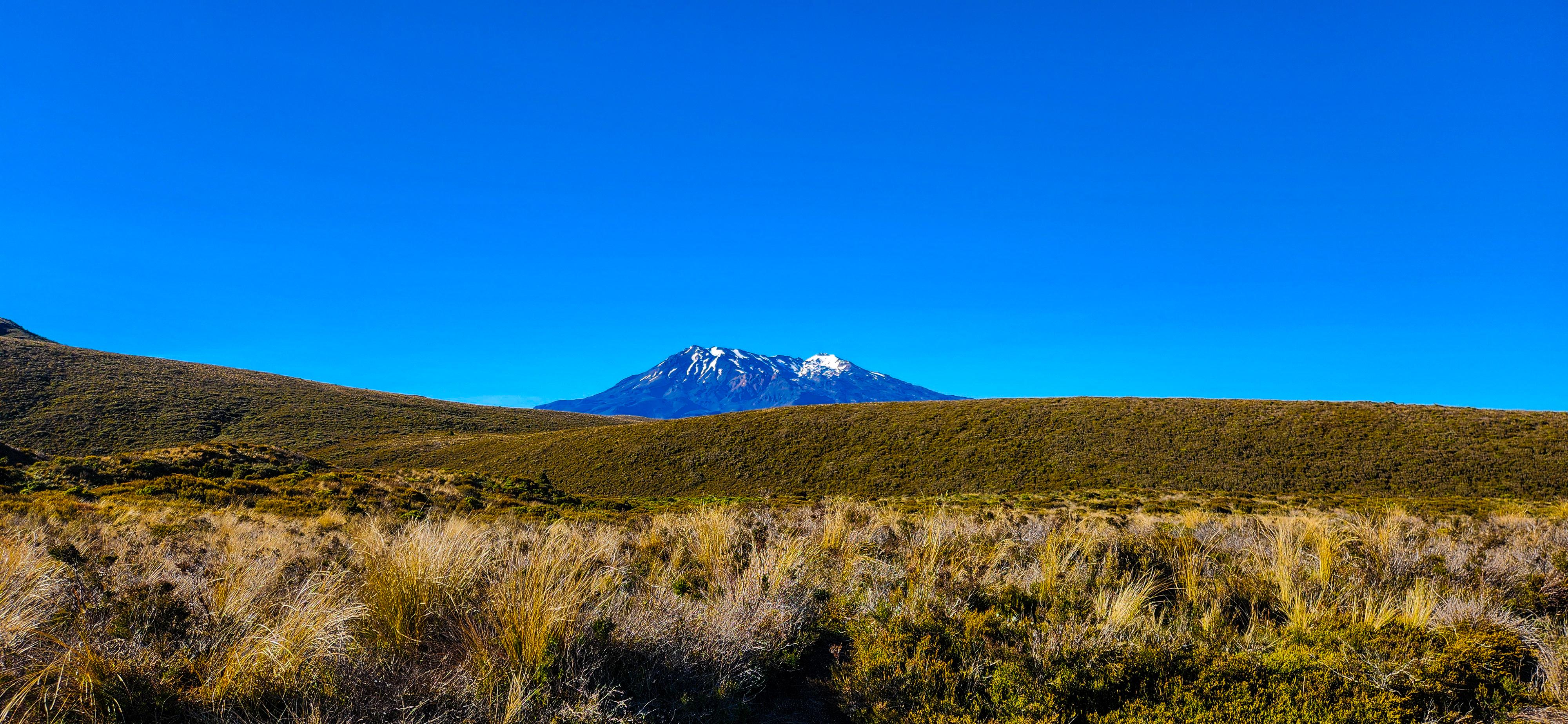
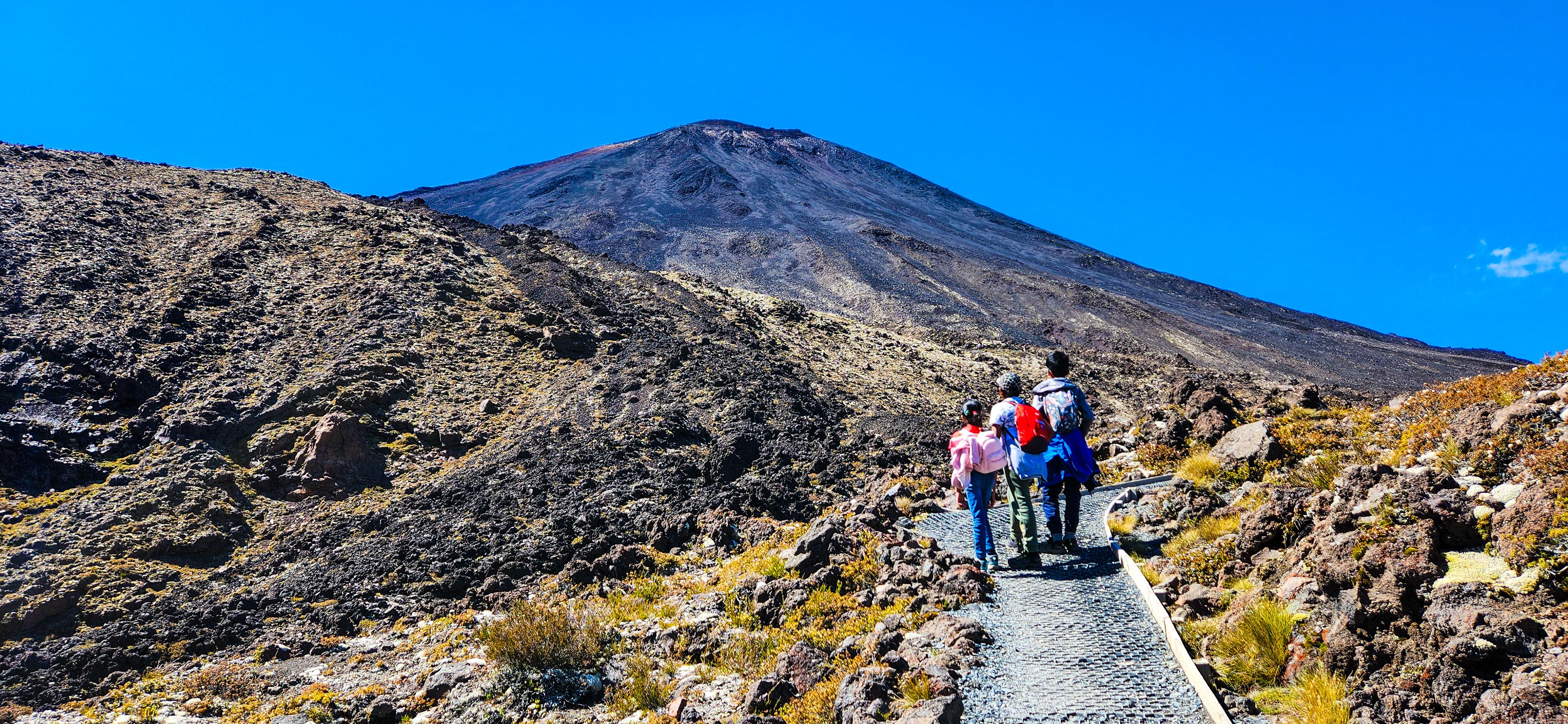
The walk begins at the Mangatepopo Car Park, where you'll be dropped off by the shuttle. Before you start, make use of the available restrooms to ensure you're ready for the hike ahead. This section begins with a relatively easy walk through the Mangatepopo Valley, surrounded by ancient lava flows and tussock grass. The path is well-graded, offering an excellent opportunity to acclimatise to the trail. As you move forward, you’ll be greeted with stunning views of Mount Ngauruhoe. Soda Springs is a great spot for a short break before the climb intensifies. The tranquil setting of the springs provides a moment of calm before the ascent.
_from_Mangatepopo_Valley.jpg)
Soda Springs to South Crater
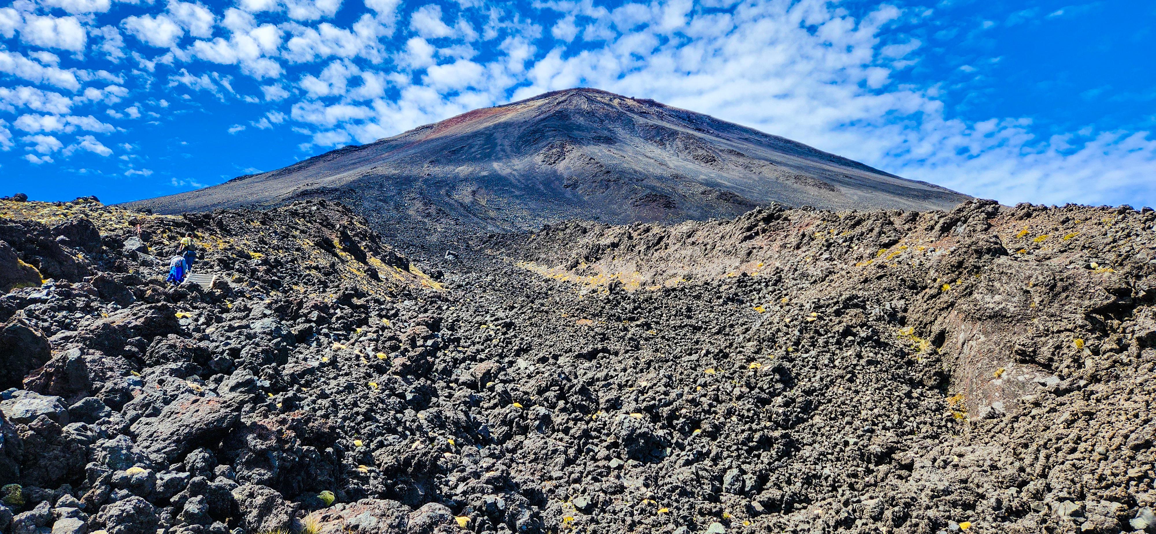
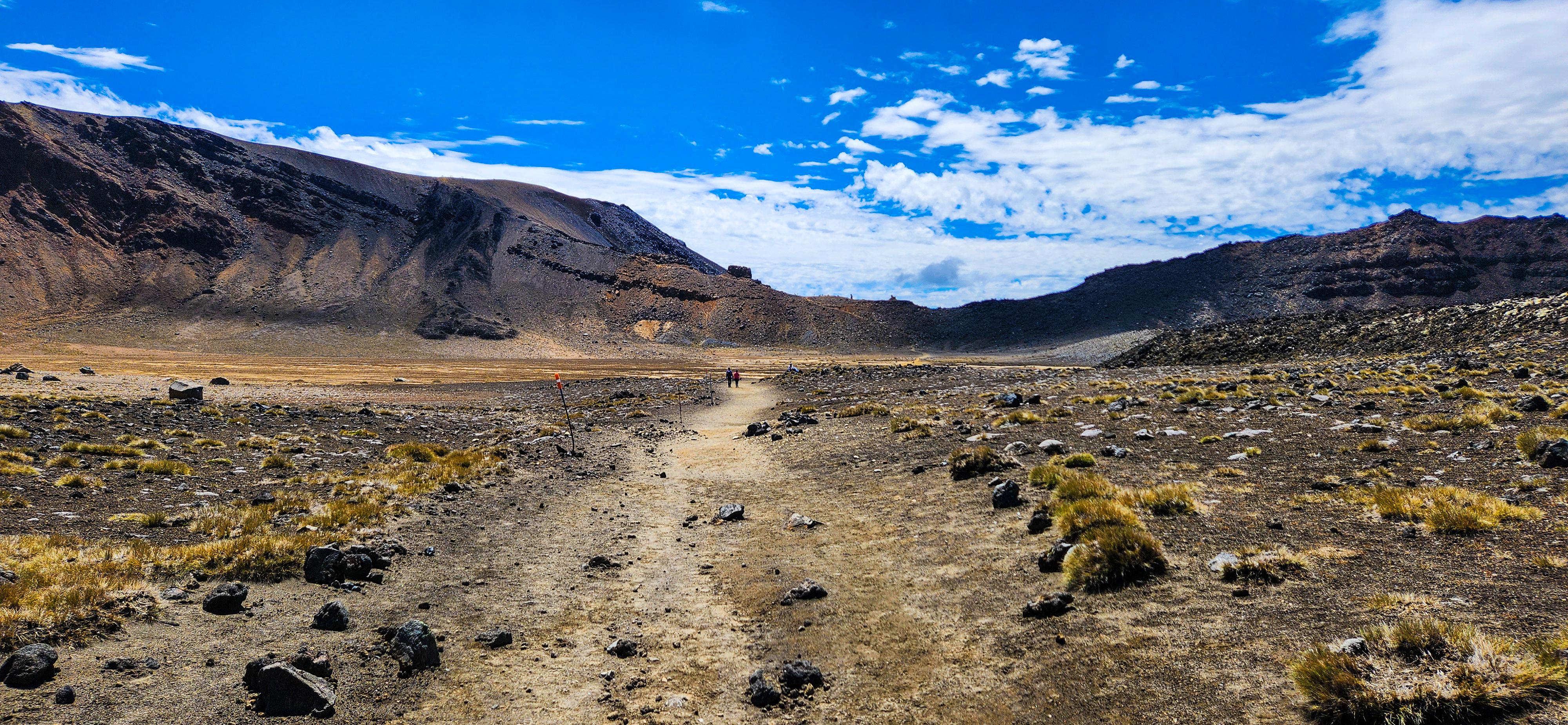
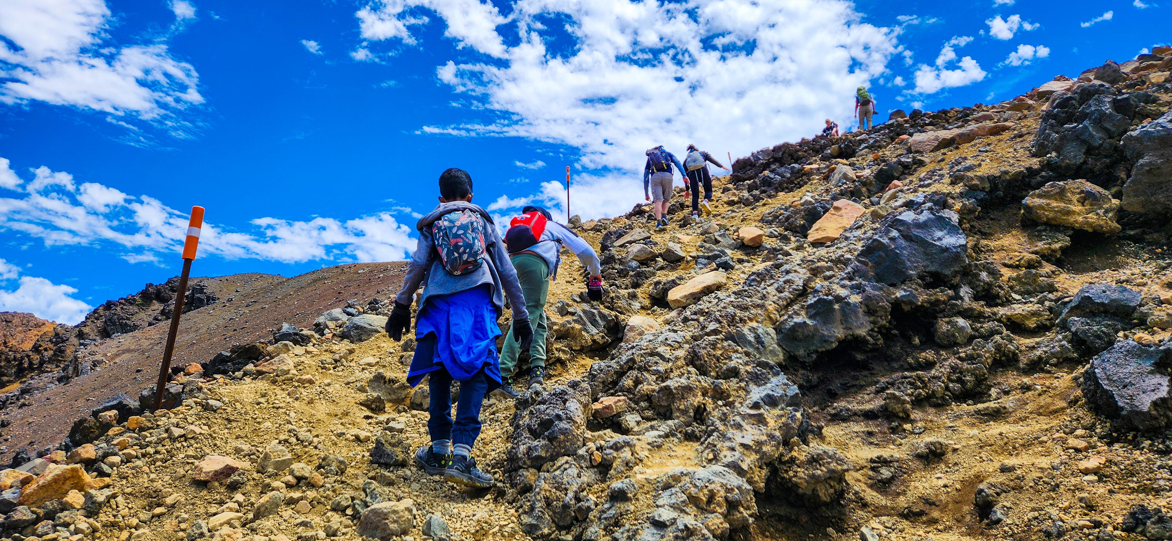
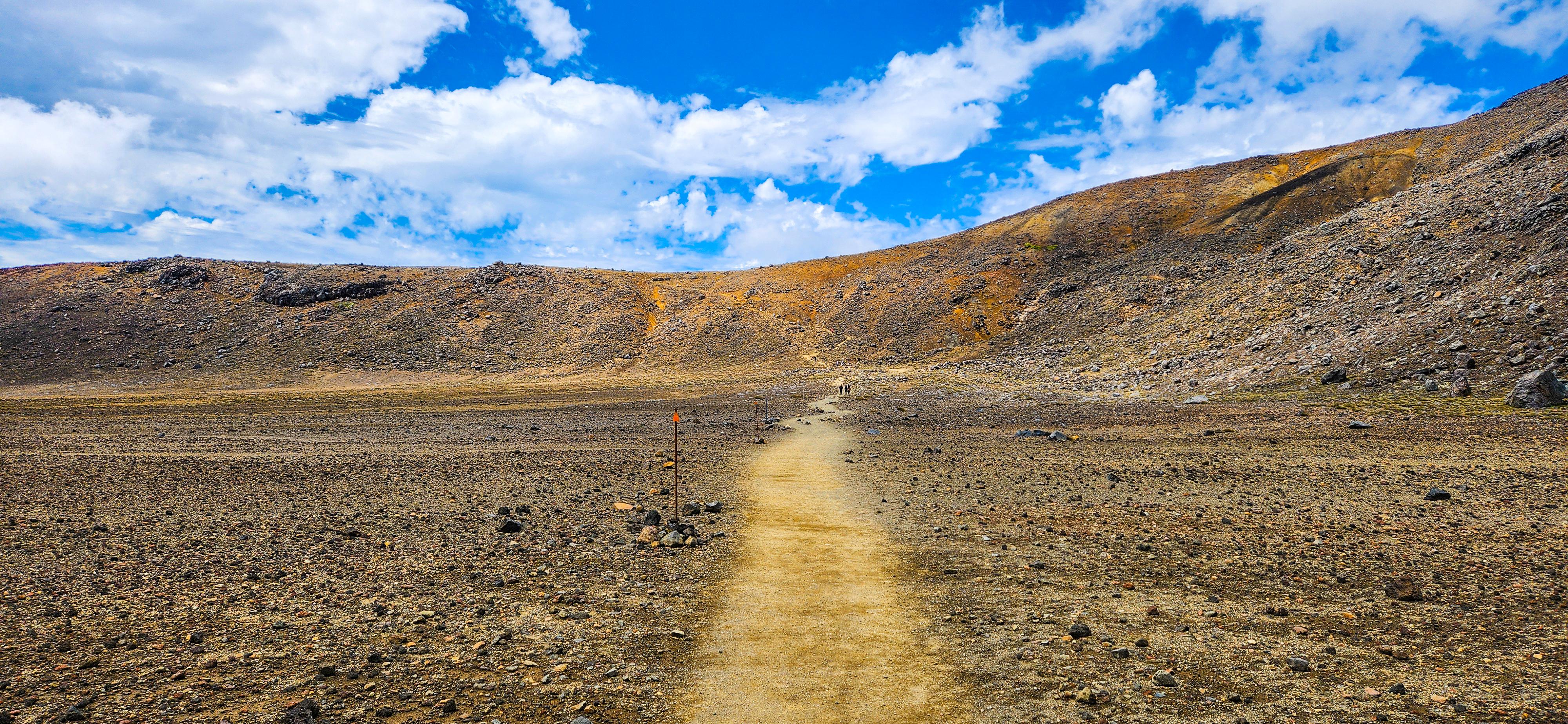
Make use of the available restrooms at Soda Springs to prepare for the journey ahead. Keep in mind that there are NO restrooms between Soda Springs and Ketetahi Hut, a stretch of approximately 8.5 km. Plan accordingly to ensure a comfortable hike, as this section covers some of the most demanding and breathtaking parts of the trail. This part of the trail is known as the "Devil's Staircase" for a reason. The path becomes steeper, demanding more effort as you ascend. However, each step rewards you with increasingly panoramic views of the surrounding volcanic landscape. The climb leads to South Crater, a broad, flat expanse that offers a welcome break from the uphill trek. The unique terrain here, with its stark, barren beauty, feels almost otherworldly.
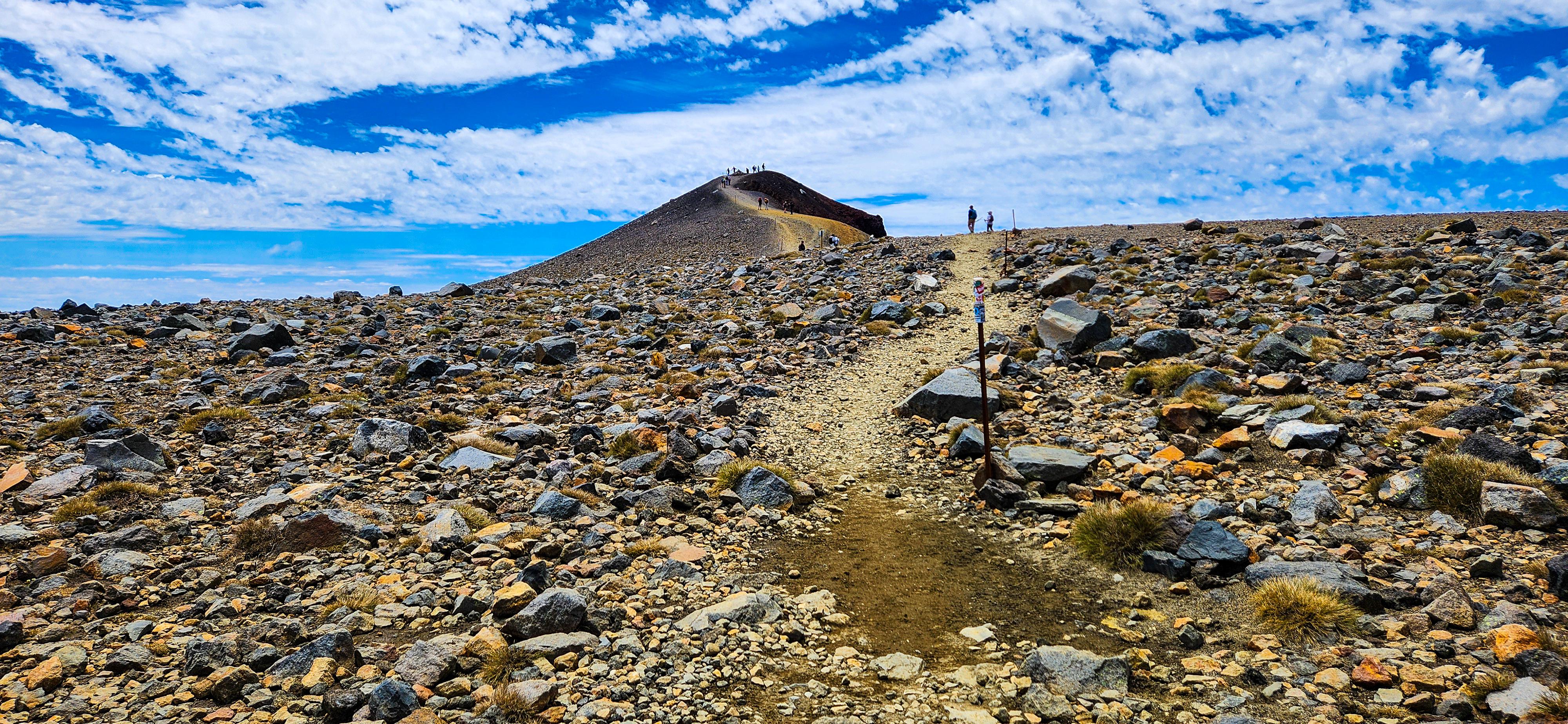
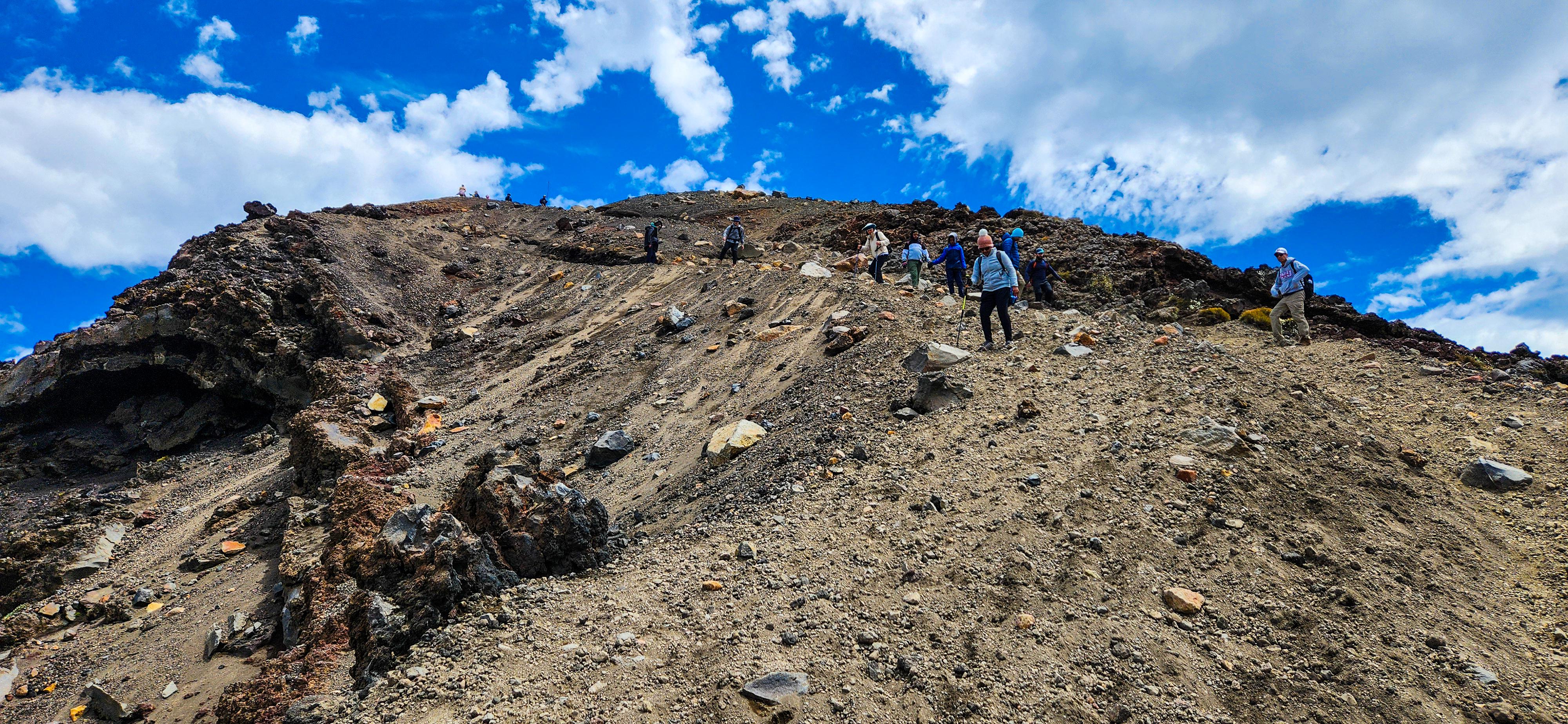
Summitting Mount Doom (Mount Ngauruhoe):
For those seeking an extra challenge, a detour to the summit of the "Lord of the Rings" famous Mount Doom, officially known as Mount Ngauruhoe, is a thrilling option. This steep and strenuous climb is not part of the official Tongariro Alpine Crossing but offers a unique opportunity to ascend an iconic volcanic cone. The detour begins when you reach the base of Mount Ngauruhoe after hiking past Soda Springs and navigating the Devil's Staircase; this is where the side trail to the summit starts. It’s important to note that there is no marked path to the top, and the ascent involves navigating loose volcanic rocks and steep inclines, requiring a good level of fitness and determination. Be prepared for a challenging climb, as this detour adds significant time and difficulty to your hike.
- Distance: Approximately 3 km return (1.5 km each way).
- Elevation Gain: Around 600 metres.
- Time Required: 2-4 hours return, depending on fitness levels and conditions.
The detour significantly increases the total time and effort of the Tongariro Alpine Crossing, so ensure you have adequate time, energy, and supplies before attempting this side trip.
.jpg)
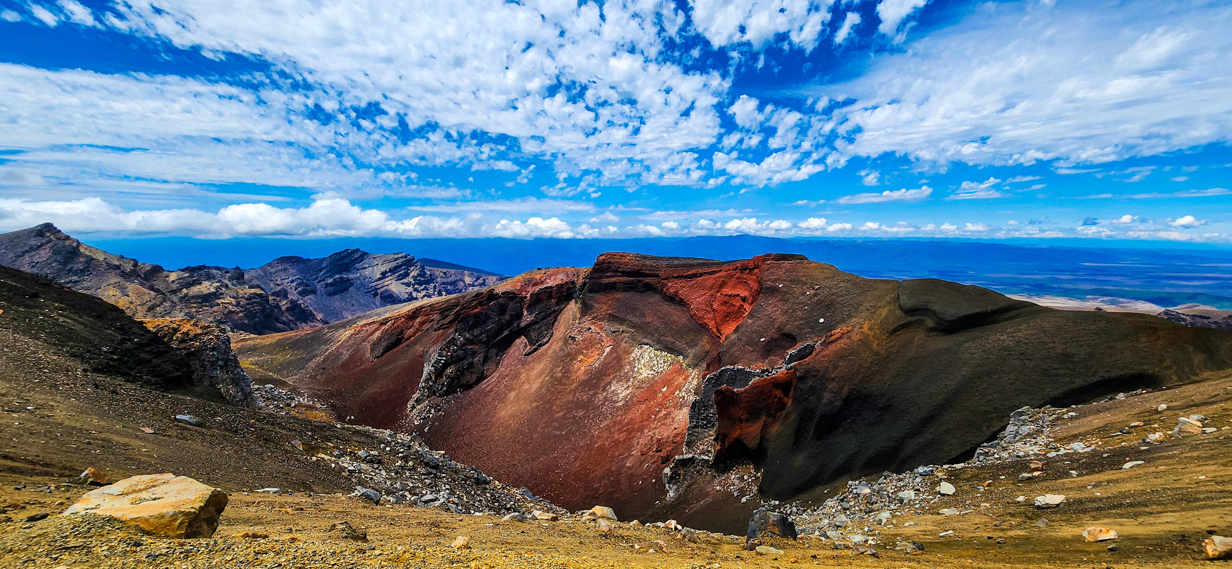
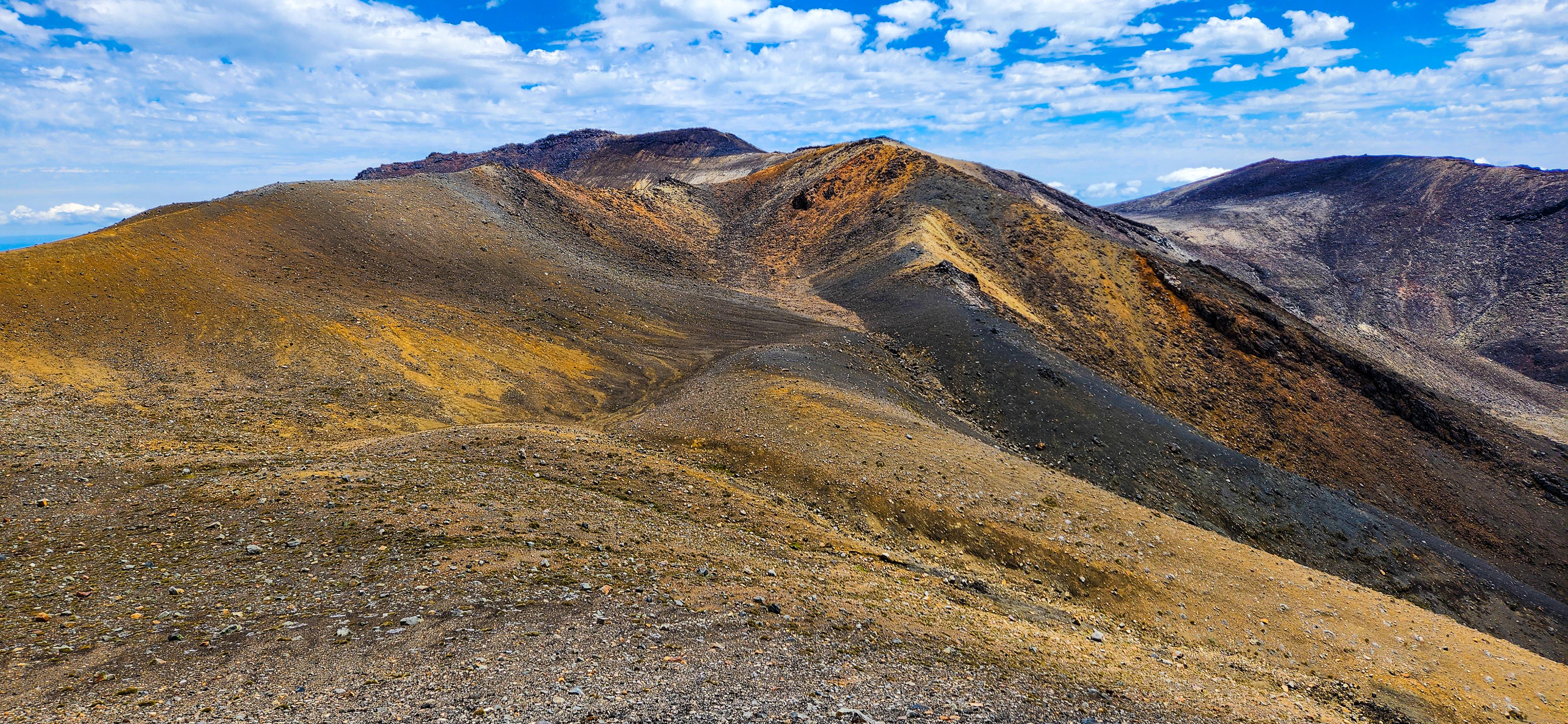
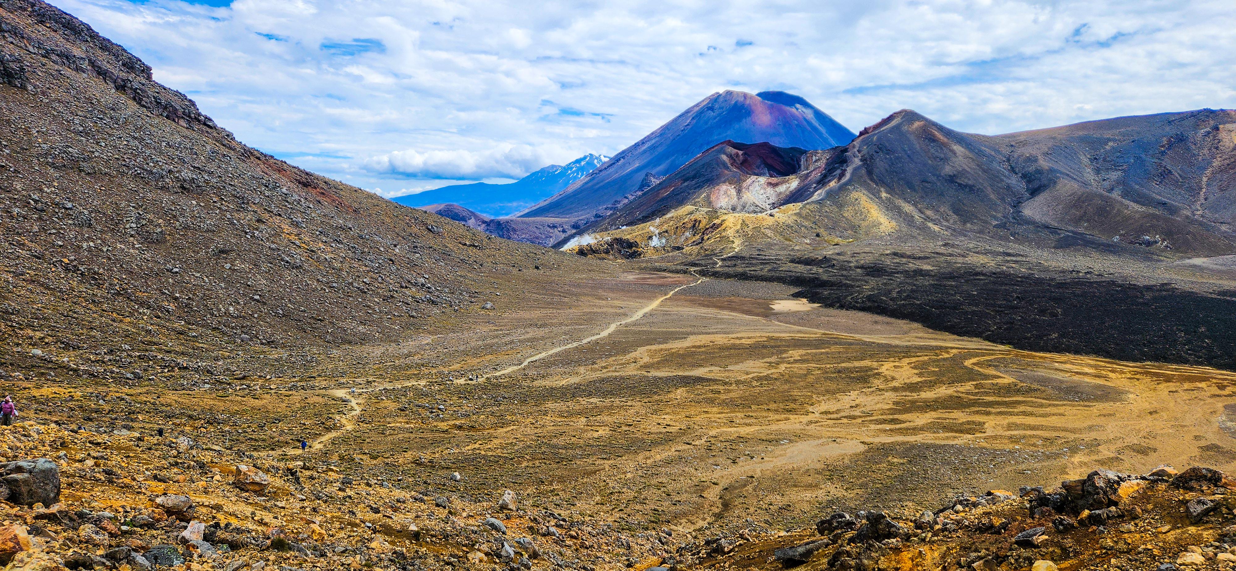
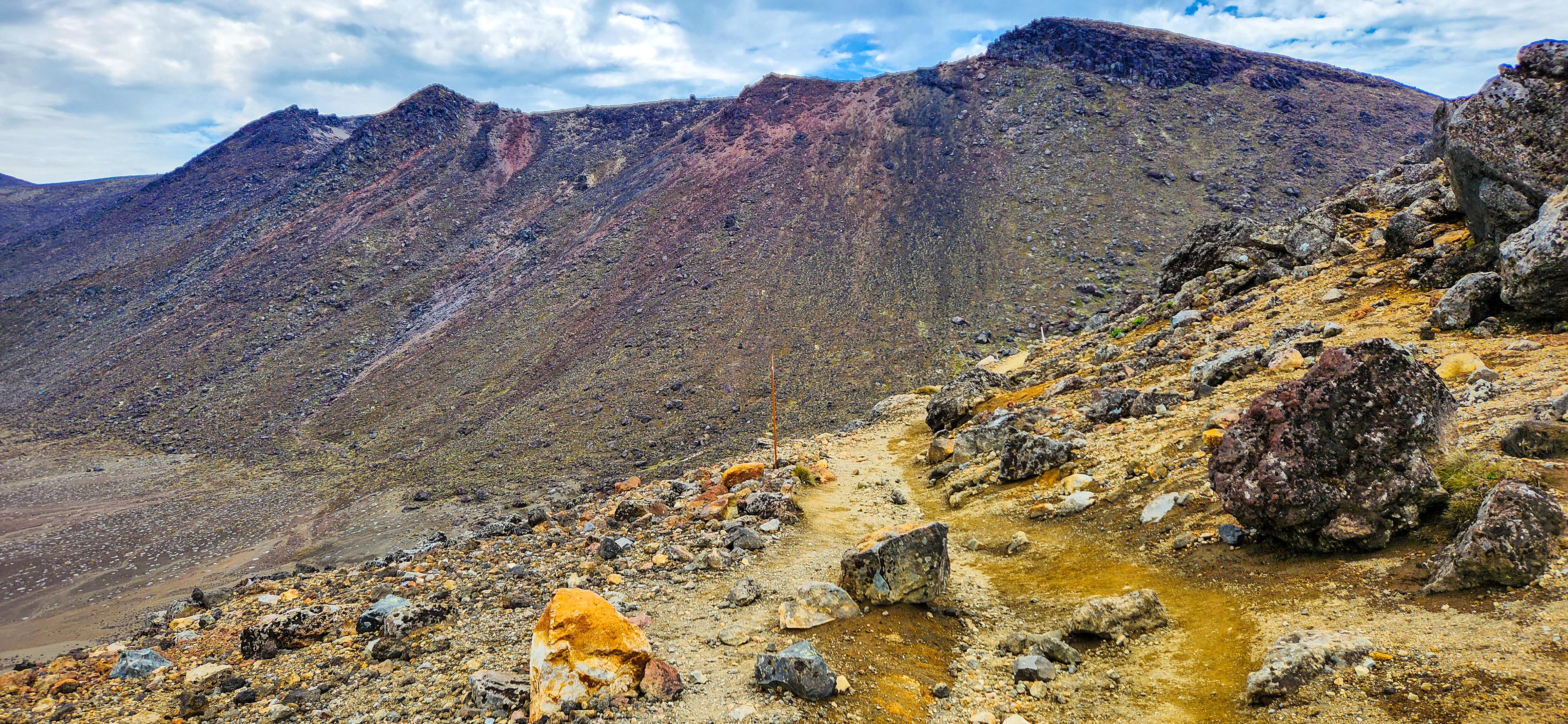
South Crater to Red Crater
Crossing the South Crater is a surreal experience, as the flat, open space is bordered by towering peaks. The ascent to Red Crater, the highest point of the Tongariro Alpine Crossing, is both steep and demanding. The trail is covered with loose scoria, which can make footing tricky, requiring careful navigation and steady balance. Even in dry conditions, the climb was very slippery for us, so it's essential to take extra caution, especially in wet or windy weather. This challenging section rewards hikers with stunning views, but safety should be a top priority as you tackle this rugged terrain. Once at the summit, the vibrant red hues of the crater and the expansive views are truly awe-inspiring. This is one of the most dramatic and memorable parts of the hike!
_and_South_Crater_on_Tongariro_Alpine_Crossing.jpg)
Hiking to Mount Tongariro Summit:
Another rewarding detour along the Tongariro Alpine Crossing is the hike to Mount Tongariro Summit. This side trip offers a less demanding climb compared to Mount Ngauruhoe but still provides incredible vistas. The trail leads you past volcanic craters and rugged terrain, culminating in breathtaking views of the Central Plateau and nearby peaks. The Mount Tongariro Summit detour is a fantastic way to experience the dramatic landscapes of the region without the intensity of a steep volcanic ascent. The detour to Mount Tongariro Summit is more straightforward and begins from the Red Crater. After reaching the Red Crater summit, a marked trail leads you towards the Mount Tongariro Summit. This side trail is well-defined and offers a relatively moderate climb, providing stunning views along the way. This detour is a great option for hikers who want to experience additional panoramic vistas without the extreme challenge of climbing Mount Ngauruhoe.
- Distance: Approximately 3 km return (1.5 km each way).
- Elevation Gain: Around 300 metres.
- Time Required: 1-2 hours return.
The detour significantly increases the total time and effort of the Tongariro Alpine Crossing, so ensure you have adequate time, energy, and supplies before attempting this side trip.
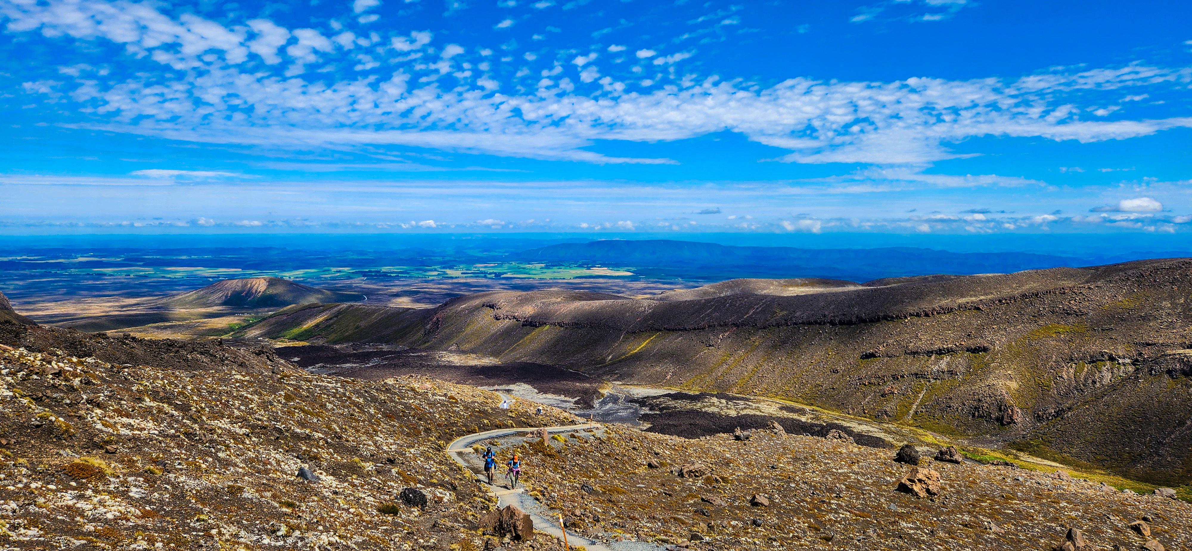
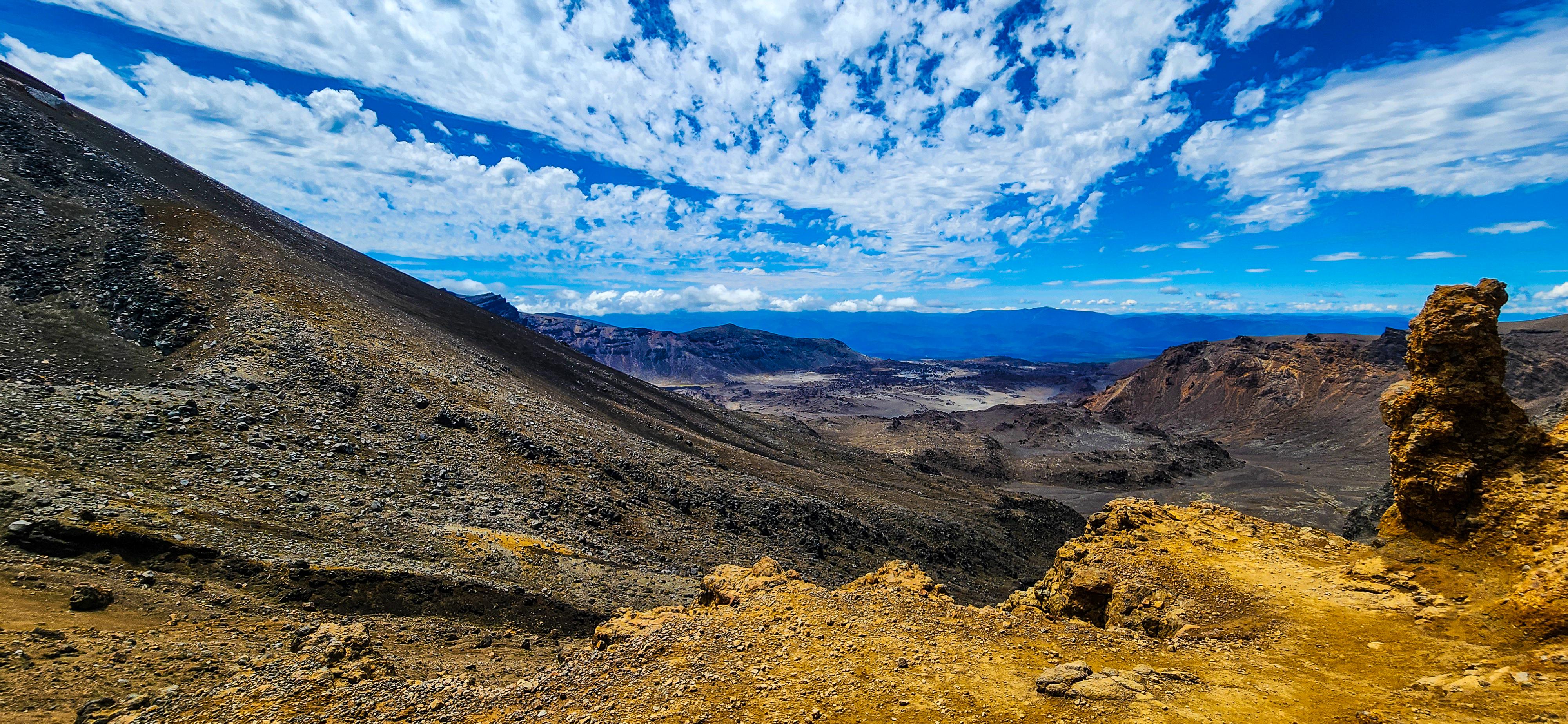
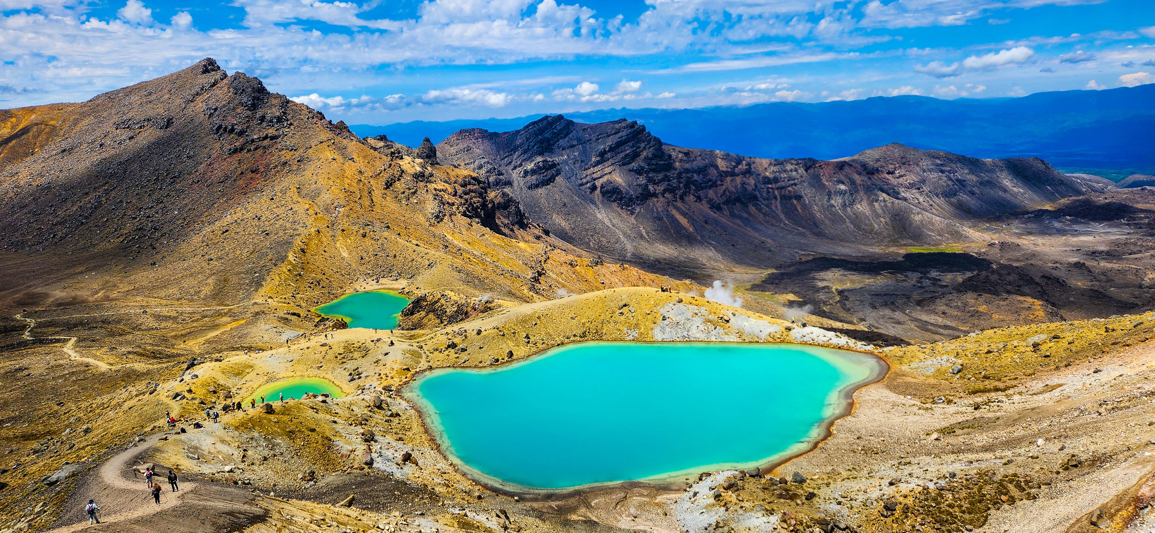
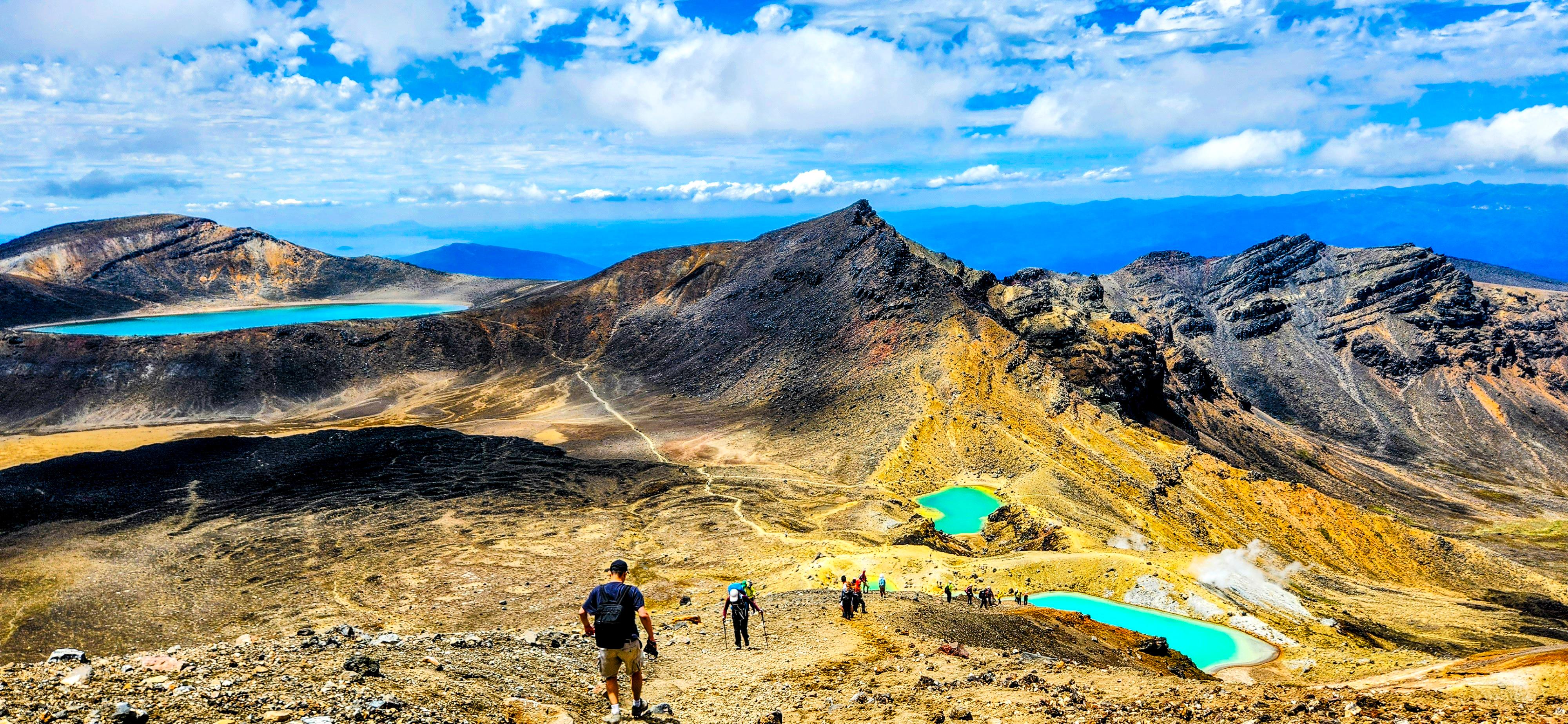
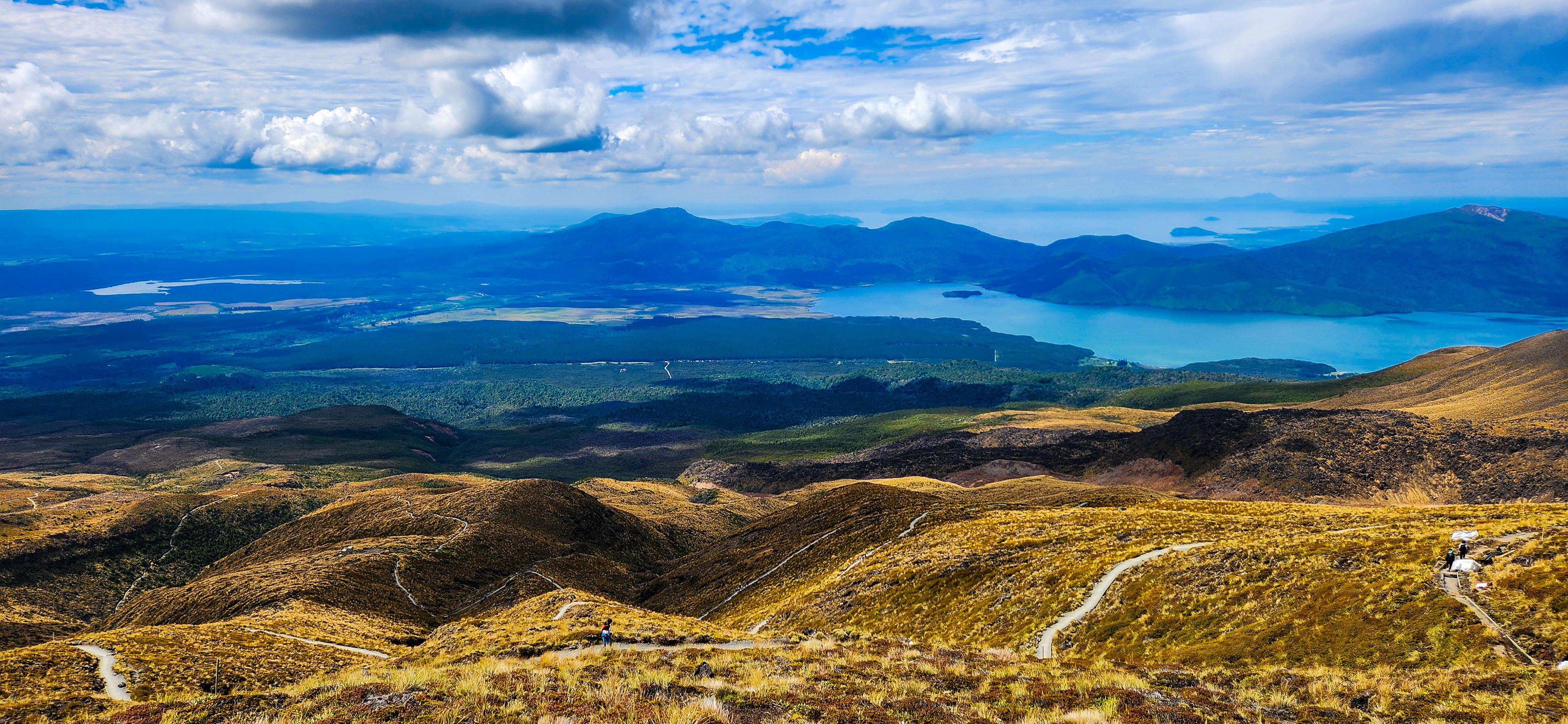
Red Crater to Emerald lakes
After soaking in the stunning views at Red Crater and enjoying our packed lunch, we began the descent towards the Emerald Lakes. This section is steep and awe-inspiring, with the vivid hues of the lakes contrasting against the rugged landscape. However, the loose gravel underfoot presents a significant challenge, making the descent tricky. It's crucial to exercise caution and consider using walking poles for extra stability and grip, ensuring a safer and more controlled journey down to the lakes. The striking turquoise waters of the lakes, surrounded by the stark volcanic landscape, create a visual spectacle. The lakes are geothermally active, with steam vents dotting the area. The contrast between the vibrant colours of the lakes and the dark volcanic rock is a photographer’s dream, making this a popular spot for a break and photo opportunity.
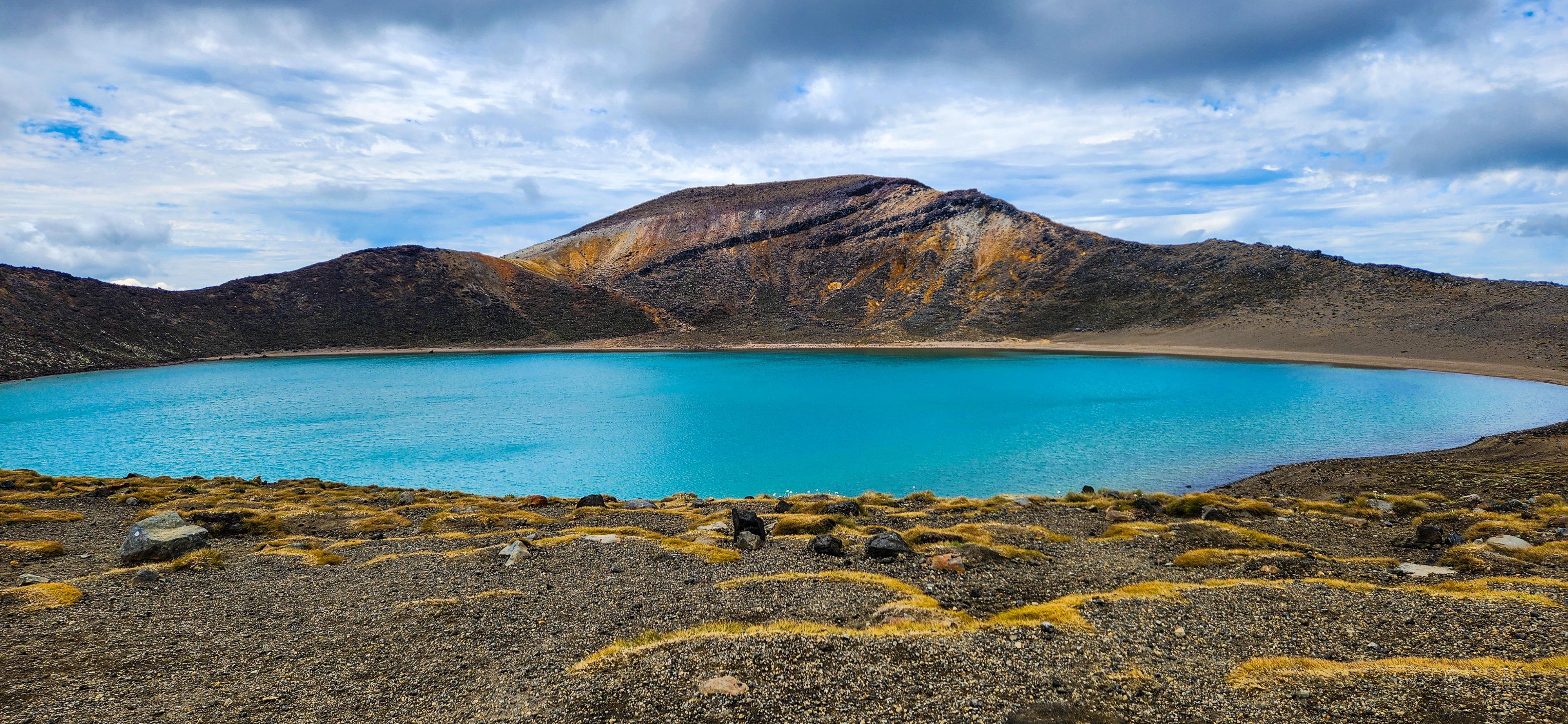
Emerald Lakes to Blue Lakes
As the trail flattens out, you’ll approach the Blue Lake, a serene and sacred body of water revered in Māori culture. It’s important to respect this site by refraining from eating or swimming near the lake. The calm, reflective waters offer a moment of tranquility, providing a peaceful pause in the journey. This serene setting is a perfect spot to take in the natural beauty before continuing your descent towards the Ketetahi Hut and the final stages of the hike.
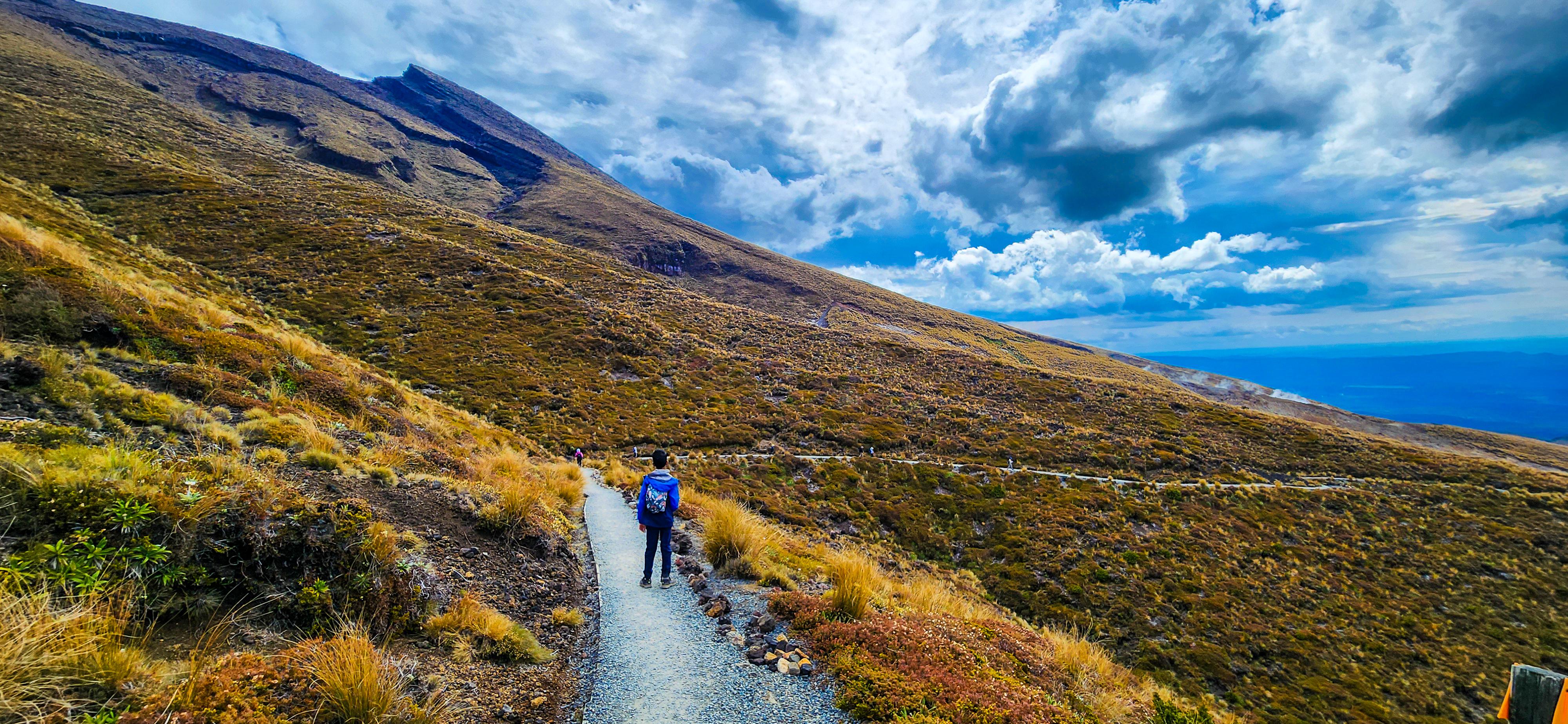
Blue Lake to Ketetahi Hut
As you descend towards Ketetahi Hut, the trail offers expansive views of Lake Taupō, the largest freshwater lake in the Southern Hemisphere and the distant hills. The terrain becomes more varied, with patches of alpine meadows and native bush and the changing scenery keeps the journey engaging and rewarding! Ketetahi Hut rest area is a great spot to rest and take in the views before tackling the final section. The Ketetahi Hut was removed after sustaining significant damage in 2012 from an eruption at the Te Maari vents. However, restrooms remain at this site, offering a crucial stop after the long trek from Soda Springs. The descent from here can be steep in places, so trekking poles may be useful.
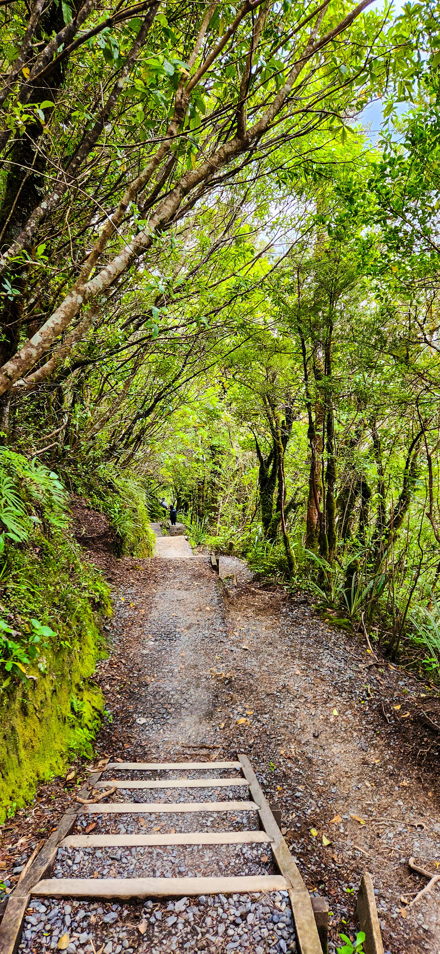
Ketetahi Hut to Ketetahi Car Park
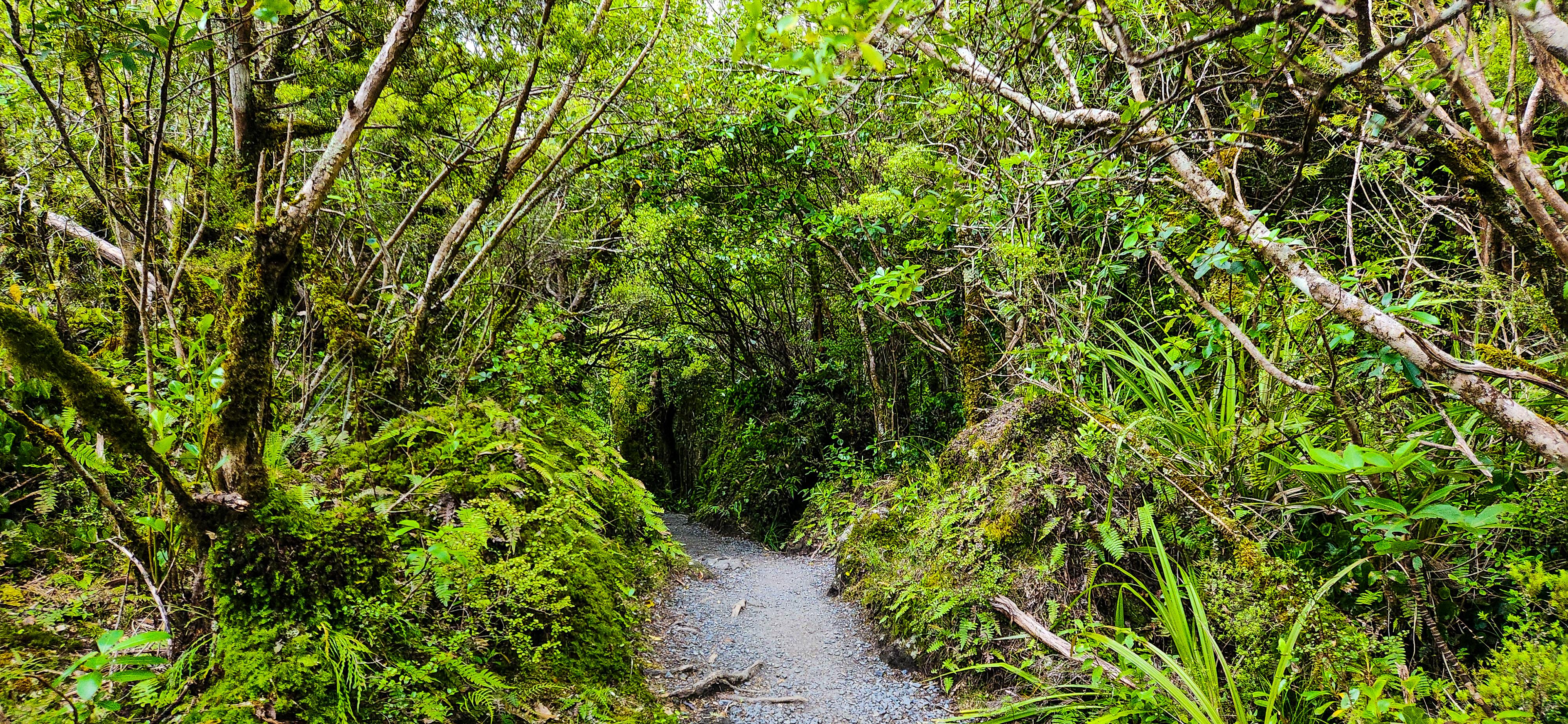
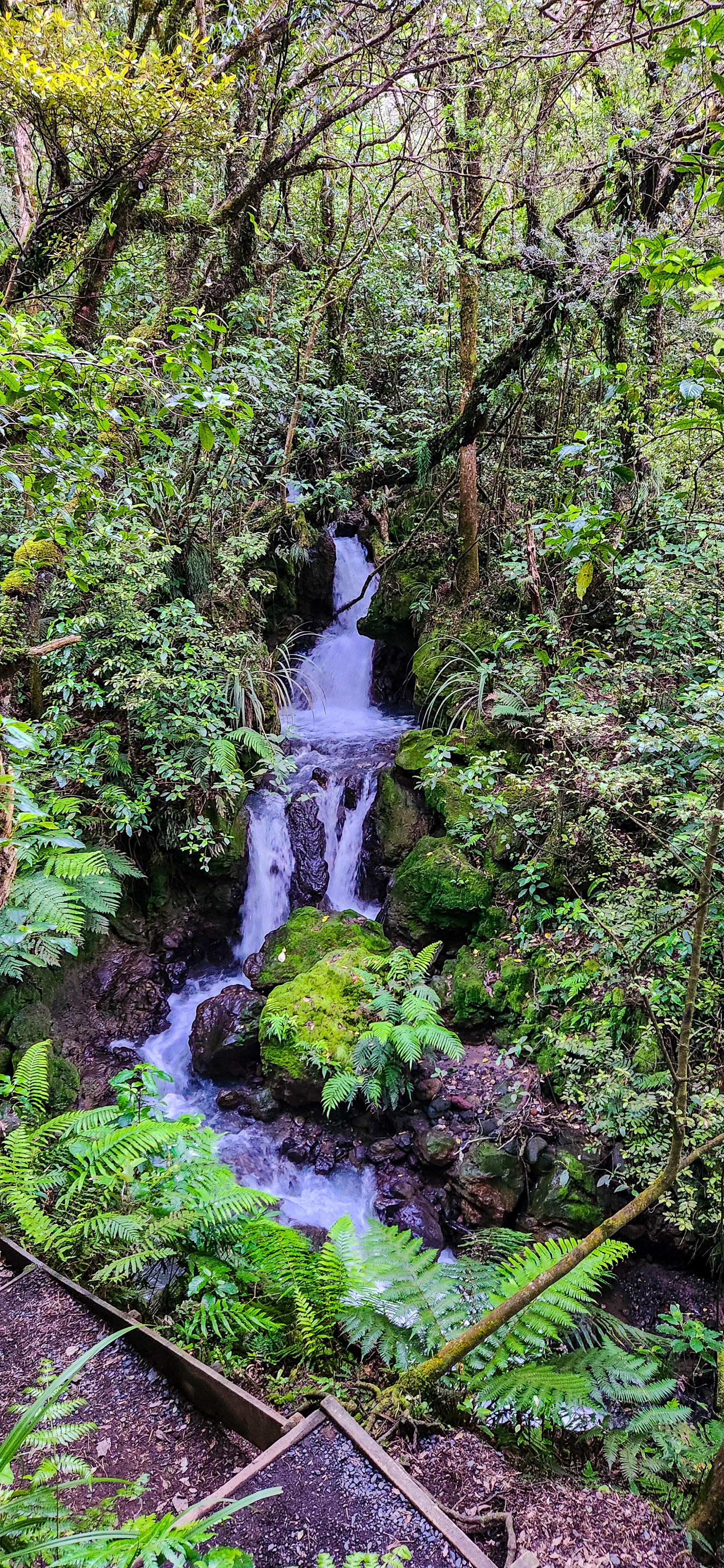
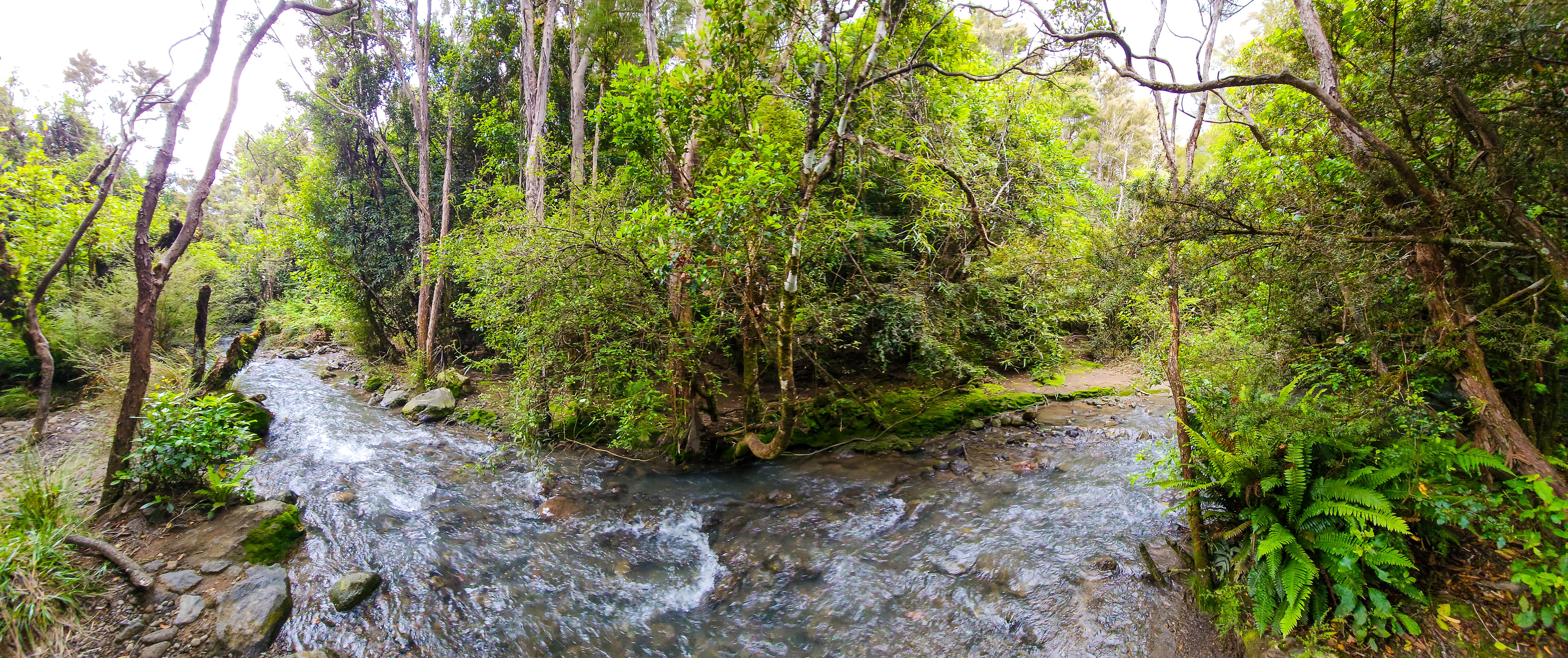
The final stretch of the walk winds through lush native forest, a stark contrast to the alpine environment of the earlier sections. This descent is gentle, though it can feel long after a full day of hiking. The sound of birds and the sight of native plants make for a peaceful conclusion to the hike. As you approach the Ketetahi Car Park, there’s a sense of accomplishment and awe at the diverse landscapes you’ve traversed. The proximity to your vehicle ensures a smooth transition back to comfort after a challenging but rewarding day.
Completing the Tongariro Alpine Crossing is a testament to one's endurance and spirit of adventure. The diverse landscapes, from volcanic craters to serene lakes, offer a hiking experience unlike any other. With proper preparation and respect for the natural environment, this journey will undoubtedly be a highlight of your New Zealand travels!
Love our itinerary? Excited to embark on the Tongariro Alpine Crossing hike? Book your accommodation via Booking.com below at cheaper prices!
This post may contain affiliate links. This means that, at no additional cost to you, we may earn a small commission if you make a purchase through the links provided. These commissions help support our website and allow us to continue sharing our travel experiences. Thank you for your support.
This itinerary is based on our personal experiences and recommendations. All information is provided for general guidance only and may change due to circumstances beyond our control. Travellers are encouraged to independently verify details and make choices according to their own preferences and safety considerations. We do not accept responsibility for any loss, injury, or inconvenience sustained by anyone using our itineraries.