Standing at the edge of the continent is no ordinary travel moment. If you’re someone who seeks out the edges of maps—the extreme ends of the land—then Steep Point deserves a top spot on your travel bucket list. Tucked away in Western Australia’s Shark Bay World Heritage Area, this remote and rugged outpost marks the westernmost point of the Australian mainland. But it’s not just the destination that leaves a lasting impression—it’s the journey. Reaching Steep Point is a true 4WD adventure, one that takes you across sand dunes, corrugated tracks, and coastal cliffs. The reward? Jaw-dropping views over the wild Indian Ocean, untouched beaches, and the unmatched thrill of standing at the edge of the continent. This is a place where rugged cliffs plunge into the sea, where remoteness meets raw beauty. Getting there is half the story — one for the prepared, the determined, and the curious. With the right vehicle and a bit of planning, you’ll embark on a journey that’s every bit as memorable as the destination.
For those eager to explore more, check out our overview itinerary post covering all the extreme points of Australia — a comprehensive journey through the far-reaching corners of this vast and captivating land.
Getting there
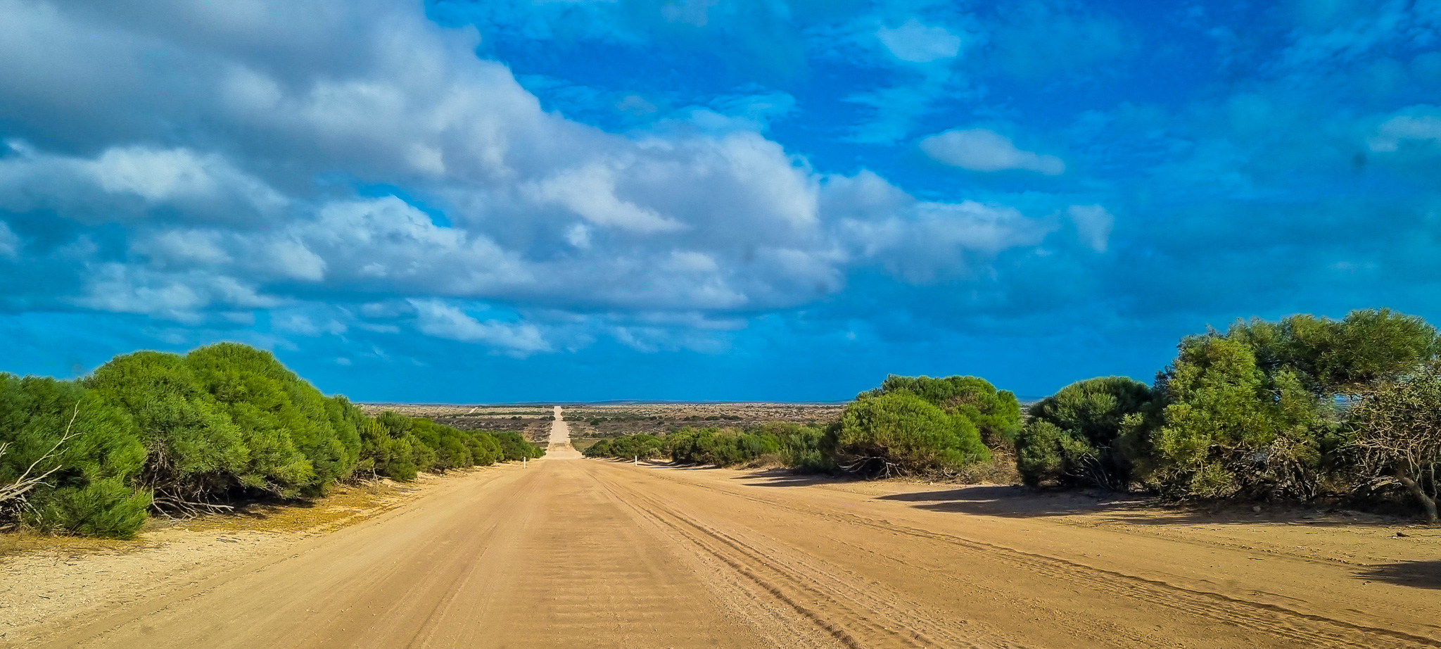
Reaching Steep Point requires careful planning and a full day of travel. It’s one of the most remote destinations in Western Australia and is only accessible by high-clearance 4WD. You can begin your journey from either Hamelin Pool or Denham. From Hamelin Pool, Steep Point is approximately 180 km away. You’ll head north along the sealed Shark Bay Road before turning left onto Useless Loop Road. If departing from Denham, the distance is around 200 km. In this case, you’ll travel south on Shark Bay Road and then connect with Useless Loop Road. Either route offers scenic glimpses of the Shark Bay region—but the adventure truly begins once you leave the bitumen behind. The round trip from either Hamelin Pool or Denham can typically be completed on a full tank of fuel, however if you’re towing or heavily loaded, carrying an extra jerry can is a wise precaution.
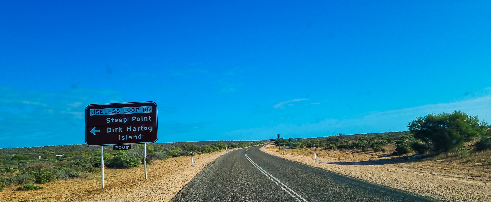
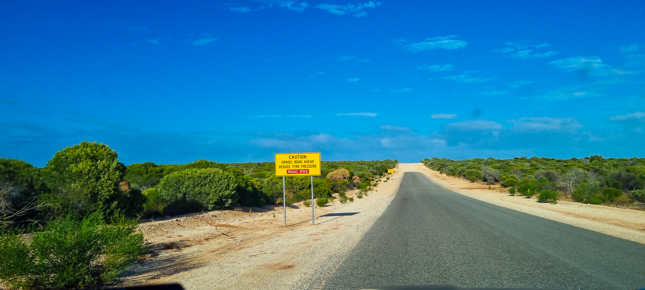
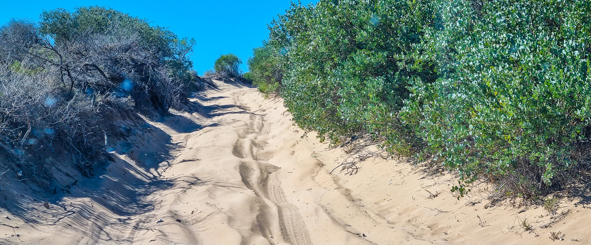
Once you turn onto Useless Loop Road, the first 22km is on a sealed road. After this, the road becomes corrugated and sandy, and it’s here for the very first time that you will lower your tyre pressure to 25–30 PSI and engage 4H (4WD high range).
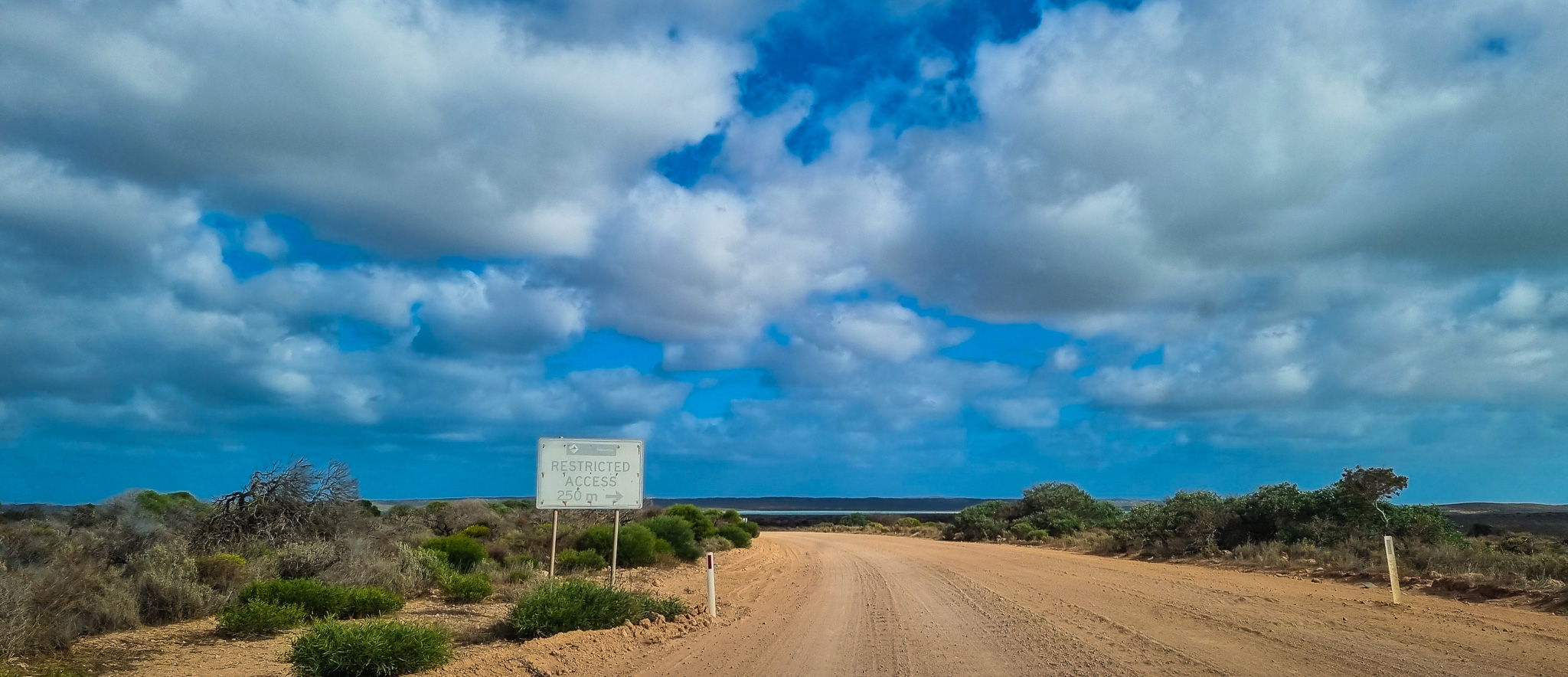
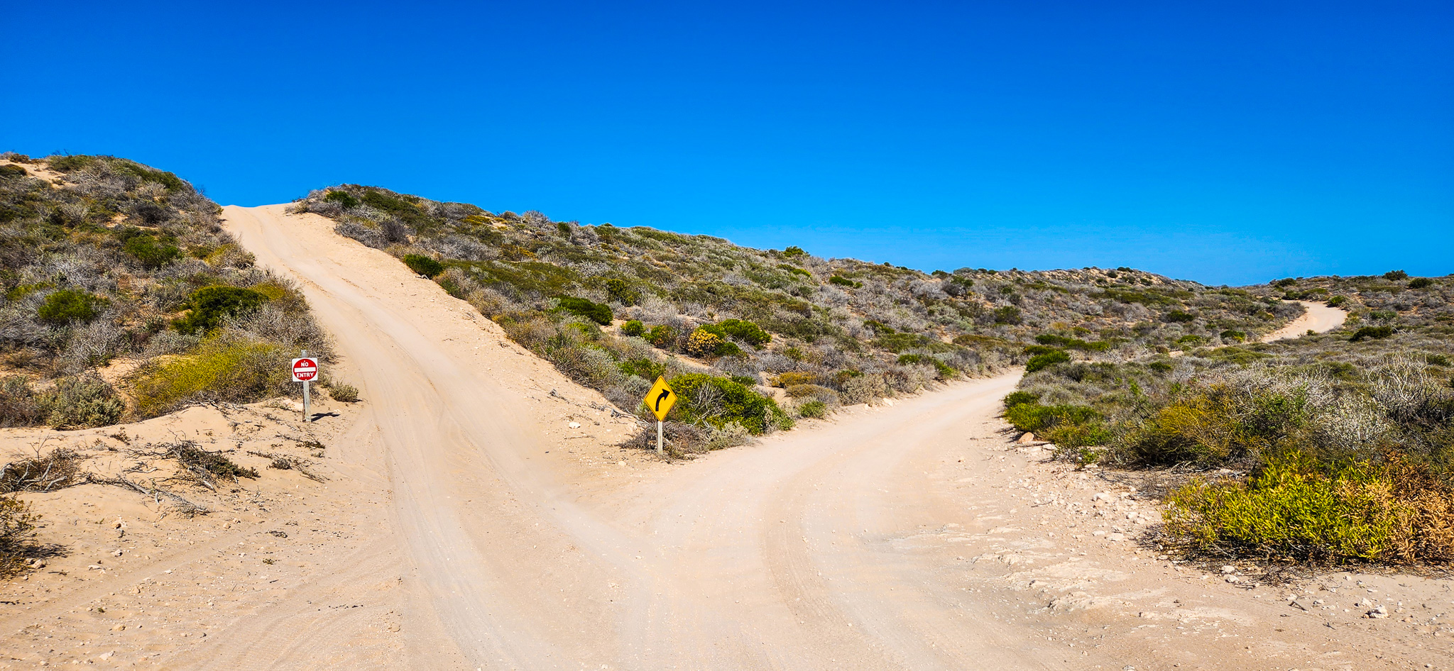
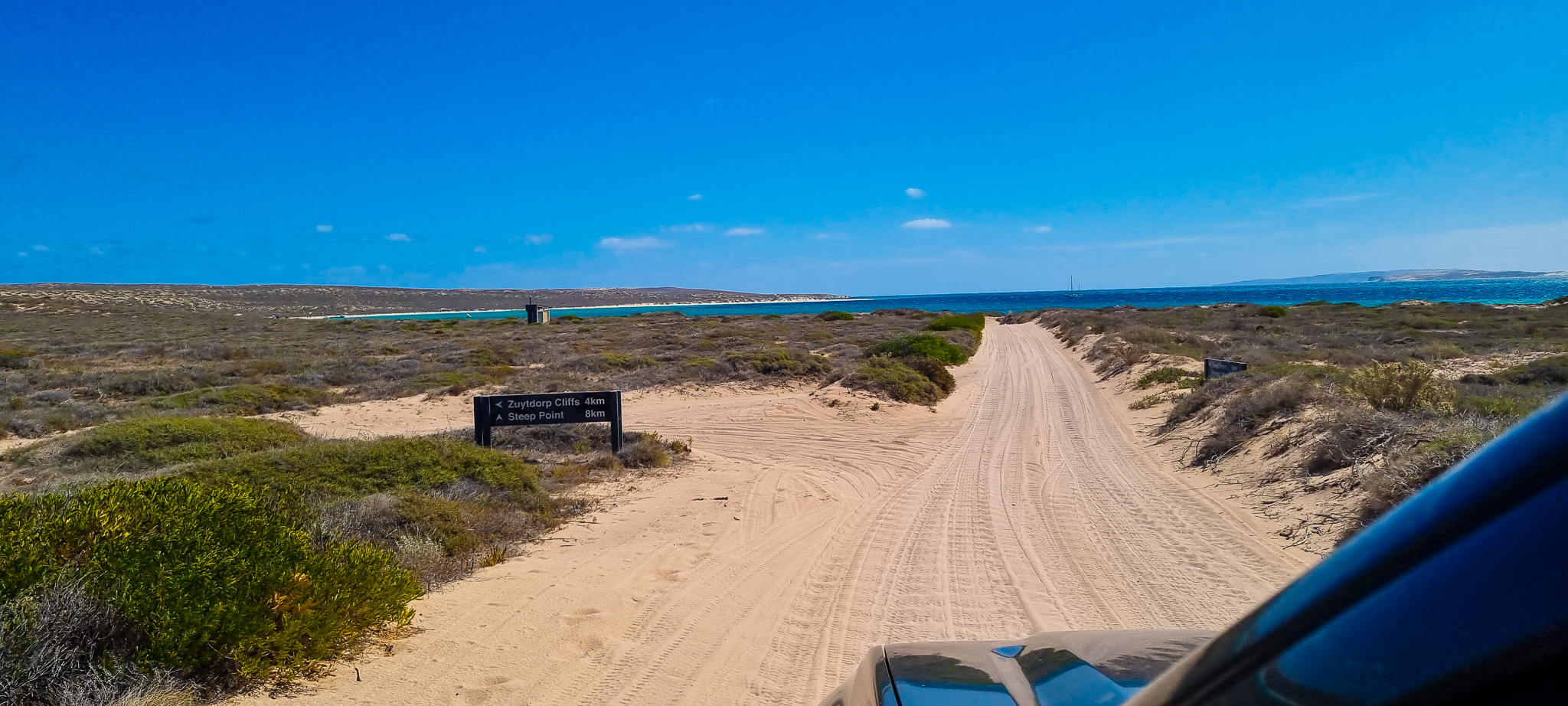
⚠️Be cautious with GPS navigation – if you're using Google Maps, around 75km into the unsealed section, Google Maps may try to redirect you through a restricted active minesite, which is not open to the public. Do not take this route! Instead of turning right as suggested, ignore the prompt and continue straight past the signpost that warns "Restricted Access in 250m" (see picture below).
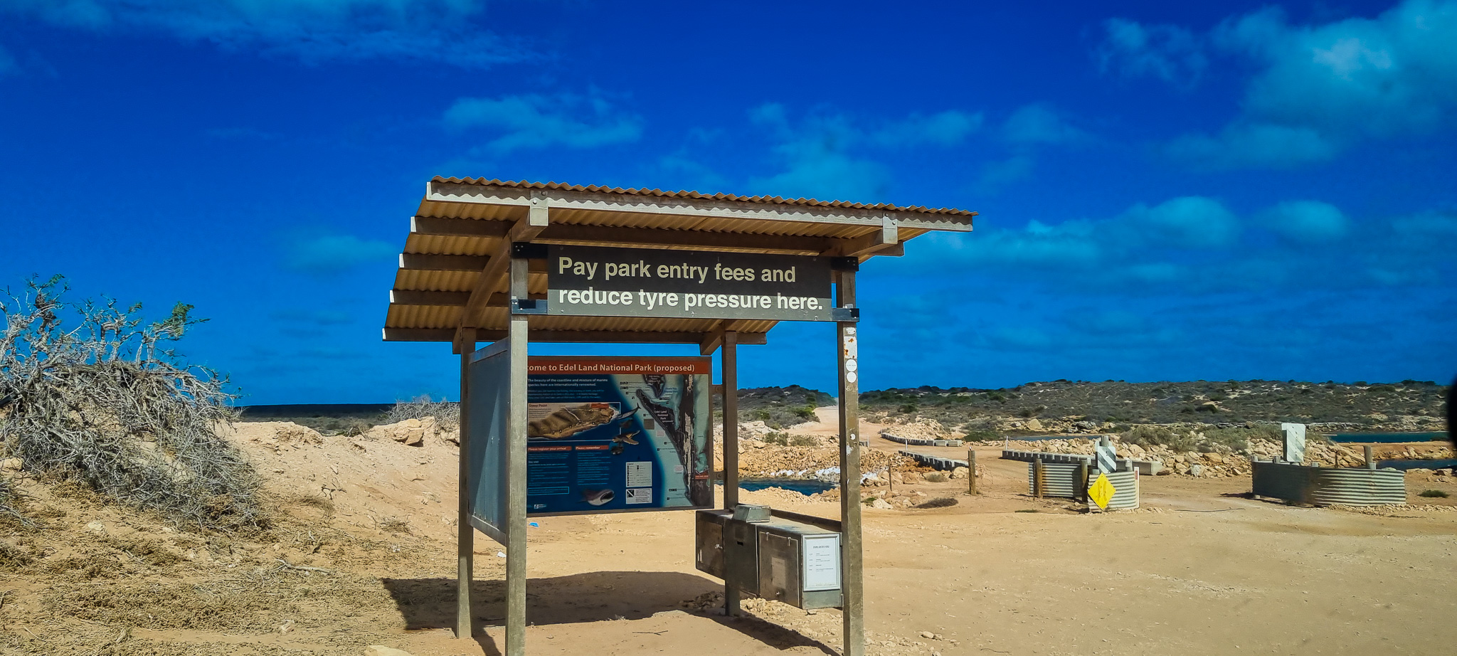
You’ll soon reach an Information Bay, which is your final checkpoint before the most challenging section of the track! You MUST drop your tyre pressure to at least 20 psi at this point before proceeding further.
Explore our itineraries hassle-free with these recommended services!
Car Rental
Why a 4WD is Non-Negotiable?
A high-clearance 4WD is absolutely essential for this trip. The sandy tracks, deep ruts, steep dunes, and rough terrain are no place for 2WDs or soft roaders. Your vehicle should be in top mechanical condition, equipped with recovery gear, an air compressor, a shovel and a solid spare tyre. It’s wise to travel with another vehicle if possible, and always inform someone of your plans before setting off. There’s no mobile reception in this remote region, so self-sufficiency is critical. The final 45 km stretch to Steep Point consists of deep, soft sand and narrow, rugged trails—standard vehicles simply don’t have the clearance or traction to handle it. Towing anything less than a purpose-built off-road trailer is strongly discouraged. Before tackling the dunes, tyre pressure must be dropped to at least 20 psi. If you ignore this, you risk getting bogged in an area with limited support, and hefty fines apply if you're unprepared and require recovery. The first sand dune is steep, full of holes, and demands not only capable 4WD hardware but also good technique, momentum, and driver control. In short, Steep Point is only for those with the right gear and off-road confidence—attempting it without a proper 4WD isn’t just a gamble, it’s downright unsafe!
What To Do If You Get Bogged
If you do get stuck, don’t panic or accelerate – you’ll only dig deeper. Instead:
- Stop immediately
- Drop your tyre pressure another 2–4 PSI
- Clear sand from around your tyres using a shovel
- Switch to 4L (low range) and slowly rock the vehicle back and forth
- Having recovery tracks or sand boards helps immensely. Patience and technique are your best friends here – not horsepower!
Things to Carry
Visiting Steep Point is a remote 4WD adventure that requires careful preparation. Here's what you should pack to ensure a safe and enjoyable experience:
4WD Essentials
- Tyre deflator and air compressor
- Recovery gear (snatch strap, shackles, traction boards, shovel)
- Spare tyre (in good condition) and tools
- Satellite phone or UHF radio (no mobile reception)
- Vehicle service kit and extra fuel (there are no fuel stops nearby)
Camping Gear (if staying overnight)
- Tent or swag suitable for coastal conditions
- Sufficient drinking water (at least 5 litres per person per day)
- Food and cooking supplies (no shops or services at Steep Point)
- Portable gas stove or BBQ (fires are prohibited)
- Rubbish bags – pack out everything you bring in
Personal Items
- Sunscreen, hat and sunglasses
- Insect repellent
- First aid kit and any required medications
- Warm layers – it can get cold overnight
- Sturdy footwear for walking on rocks and dunes
- Binoculars for spotting marine life
- Camera or drone (if permitted) for incredible coastline shots
Navigation
- Printed maps or GPS (don’t rely on mobile apps)
- Shark Bay road condition updates from DBCA or local ranger stations
Weather and Track Conditions
At times, the track into Steep Point can be particularly challenging, especially after periods of heavy rain. In such cases, the Shire may close the road if it’s deemed unsafe or if ongoing traffic risks causing significant damage to the track. These closures are usually temporary but can impact your travel plans if not checked in advance. If you have any doubts about the current track conditions, it's strongly recommended to contact the Steep Point Ranger on (08) 9948 3993 for up-to-date information. You can also check the Useless Loop Road status through the Shire’s official updates, and stay informed via the Department of Biodiversity, Conservation and Attractions alerts page . Being informed before your journey is crucial — road conditions in this remote part of WA can change quickly and dramatically.
Entry Fee and Park Access
As of 2025, the entry fee is $12 per vehicle. This can be paid in cash at the Information Bay using a provided envelope or later at the Ranger Station near the Shelter Bay Campground. It’s best to carry exact change, as no card facilities are available.
Back to Our 4WD Adventure to Steep Point
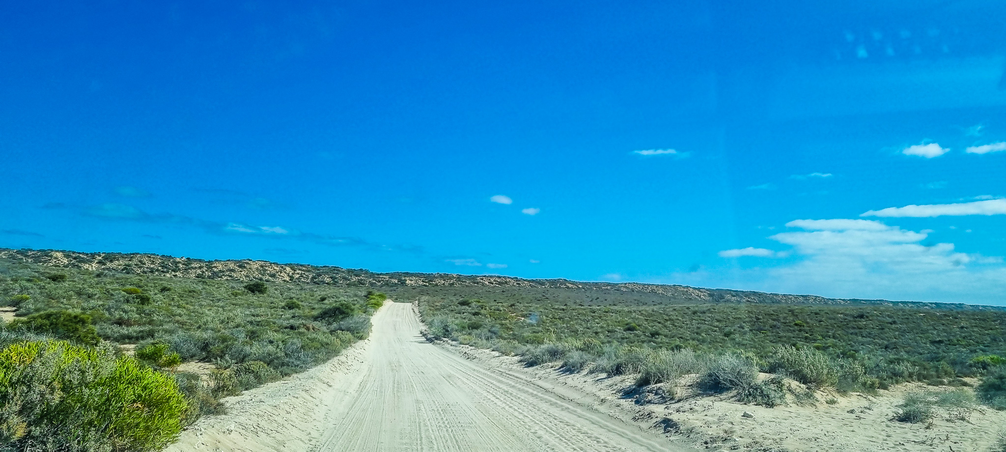
From the Information Bay, you’ve got roughly 45 km to Steep Point, but the first 14 km are particularly punishing, with intense corrugations that will shake your vehicle and test your patience. Take it slow to protect your car and gear.
Then comes the first sand dune – steep, soft, and filled with ruts. This is the hardest part of the drive and requires total control and confidence. Keep your tyres deflated to 20 PSI or lower, depending on your vehicle, load, and rims.
Once you’ve tackled the first sand dune, the rest of the drive is much easier, with occasional uphills and corrugations but nothing too daunting. Keep an eye out for bogged cars or trailers on the narrow track – if the road is blocked, you’ll have to wait until it clears!

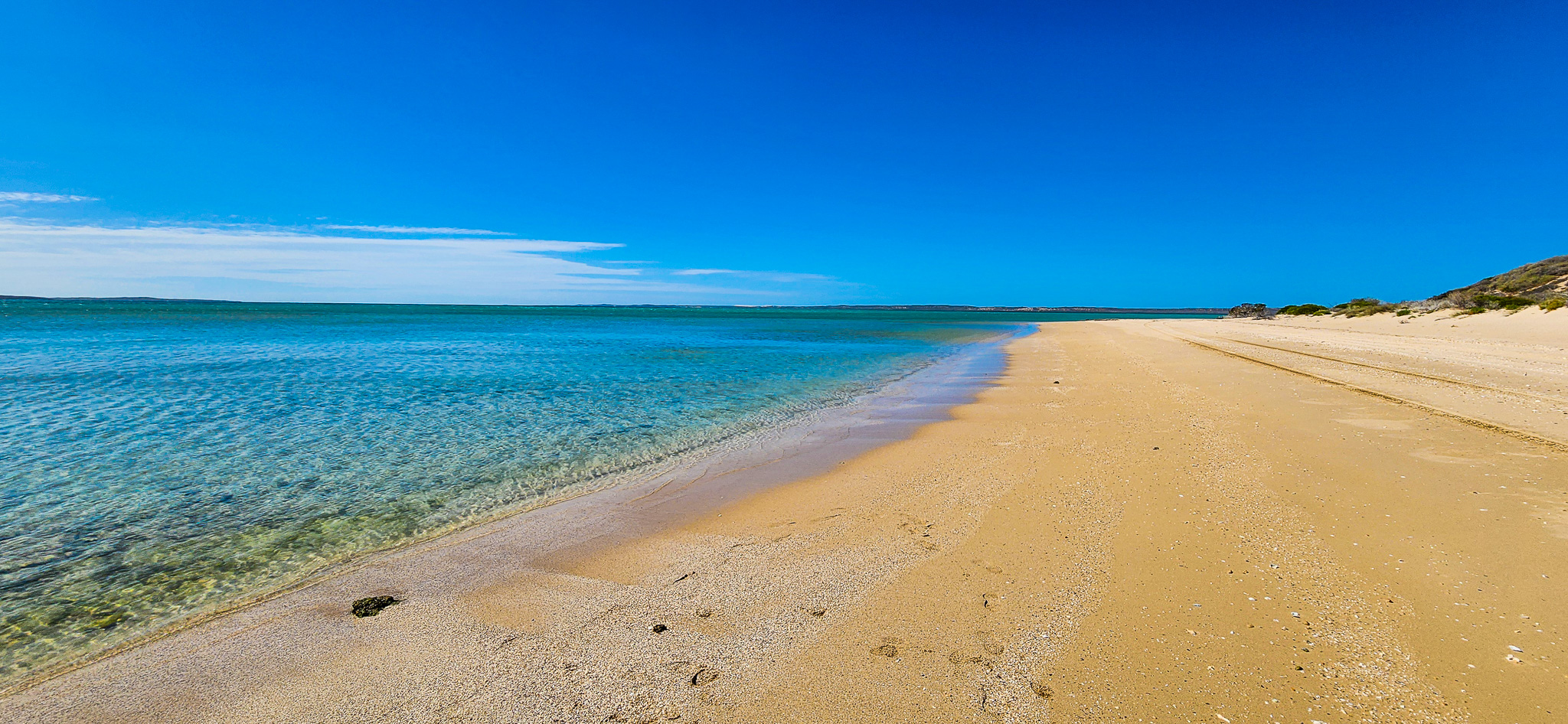
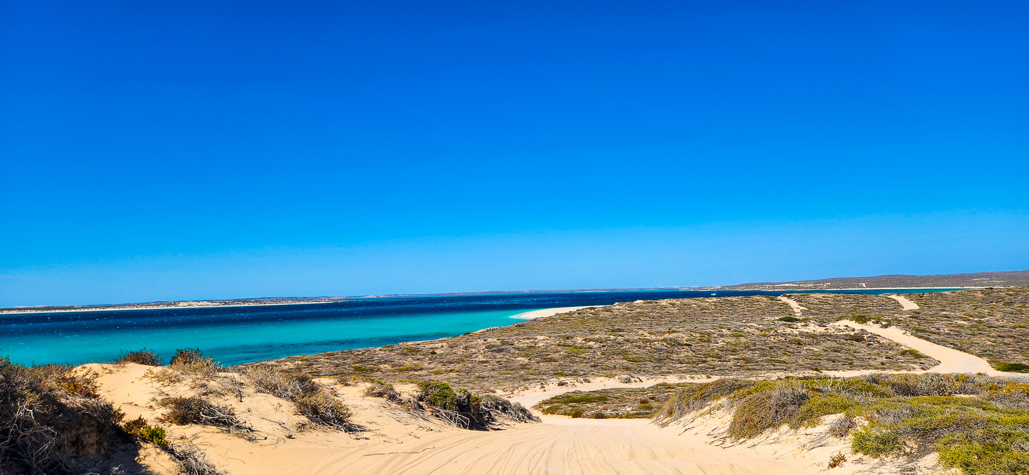
As you approach the final stretch towards Steep Point, the track takes you along a stunning beach section stretching over a kilometre — an unforgettable drive with the turquoise waters of Shark Bay just metres away!
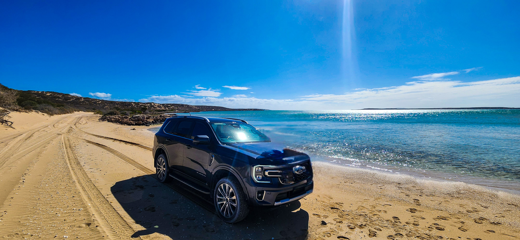
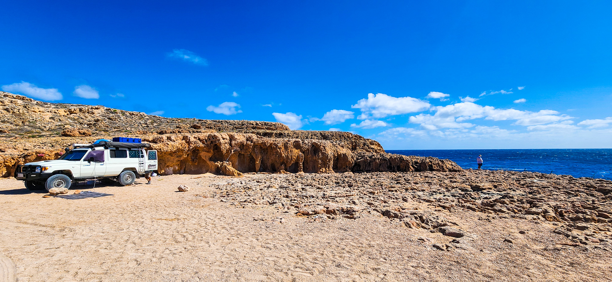
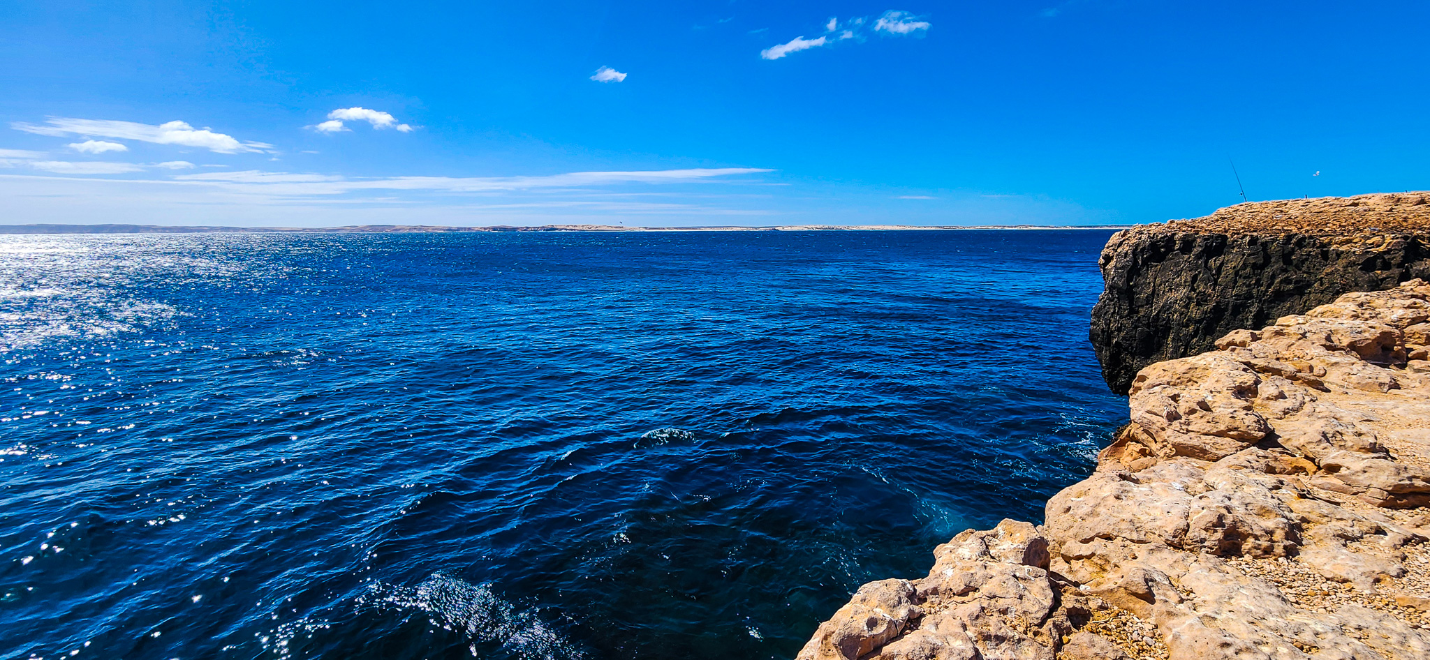
Soon after, you’ll pass the Ranger Station, where you'll need to show your entry receipt or pay the $12 access fee if you haven’t already done so at the Information Bay. Less than 2 km beyond the station is the Shelter Bay campground, a popular spot for travellers spending a night or two in this remote coastal wilderness. From here, it’s only an 8 km drive to the main lookout at Steep Point, where the rugged cliffs drop dramatically into the vast, untamed Indian Ocean!
Campgrounds and Booking:
If you decide to camp at Steep Point, there are several designated campgrounds in the area, including Steep Point, Shelter Bay, and False Entrance. Facilities are basic, with drop toilets but no drinking water or power, so come prepared. All sites must be booked in advance through the Park Stay WA website.
Bring all the essentials, including food, water, fuel, and rubbish bags (you must take everything back out with you). Generators are permitted, but campfires are not. This is leave-no-trace camping in a delicate environment.
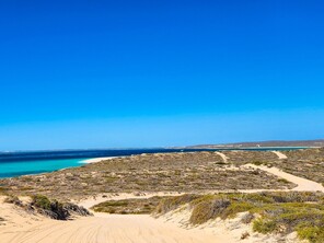
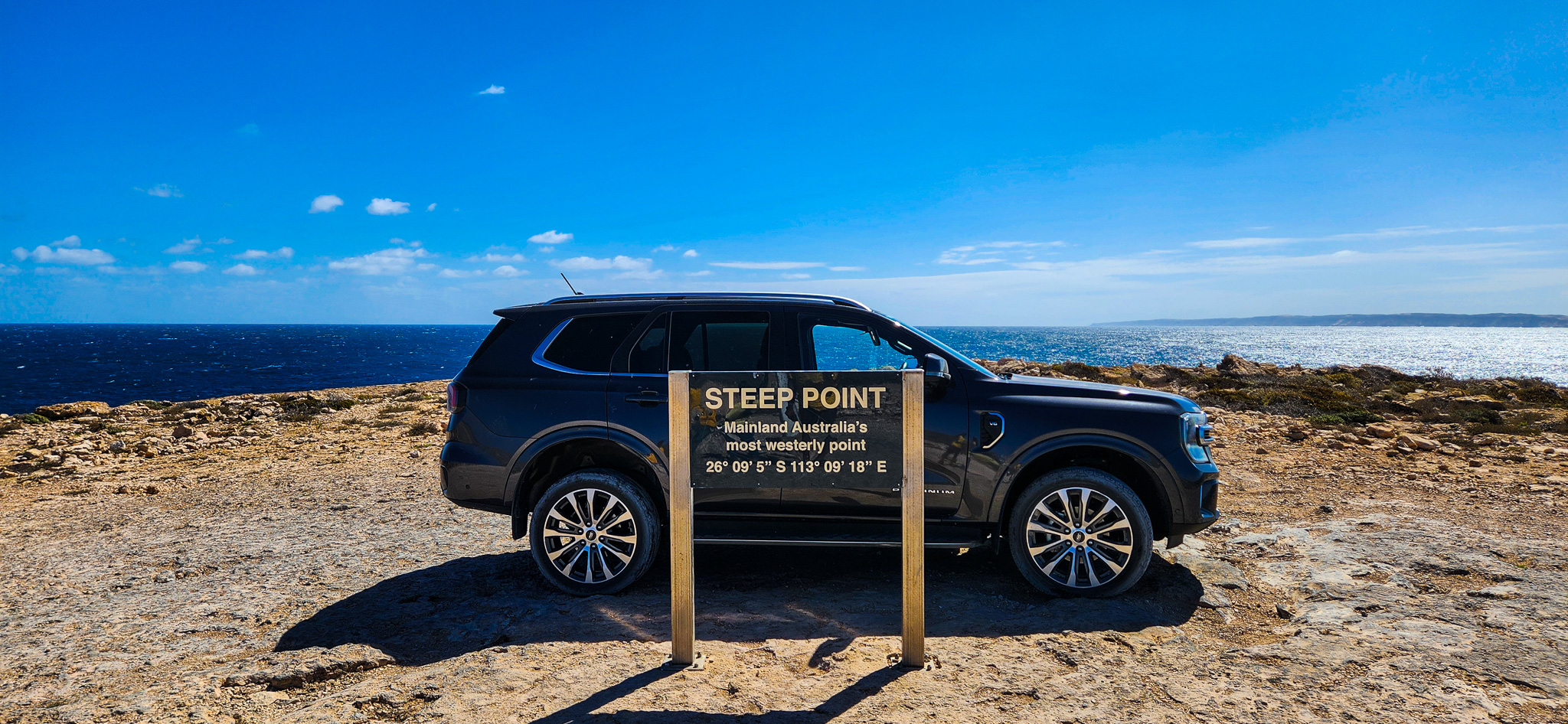
As you reach Steep Point, the track narrows and the sea breeze becomes stronger. A sign marks the westernmost point, and stepping out to take in the dramatic views over the Indian Ocean is a truly special moment. The rugged cliffs, pristine beaches, and raw natural beauty are unmatched.
Spend time walking along the cliffs (with caution), enjoying a quiet picnic, or simply soaking up the isolation and grandeur of the landscape. Keep an eye out for whales and dolphins in the deeper waters offshore during migration seasons.
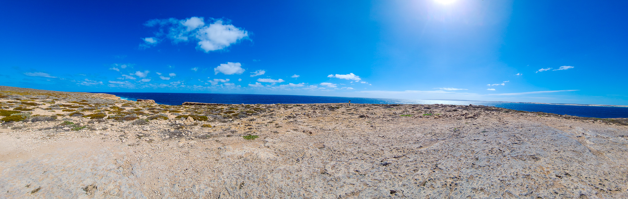
Just a couple of hundred metres from the Steep Point sign, you’ll come across the Steep Point Campground. This campground offers rock-surface campsites, providing a firm and level base for tents and vehicles in an otherwise sandy area. It’s a truly scenic spot, with sweeping views of the Indian Ocean and easy access to the cliffs and fishing points nearby. However, do note that this campground is much more exposed to wind and weather compared to Shelter Bay Campground, which sits in a more protected cove. If you're planning to camp here, come prepared for strong coastal gusts—especially overnight. Steep Point is also a known cliff risk area, so it’s essential to keep well clear of cliff edges, remain alert for sudden wind gusts and large, unpredictable waves, and closely supervise children at all times.
Note: On your way out, make sure to stop at the Information Bay to reinflate your tyres using your air compressor. This is essential for safe handling on the sealed road. Also, don’t forget to disengage 4H before you hit the bitumen. Driving in 4WD on sealed roads can cause serious drivetrain issues and lead to expensive repairs.
Steep Point is not your typical road trip stop. It’s remote, demanding, and challenging – but also awe-inspiring, beautiful, and deeply rewarding. If you’re chasing Australia’s four extreme points or just looking for the ultimate off-grid adventure, Steep Point delivers in spades. With the right preparation and a spirit of adventure, you’ll come away with not just epic photos, but an unforgettable memory etched into the red dust and salt spray of Western Australia’s wild coast.
Thunder Bay Blowholes:
While we didn't have the opportunity to visit the Thunder Bay Blowholes during our trip to Steep Point, this natural spectacle comes highly recommended for those exploring the region. Situated along the rugged Zuytdorp Cliffs in Western Australia's Edel Land National Park, the blowholes are formed by powerful ocean swells forcing air and sea spray through eroded limestone cavities, creating impressive jets of water that can soar up to 20 meters high during heavy seas. Accessible only by high-clearance 4WD vehicles, the journey to the blowholes is an adventure in itself, traversing sandy and corrugated tracks. For those venturing to Steep Point, a detour to witness the Thunder Bay Blowholes offers a unique and memorable encounter with nature's raw power.