Central Australia is home to some of the most powerful landscapes on the continent. Towering sandstone cliffs, ancient monoliths, wind-carved valleys, and vast desert plains create a setting unlike anywhere else in Australia. While many travellers admire the Red Centre from scenic lookouts, the true magic reveals itself when you explore these landscapes on foot. Walking trails here allow you to experience the scale, silence, geology and cultural significance of the land in a way that driving simply cannot match. Within a relatively small region around Uluru, Kata Tjuta and Kings Canyon, several walks stand out as the defining hikes of Central Australia. These trails range from accessible desert walks to dramatic canyon rim adventures, each offering a unique perspective of this extraordinary environment.
Explore our itineraries hassle-free with these recommended services!
Car Rental
In this guide, we highlight four of the most unforgettable walks in Central Australia:
- Uluru Base Walk
- Valley of the Winds Walk (Kata Tjuta)
- Walpa Gorge Walk (Kata Tjuta)
- Kings Canyon Rim Walk
Together, these walks showcase the geological drama, cultural heritage, and raw beauty that make the Red Centre one of Australia’s most remarkable travel destinations.
Media Permit Notice
Uluṟu–Kata Tjuṯa National Park is a culturally significant landscape jointly managed by the Aṉangu Traditional Owners and Parks Australia. The use of photographs, video or other media from within the park — particularly for publication on websites, blogs or other public platforms — requires permission under the park’s media and photography guidelines.
In accordance with these requirements, we obtained the appropriate media permit from Parks Australia prior to publishing images from Uluṟu–Kata Tjuṯa National Park on this website.
Visitors should also be aware that certain areas within the park are culturally sensitive, and photography or filming may be restricted in some locations. All visitors are encouraged to follow signage, respect cultural protocols, and honour the wishes of the Aṉangu people when visiting and sharing experiences from this extraordinary place.
Why Walking Is the Best Way to Experience the Red Centre
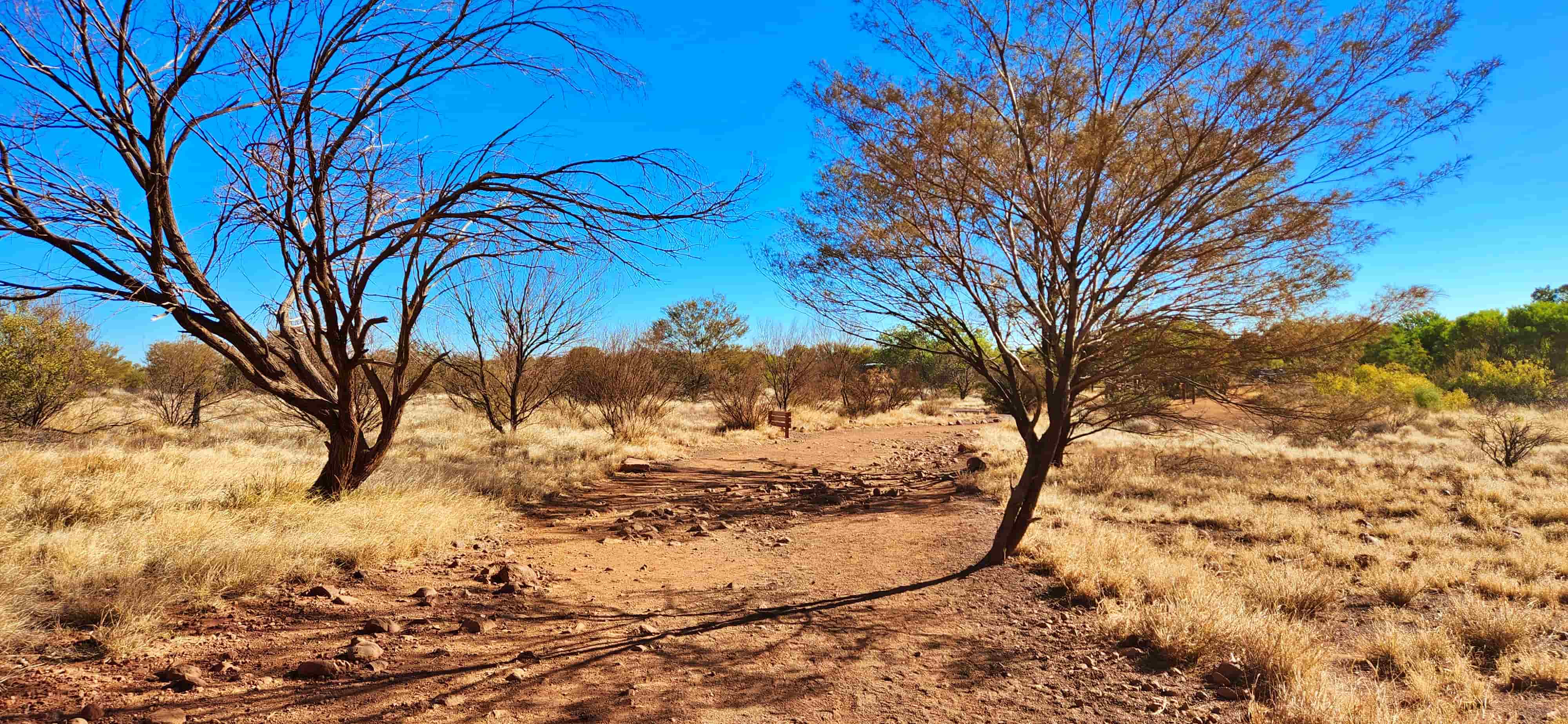
Central Australia’s landscapes are ancient — many of the rock formations here date back hundreds of millions of years. Walking through these environments reveals subtle details you would otherwise miss: hidden waterholes, desert vegetation, rock textures shaped by wind and rain, and sacred cultural sites that hold deep significance to the Traditional Owners.
Walking also slows the experience down.
Instead of rushing between viewpoints, you begin to notice how the colours of the rock shift through the day, how wind moves through narrow valleys, and how wildlife adapts to one of the harshest environments in Australia.
For travellers exploring the Red Centre, these walks are not simply scenic hikes — they are immersive journeys through geology, culture, and deep time.
Top Tips Before You Tackle the Great Walks of Central Australia
Walking in Central Australia is incredibly rewarding, but it’s also very different from hiking elsewhere in Australia. These landscapes are remote, exposed, and shaped by extreme temperatures, which means preparation is essential. Before setting out on walks around Uluru, Kata Tjuta, and Kings Canyon, take the time to understand the conditions, respect cultural protocols, and plan carefully — it will make your experience safer, more comfortable, and far more enjoyable.
- Choose the right time of year: The best months for walking in Central Australia are April to September, when daytime temperatures are cooler and safer for prolonged activity. Summer (October to March) brings extreme heat, often exceeding 40°C, and many walks may be restricted or closed.
- Start early — always: Early mornings are critical, particularly for longer walks like Kings Canyon Rim Walk and Valley of the Winds. Not only are temperatures lower, but park authorities may close walks after specific cut-off times on hot days (9:00 am for Kings Canyon Rim Walk and 11:00 am for Valley of the Winds).
- Carry more water than you think you need: There is no drinking water on any of these walks. A minimum of 3 litres per person is recommended for longer hikes, even in cooler months. In warmer conditions, carry more.
- Wear proper footwear: Sturdy hiking shoes with good grip are essential. Trails include steep stone steps, uneven rock surfaces, sandy creek beds, and exposed rock slabs that can become slippery.
- Sun protection is non-negotiable: A wide-brim hat, sunscreen, sunglasses, and lightweight long sleeves will make a significant difference. Shade is limited on most sections, especially along exposed ridgelines.
- Respect cultural significance: Uluru and Kata Tjuta are living cultural landscapes of deep importance to Anangu people. Stay on marked paths, observe photography restrictions, and follow all signage. Swimming in waterholes is not permitted.
- Check conditions daily: Weather, heat policies, and track closures can change quickly. Always check park notices at visitor centres or car parks before starting a walk.
- Mobile reception is limited: Do not rely on phone signal for navigation or emergencies. Let someone know your plans, especially for longer or more remote walks.
- Pace yourself and know your limits: Walks like Valley of the Winds and Kings Canyon Rim Walk are graded as moderate to challenging. Take regular breaks, eat snacks, and turn back if conditions or energy levels decline.
- Stay on marked trails: Leaving designated paths damages fragile desert environments and can be dangerous due to unstable rock edges and heat exposure.
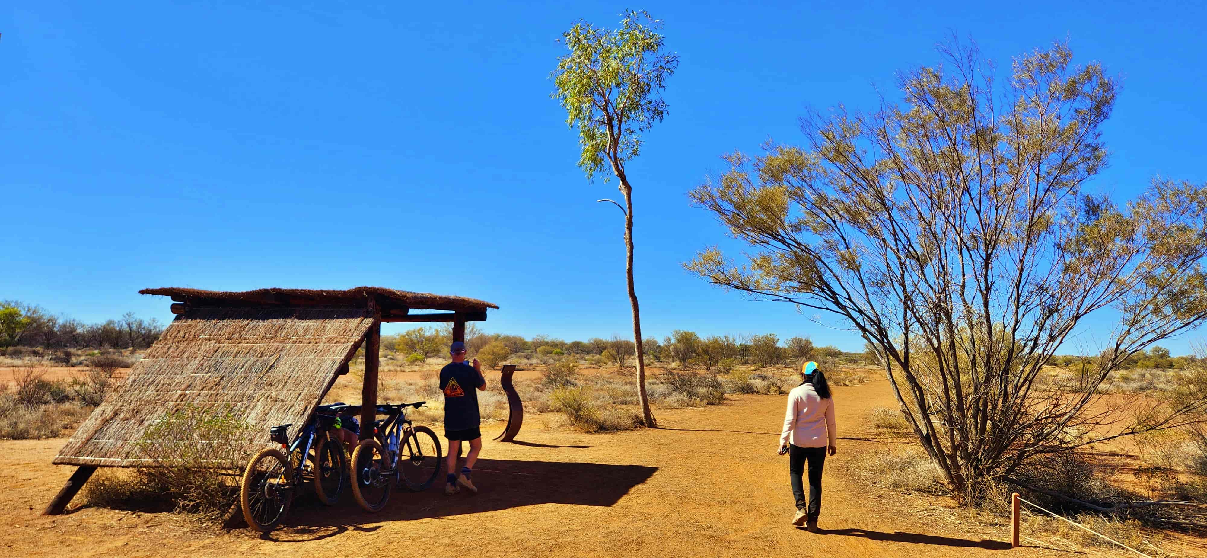
- Plan accommodation nearby: Staying close to trailheads (Kings Canyon Resort, Yulara, or Alice Springs depending on your itinerary) makes early starts easier and reduces fatigue from long drives.
- Understand park entry passes: A valid Uluṟu–Kata Tjuṯa National Park pass is required to access Uluru and Kata Tjuta and cannot be substituted with an NT Parks Pass. The NT Parks Pass can be used to access Kings Canyon (Watarrka National Park). Make sure you have the correct pass organised before arrival.
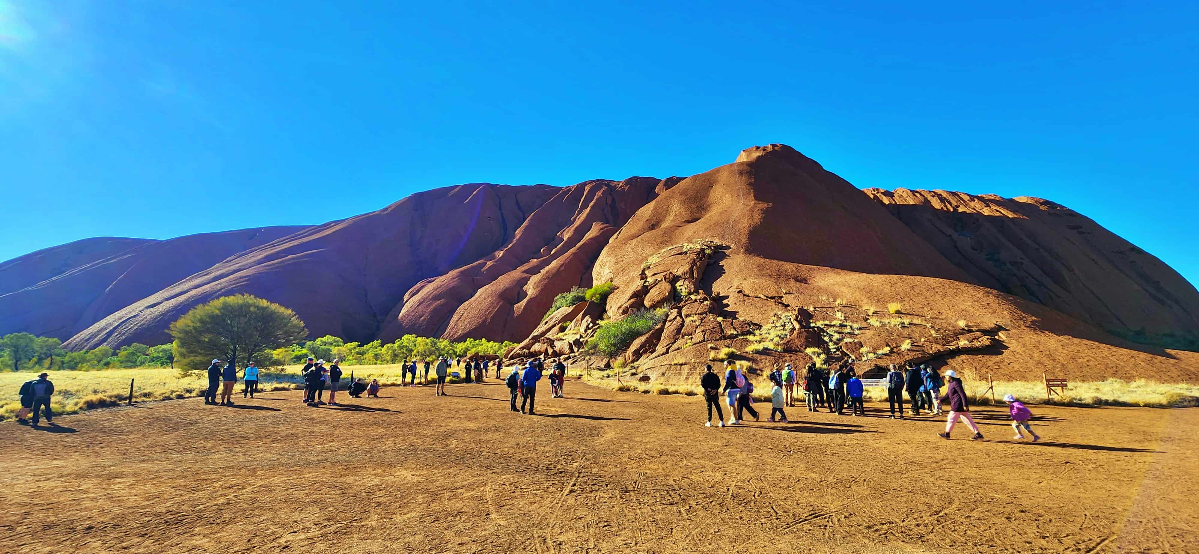
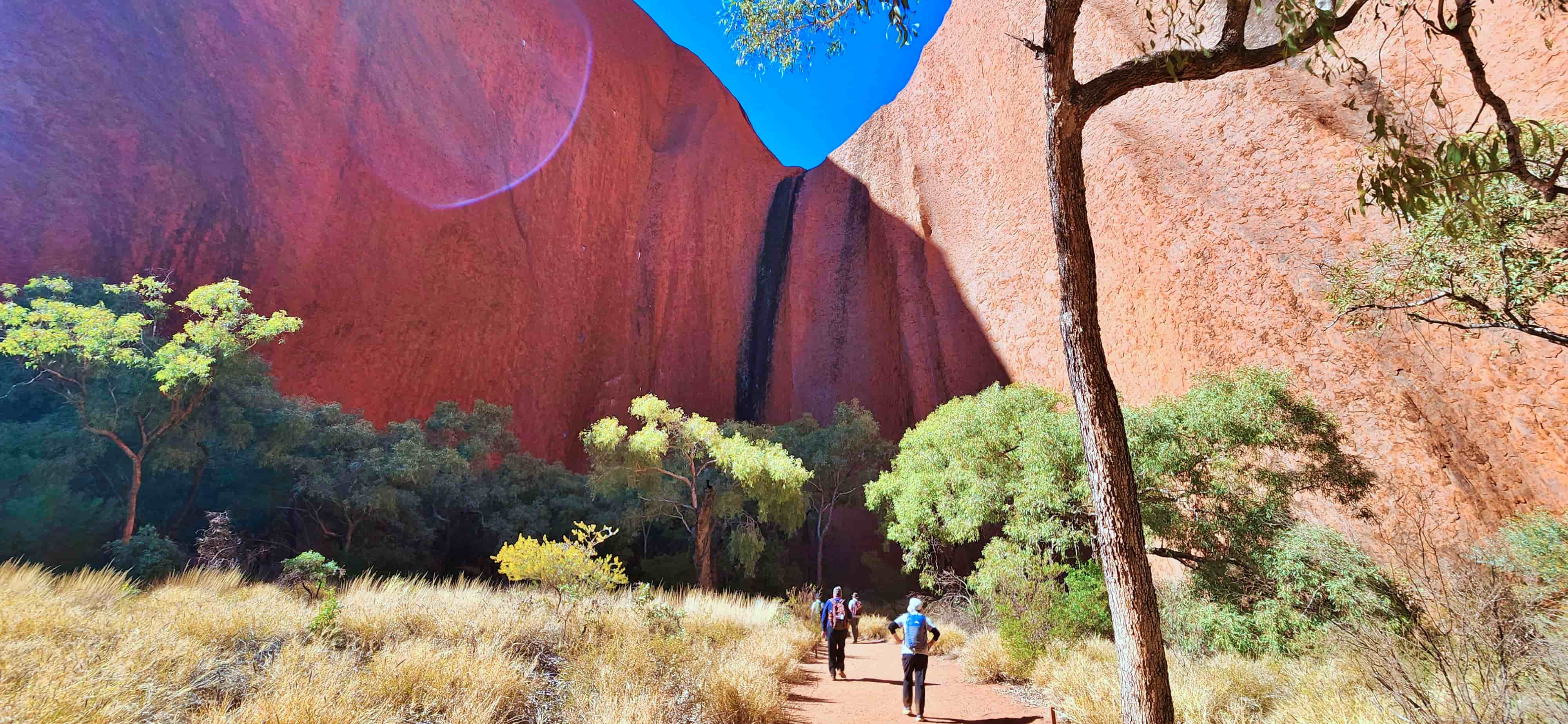
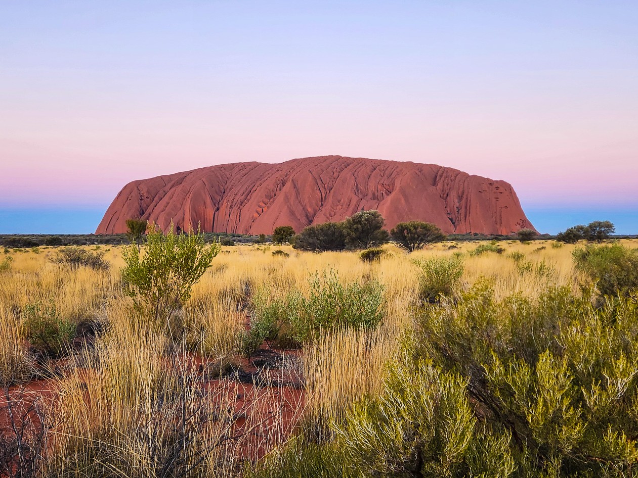
Walk #1: Uluru Base Walk - Walking Around Australia’s Most Iconic Monolith
The Uluru Base Walk is one of the most iconic walks in Australia and arguably the most meaningful way to experience Uluru. Rather than viewing the rock from a distance, this 10.6 km circuit allows you to walk completely around its base, revealing constantly changing perspectives of the monolith.
As you follow the track, the landscape shifts dramatically. Towering rust-red walls give way to shaded caves, desert woodlands, sacred cultural sites and hidden waterholes. Each section of the walk reveals deeper insights into Uluru’s geology and its immense cultural significance to the Anangu people.
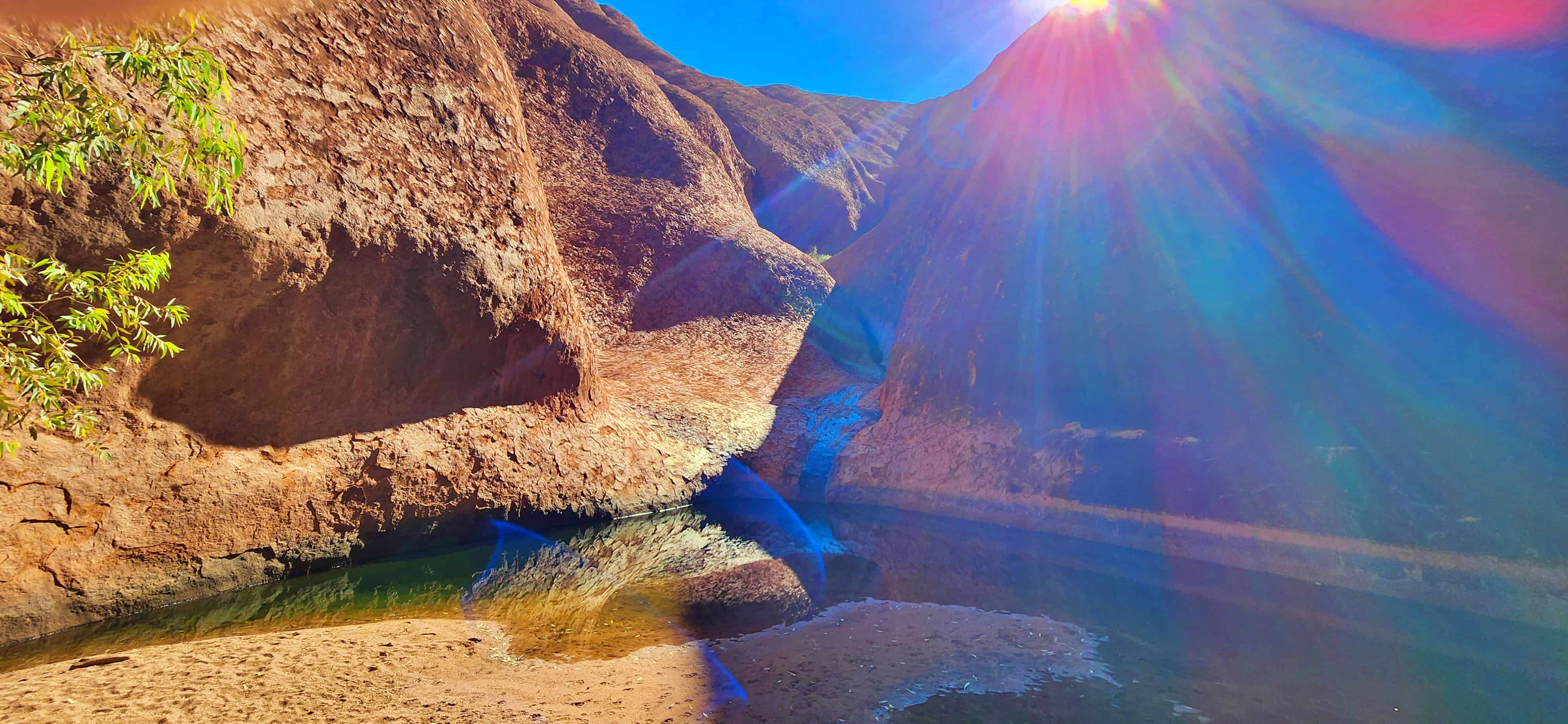
Along the way you’ll encounter culturally important locations including the Mala Walk, ancient rock art sites, and the peaceful Muṯitjulu Waterhole, where desert vegetation gathers around one of the few permanent water sources in the region.
Although the terrain is mostly flat, the exposed desert environment means preparation is essential. Early morning starts are strongly recommended to avoid rising temperatures.
Getting There
Uluru Base Walk is located within Uluṟu–Kata Tjuṯa National Park in the Northern Territory. The walk can be accessed from several points around the rock, with the most common starting locations being Mala Carpark on the north-west side and Kuniya Carpark on the south-east side near Muṯitjulu Waterhole. Uluru lies about 20 minutes from Yulara (Ayers Rock Resort) and around 4.5–5 hours’ drive from Alice Springs.
| Uluru Base Walk – Key Facts | |
|---|---|
| Trailhead | Mala Carpark (north-west side) or Kuniya Carpark (south-east side) |
| Trail Type | Loop |
| Distance | 10.6km |
| Duration | 3.5–5 hours (allow longer for stops) |
| Accumulated Elevation Gain | 156m |
| Difficulty | Grade 3 – moderate (due to length and exposure) |
| Best Time to Hike | April to September |
| Heat policy | Sections may close in extreme heat |


👉 For a detailed guide including sections of the walk, cultural highlights, maps and practical tips, read our full guide:
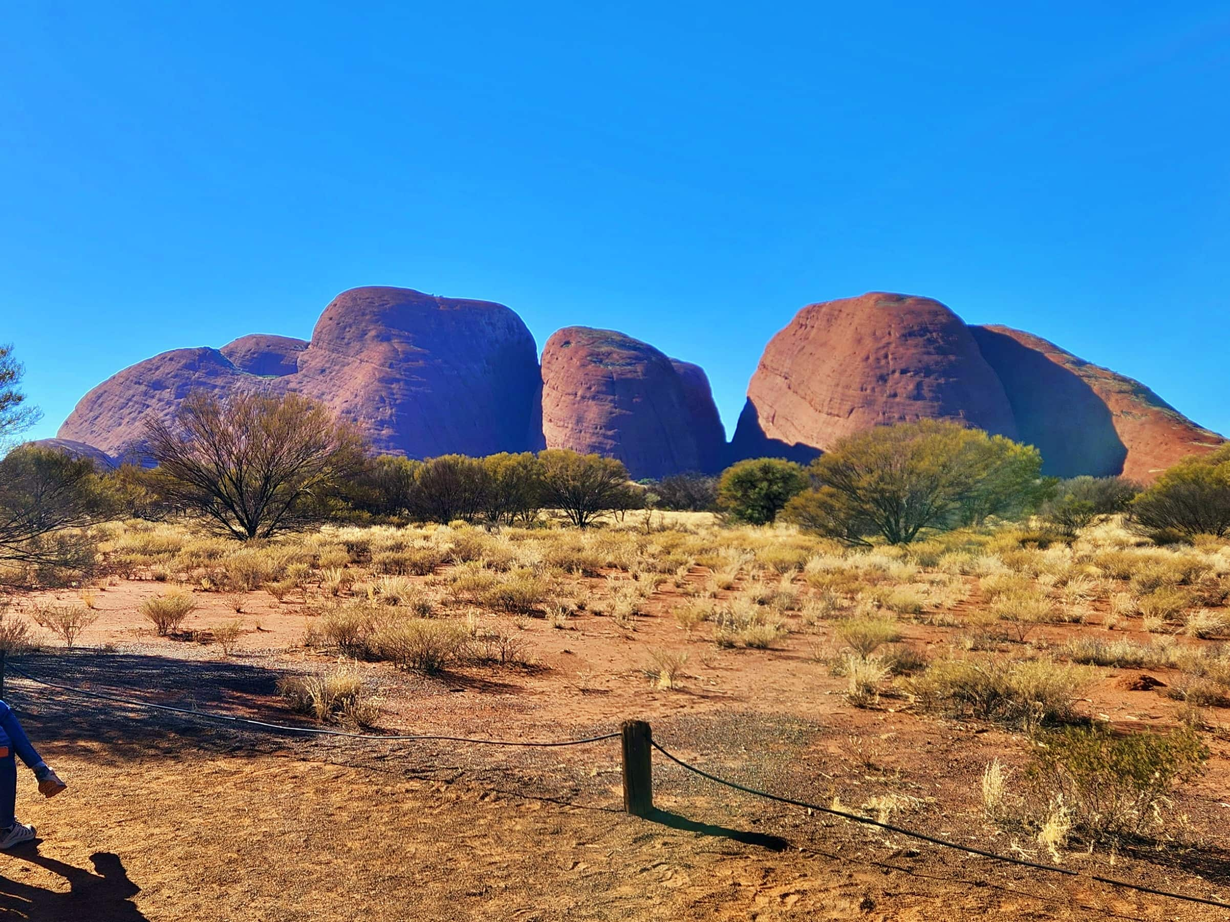
Walk #2: Valley of the Winds Walk - A Spectacular Hike Through the Domes of Kata Tjuta
If Uluru represents the spiritual heart of the Red Centre, the Valley of the Winds Walk delivers one of its most dramatic hiking experiences.
This trail takes you deep into the domes of Kata Tjuta, weaving through narrow valleys, rocky creek beds and windswept ridgelines. The towering conglomerate formations create a landscape that feels both immense and intimate as you move between them.
Two major lookouts define the walk:
- Karu Lookout
- Karingana Lookout
From these elevated viewpoints, sweeping views stretch across the valleys and domes of Kata Tjuta, offering a perspective that cannot be experienced from roadside viewing areas alone.
The full circuit involves rocky terrain and moderate climbs, making it one of the more physically demanding walks in Uluru–Kata Tjuta National Park.
Getting There
The Valley of the Winds Walk begins at the Valley of the Winds Car Park in Kata Tjuta, located within Uluṟu–Kata Tjuṯa National Park. The trailhead sits about 50 km west of Yulara (Ayers Rock Resort) and can be reached via the sealed Kata Tjuta Road, with a drive time of approximately 40 minutes.
| Valley of the Winds Walk – Key Facts | |
|---|---|
| Trailhead | Valley of the Winds Car Park (Kata Tjuta) |
| Trail Type | Loop |
| Distance | 7.4km |
| Duration | 3 - 4 hours |
| Accumulated Elevation Gain | 328m |
| Difficulty | Grade 4 (moderate to challenging) |
| Best Time to Hike | April to September |
| Heat policy | Sections may close from 11am if forecast is 36°C or above |
👉 For a complete breakdown of the walk including Karu Lookout, Karingana Lookout, full circuit details and safety tips, read our full guide:
Note: We chose not to take any photographs during the Valley of the Winds walk out of respect for the wishes of the Traditional Custodians and the cultural significance of this area. While this means we cannot visually showcase the domes from within the walk itself, we still felt it was important to share this guide so visitors can understand what the experience involves and appreciate the landscape in a meaningful and informed way. By describing the journey rather than capturing it on camera, we hope to both honour cultural protocols and help others prepare for this remarkable walk.
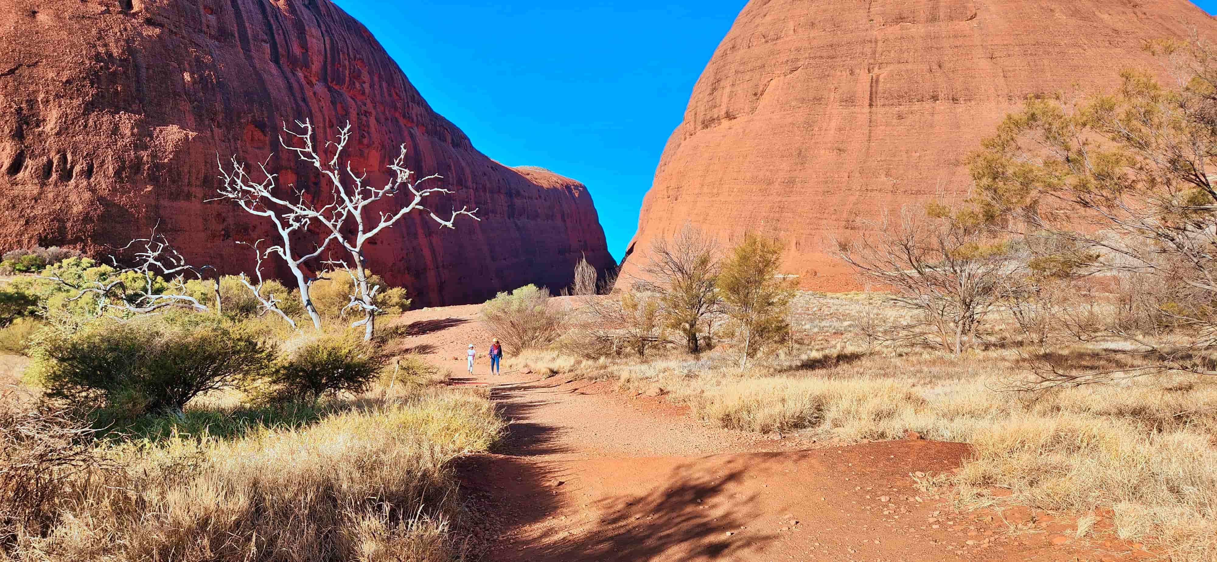
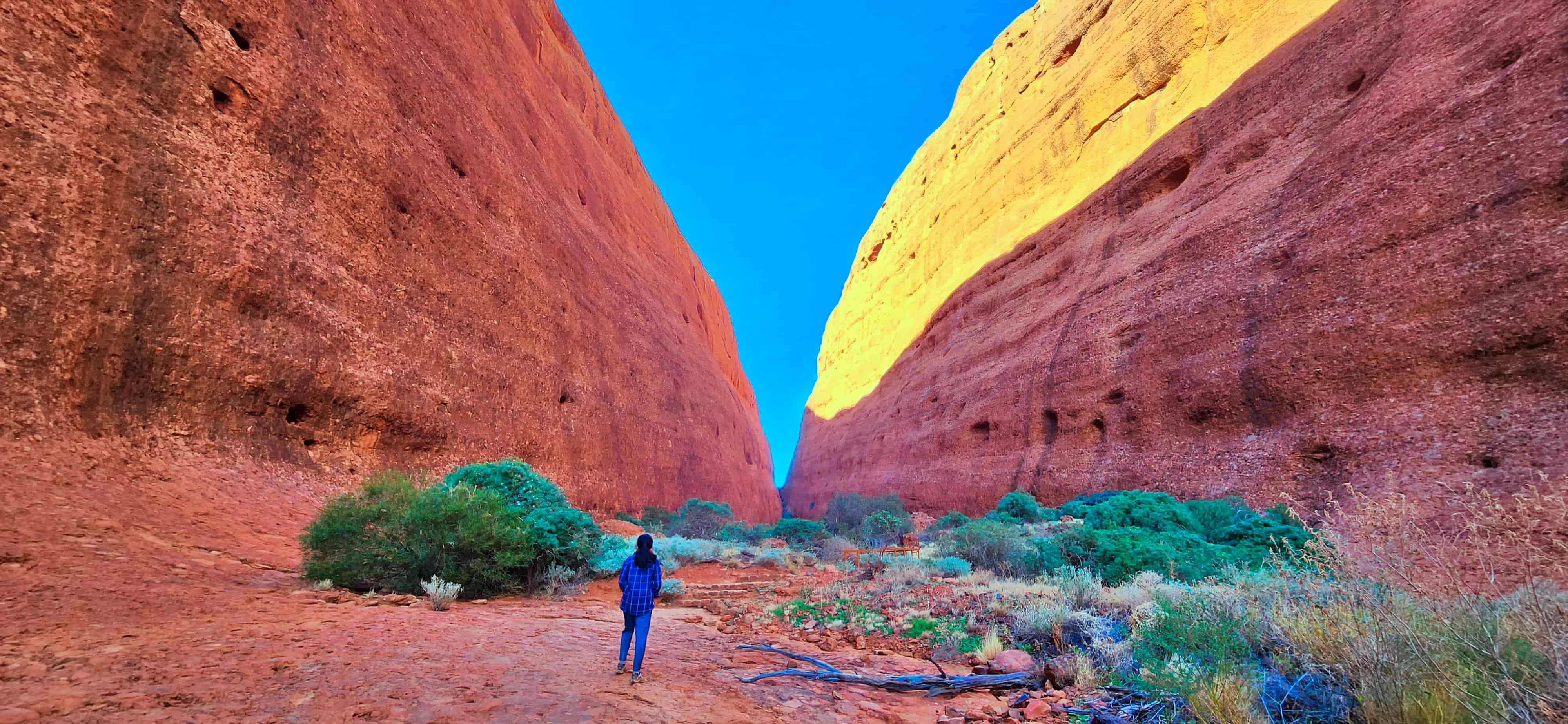
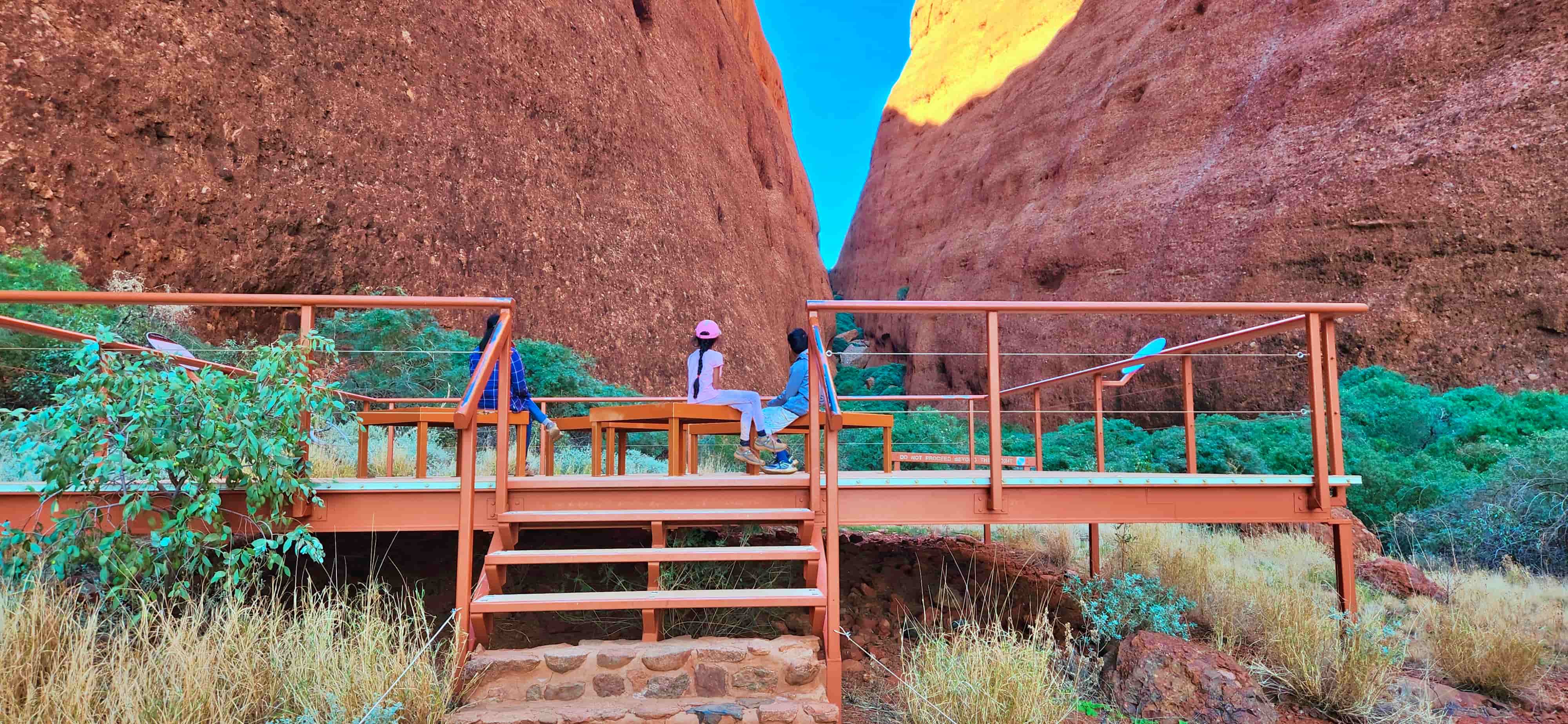
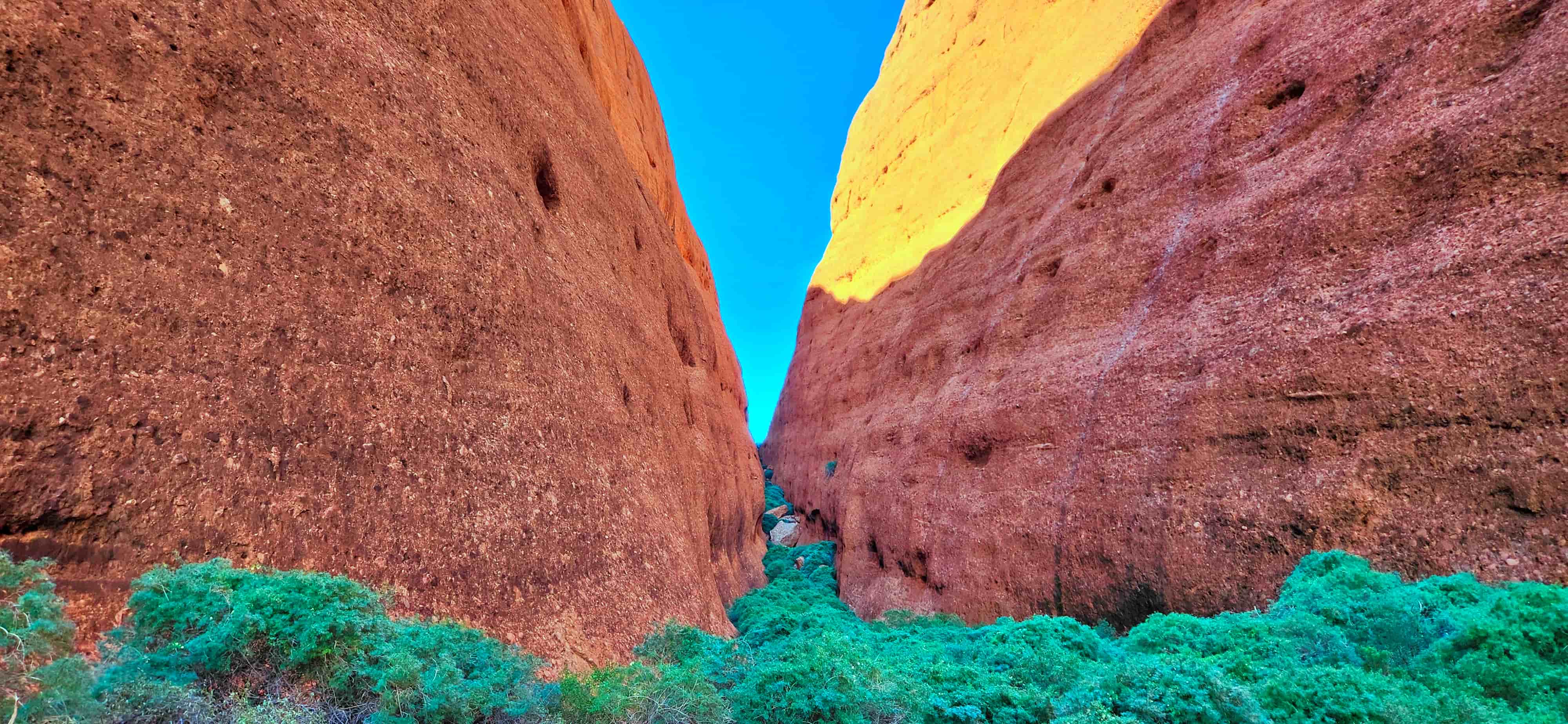
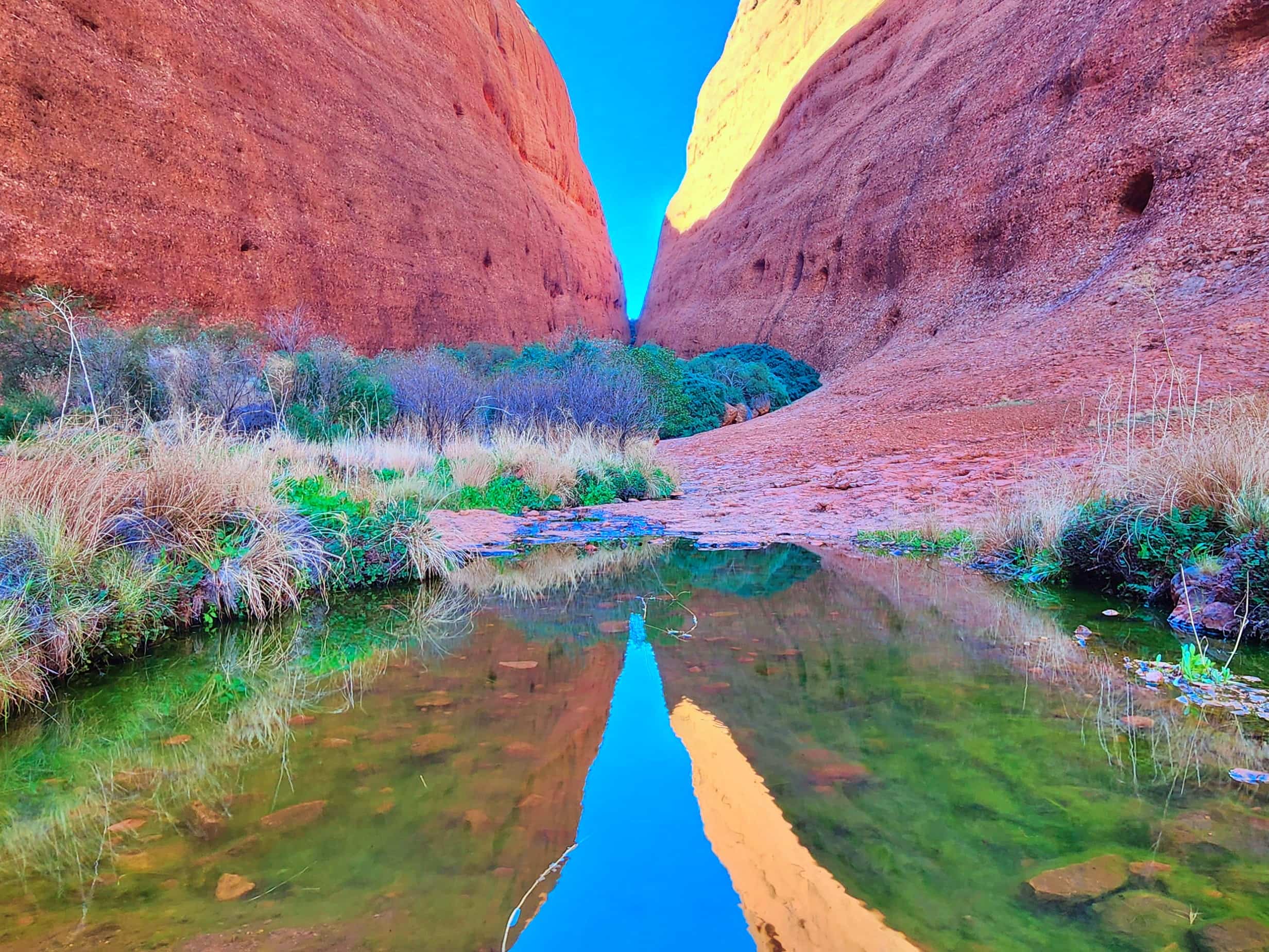
Walk #3: Walpa Gorge Walk - A Short Walk into the Heart of Kata Tjuta
The Walpa Gorge Walk offers a quieter but equally powerful way to experience Kata Tjuta.
This shorter trail leads into a natural gorge between two massive domes, where towering rock walls rise dramatically on either side of the track. As you move deeper into the gorge, the environment becomes noticeably cooler and more sheltered.
The word “Walpa” means wind in Pitjantjatjara, and gusts often funnel through the narrow corridor between the domes — a reminder of the natural forces that shaped this landscape over millions of years.
The trail follows a rocky creek bed and ends at a viewing platform where the towering walls of Kata Tjuta close in around you, creating a quiet and powerful natural space.
Getting There
Walpa Gorge is located within Kata Tjuta in Uluṟu–Kata Tjuṯa National Park, approximately 40 minutes’ drive from Yulara (Ayers Rock Resort) via the sealed Kata Tjuta Road. The walk begins at the Walpa Gorge Car Park, which includes picnic facilities, water and safety information boards.
| Walpa Gorge Walk – Key Facts | |
|---|---|
| Trailhead | Walpa Gorge Car Park (Kata Tjuta) |
| Trail Type | Out & Back |
| Distance | 2.6km return |
| Duration | 1 - 1.5 hours |
| Accumulated Elevation Gain | 143m |
| Difficulty | Grade 3 – moderate (rocky and uneven in parts) |
| Best Time to Hike | April to September |
| Heat policy | Always check daily safety boards before starting |
👉 For a detailed guide including the full walk experience, maps and practical tips, read our full guide:
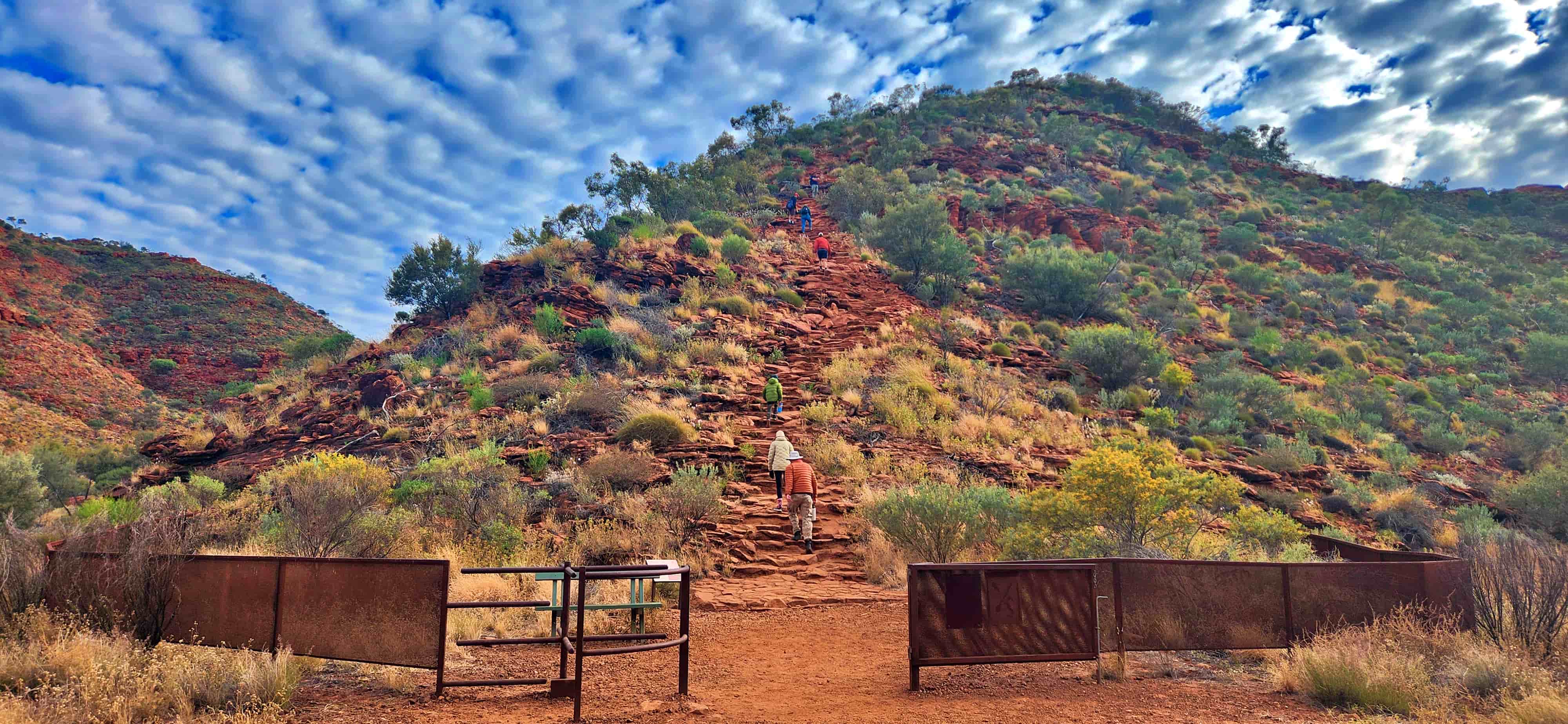
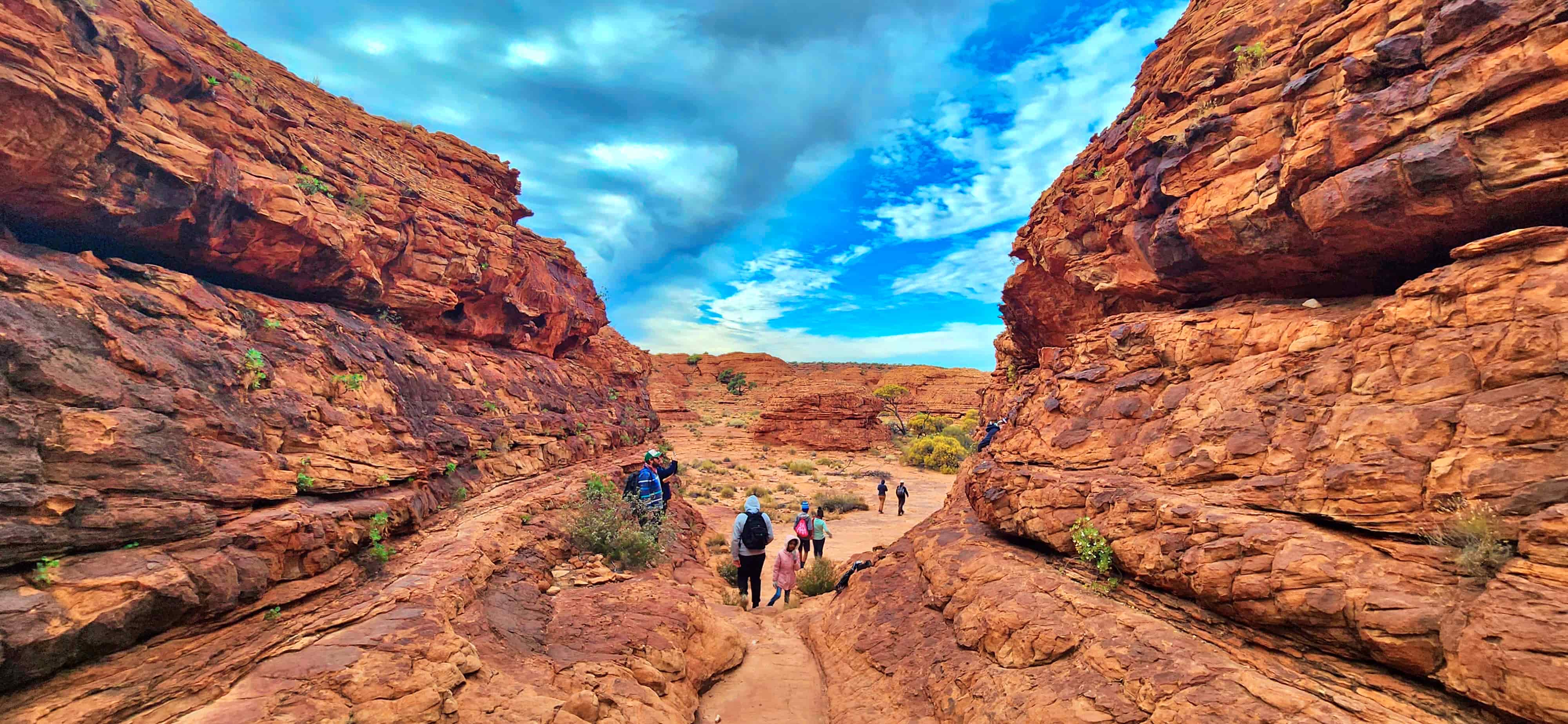
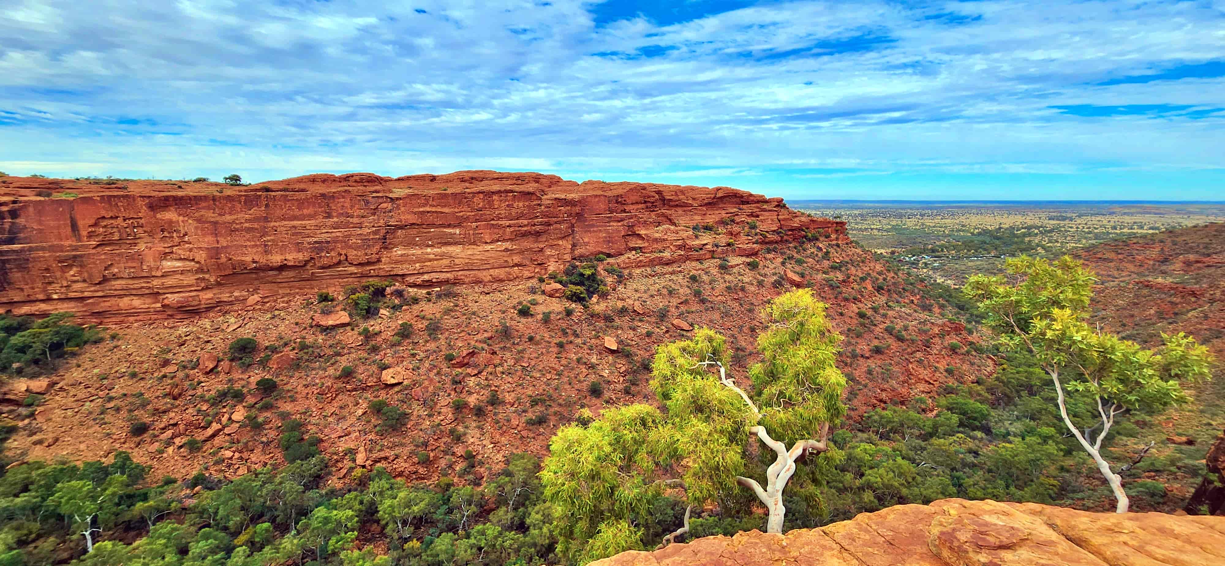
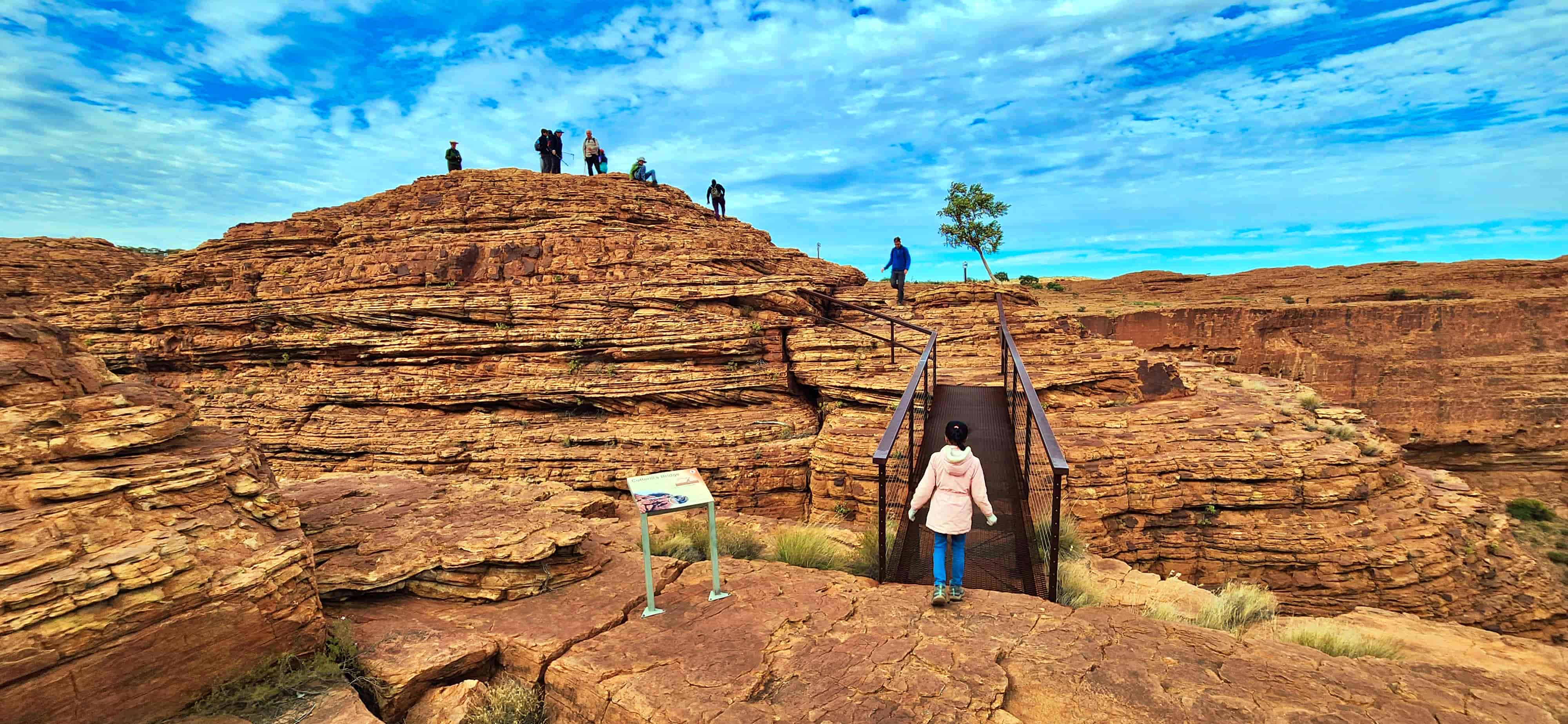
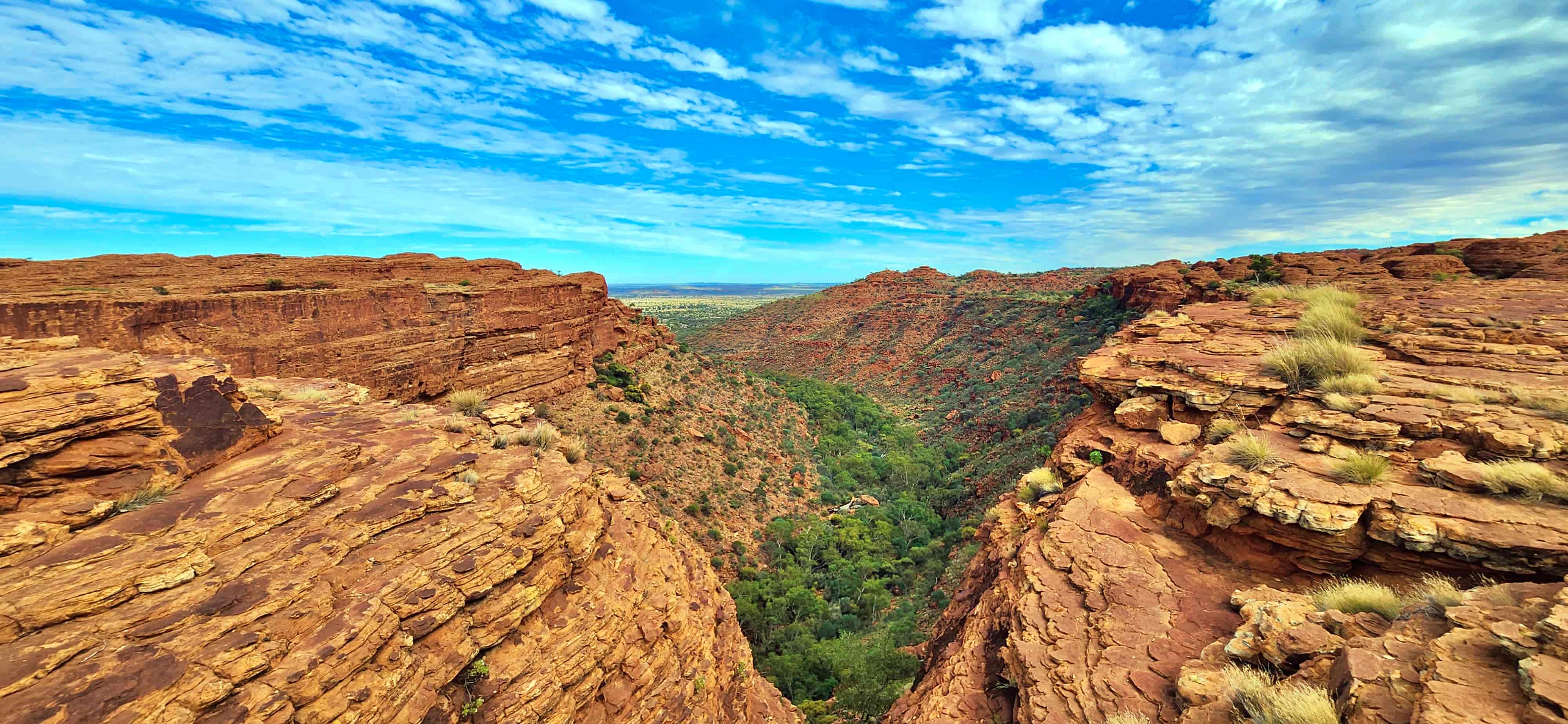
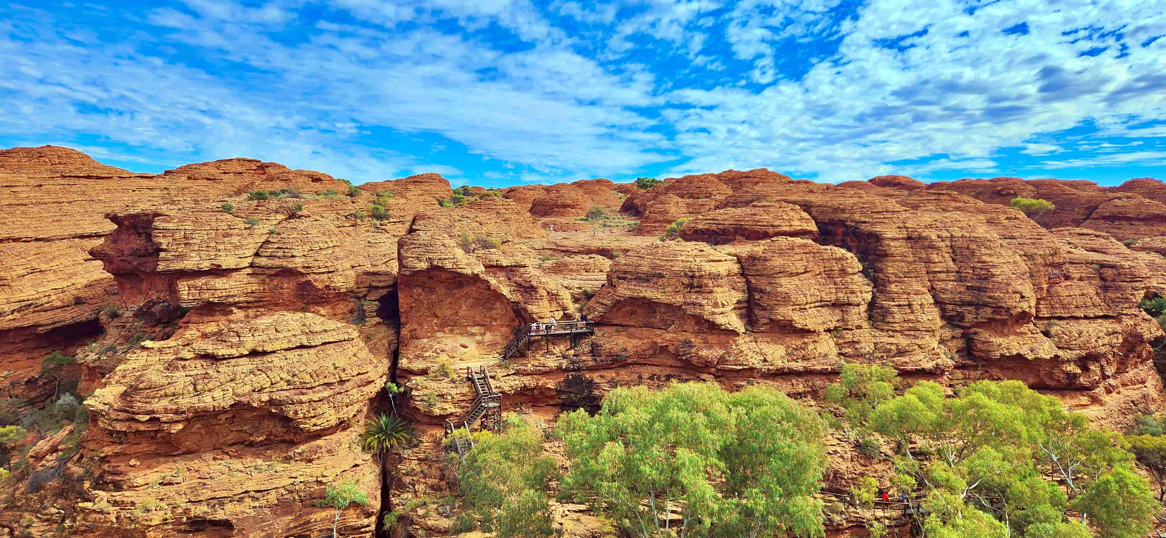
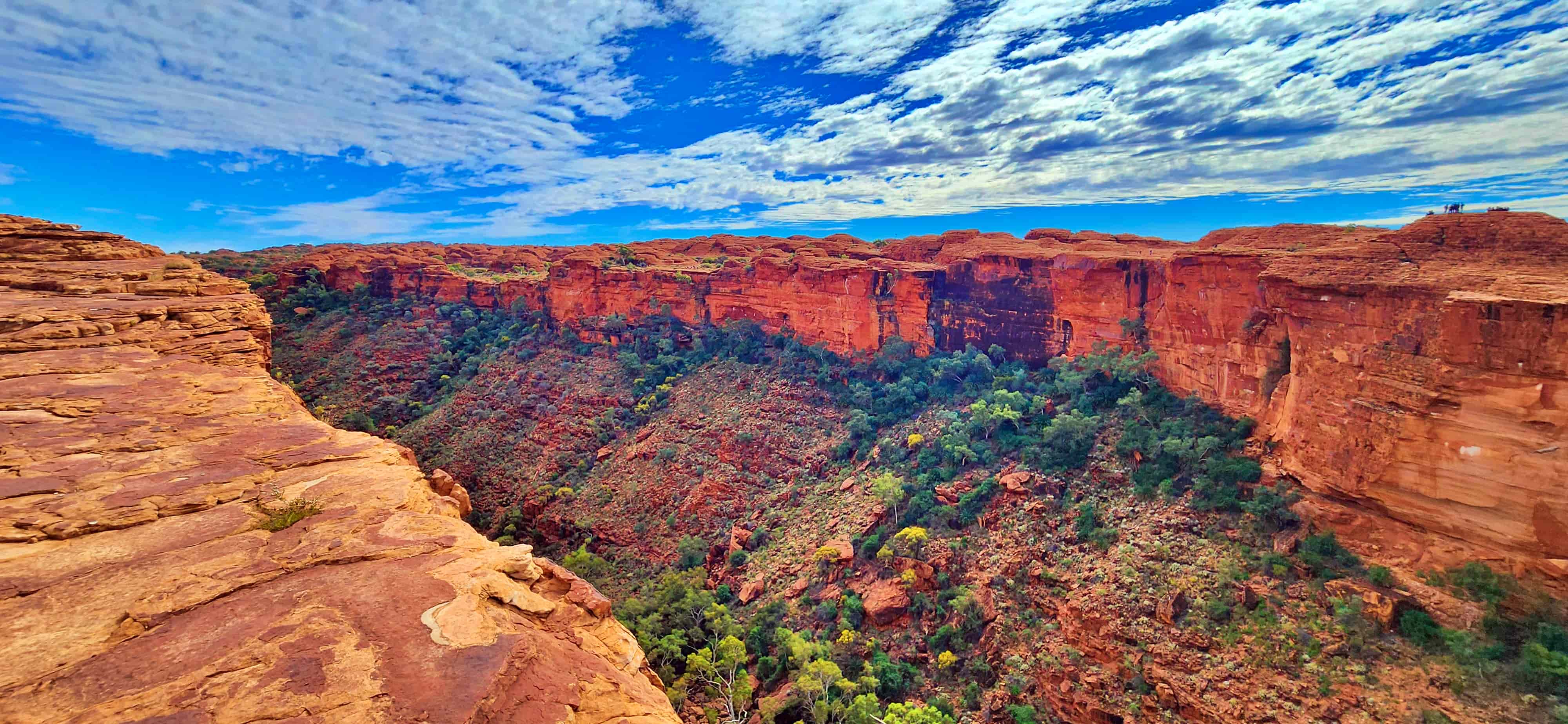
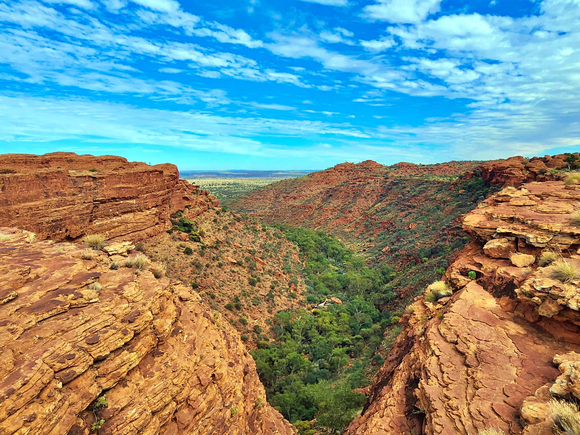
Walk #4: Kings Canyon Rim Walk – One of Australia’s Most Spectacular Canyon Hikes
The Kings Canyon Rim Walk is one of the most breathtaking hikes in Australia and a defining experience of the Red Centre. Located in Watarrka National Park, this dramatic loop trail climbs steeply to the rim of Kings Canyon before following the edge of towering sandstone cliffs that plunge into the canyon below.
The walk begins with a steep ascent commonly known as Heart Attack Hill, a short but intense climb that rewards hikers with sweeping views across the canyon and surrounding desert.
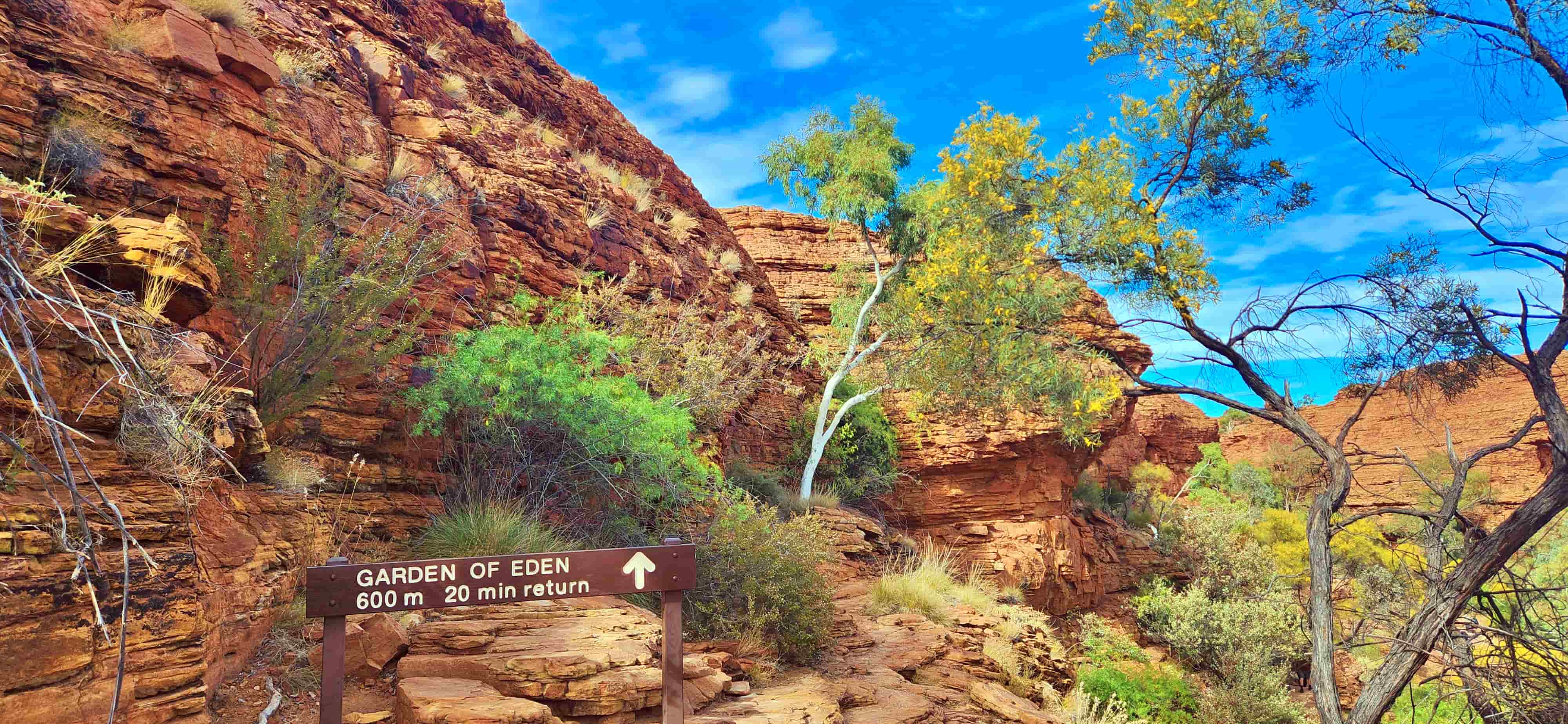
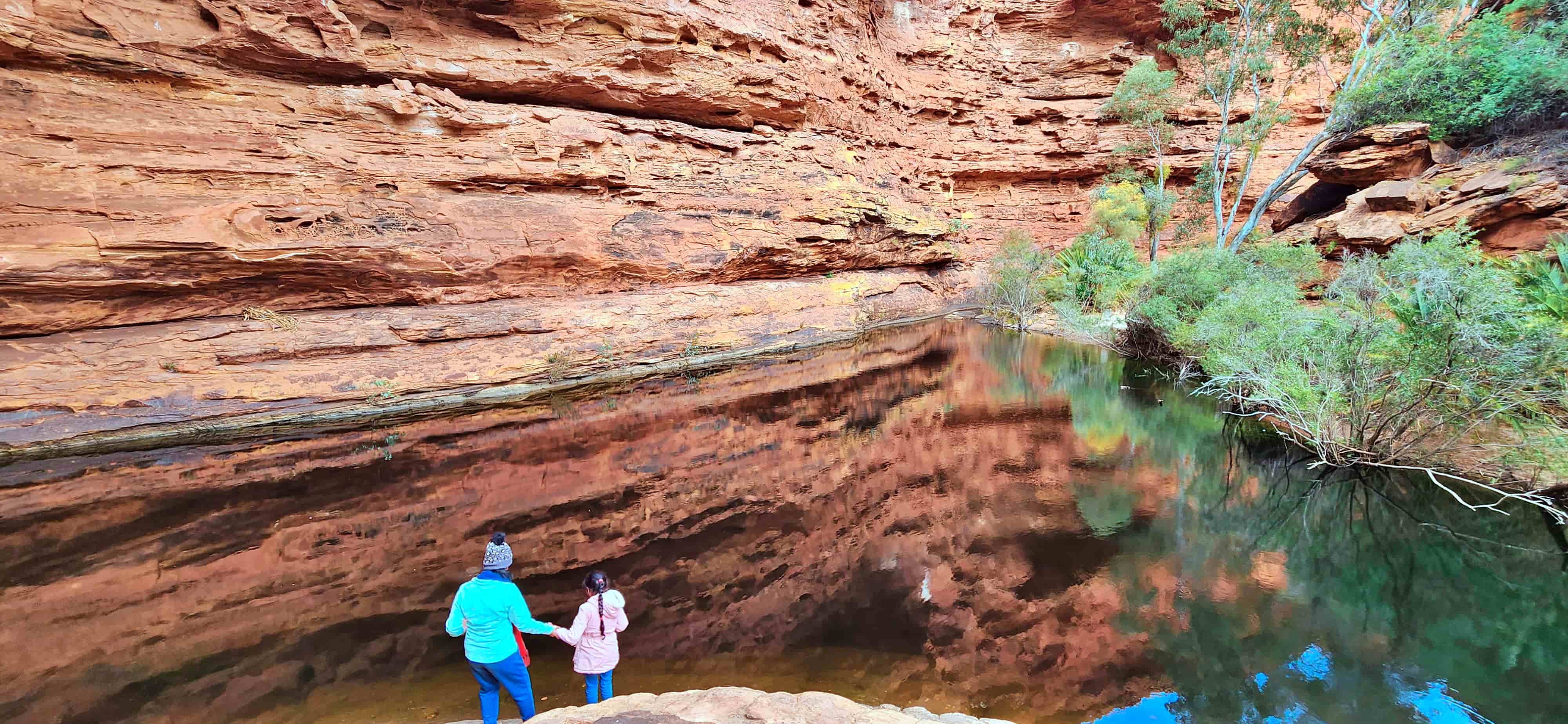
Once on the rim, the trail reveals sculpted rock domes, vast cliff-edge viewpoints and the lush oasis of the Garden of Eden hidden deep within the canyon. Because of the exposed terrain and intense desert heat, early starts and careful preparation are essential.
Getting There
Kings Canyon lies within Watarrka National Park, roughly 300 km south-west of Alice Springs and about 300 km north-east of Uluru. The walk begins at the Kings Canyon Rim Walk Car Park, which can be reached via sealed roads from Alice Springs or via the scenic unsealed Mereenie Loop Road (4WD permit required).
| Kings Canyon Rim Walk – Key Facts | |
|---|---|
| Trailhead | Kings Canyon Rim Walk Carpark |
| Trail Type | Loop |
| Distance | 6km |
| Duration | 3 - 4 hours |
| Accumulated Elevation Gain | 208m |
| Difficulty | Grade 4 (moderate to challenging) |
| Best Time to Hike | April to September |
| Heat policy | Walk may close after 9:00 am in hot weather |
👉 For a complete walkthrough of the trail including Heart Attack Hill, Garden of Eden and key viewpoints, read our full guide:
Central Australia is one of the most extraordinary landscapes in the world, and walking through it offers a perspective that driving alone simply cannot provide. From the sacred base of Uluru to the wind-carved valleys of Kata Tjuta and the towering cliffs of Kings Canyon, these four walks represent the very best hiking experiences in the Red Centre. Whether you complete just one or all four, each trail offers a deeper connection to the land — its geology, its stories, and its immense sense of space. If you’re planning a Red Centre adventure, these Great Walks of Central Australia deserve a place at the very top of your itinerary.
Love our itinerary? Excited to embark on the great walks of Central Australia? Book your accommodation via Booking.com below at cheaper prices!
This post may contain affiliate links. This means that, at no additional cost to you, we may earn a small commission if you make a purchase through the links provided. These commissions help support our website and allow us to continue sharing our travel experiences. Thank you for your support.
This itinerary is based on our personal experiences and recommendations. All information is provided for general guidance only and may change due to circumstances beyond our control. Travellers are encouraged to independently verify details and make choices according to their own preferences and safety considerations. We do not accept responsibility for any loss, injury, or inconvenience sustained by anyone using our itineraries.